Enable Location

We need your location to show you interesting places around you

Discover nearby places

Find interesting locations and hidden gems around you

Precise directions

Get accurate directions and distances to places

Your location is never shared with other users. It's only used when you tap the location button.

Sucuriú River

Log in to your account

Start exploring — it's free

Trusted by 61,996 travelers worldwide

Continue with Google
Continue with Apple
or

We will send you a code to connect

By continuing, you accept our Terms and Conditions and our Privacy Policy

Check your inbox

We've sent a pincode in your inbox. Please enter the code below.

Sucuriú River

Sucuriú River, Tributary river in Mato Grosso do Sul, Brazil.

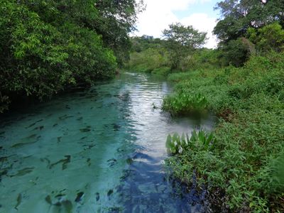
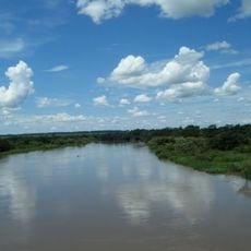
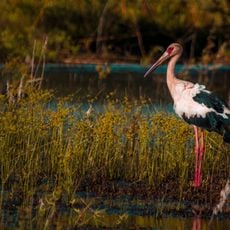
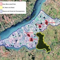
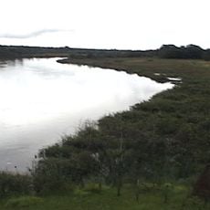
The Sucuriú River is a tributary in Mato Grosso do Sul that flows from the Serra dos Caiapós toward the southwest before meeting the Paraná River. The waterway passes through areas of tropical forest and savanna, with banks lined by dense vegetation that provides habitat for wildlife.

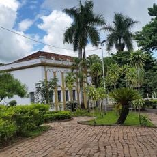
The river served as a crucial waterway and food source for indigenous populations who settled along its banks over many centuries. As European colonization reached the region, the river became integrated into early trade routes and the development of settlements in the area.

Local communities have relied on this waterway for generations as a source of food and transportation through the region. The river remains woven into daily life and the identity of people who live along its banks.

The best time to visit is during the dry season when water levels are lower and the banks are easier to access. Sturdy footwear is important since the banks can be slippery, and the surrounding area consists of thick forest terrain.

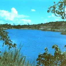
The river is known for its clear water that reveals the world below, allowing visitors to spot numerous fish species and aquatic vegetation several meters down. This clarity makes it an exceptional location for observing aquatic life and underwater photography.

The community of curious travelers

AroundUs brings together thousands of curated places, local tips, and hidden gems, enriched daily by 60,000 contributors worldwide.

Start exploring
GPS coordinates
-20.71190,-51.66000
Latest update
December 6, 2025 17:42
Natural areas of central west Brazil: waterfalls, caves, national parks

The central west region of Brazil encompasses states including Goiás, Mato Grosso and Mato Grosso do Sul. These areas contain national parks with hiking trails, waterfalls and cave systems. Chapada dos Veadeiros National Park near Alto Paraíso de Goiás displays cerrado vegetation and rock...

« Sucuriú River - Tributary river in Mato Grosso do Sul, Brazil » is provided by Around Us (aroundus.com). Images and texts are derived from Wikimedia project under a Creative Commons license. You are allowed to copy, distribute, and modify copies of this page, under the conditions set by the license, as long as this note is clearly visible.

Discover hidden gems everywhere you go!

From secret cafés to breathtaking viewpoints, skip the crowded tourist spots and find places that match your style. Our app makes it easy with voice search, smart filtering, route optimization, and insider tips from travelers worldwide. Download now for the complete mobile experience.

Around Us App Screenshot

A unique approach to discovering new places

Le Figaro

All the places worth exploring

France Info

A tailor-made excursion in just a few clicks

20 Minutes

Around Us
Travel Guide & Maps
Download

Send to your phone

QR Code
1

Open the camera app on your mobile.

2

Point at the QR code with your camera. A notification will appear.

3

Tap the notification to open the link.