Ribeirão Claro, Agricultural municipality in Norte Pioneiro Paranaense, Brazil
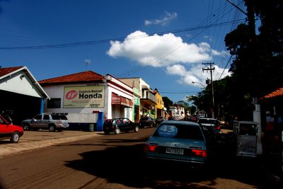
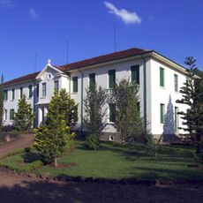
Ribeirão Claro is a municipality in the Norte Pioneiro Paranaense region of Paraná state, situated at about 535 meters elevation. The area spreads across agricultural land with settlements and road connections to neighboring towns.
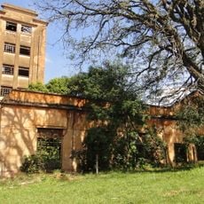
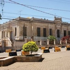
From the late 19th century, settlers from São Paulo, Minas Gerais, and Rio de Janeiro established themselves in this area. They cultivated coffee in the fertile purple soil that defines the region's character to this day.
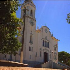
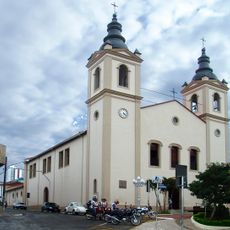
The Sanctuary of Saint Vincent de Pallotti is the only temple in the world dedicated to this saint, attracting religious visitors throughout the year.
The municipality connects to larger cities through highways, with the nearest airports in Londrina about 180 kilometers away and in Curitiba about 400 kilometers away. Visitors should plan to arrive by car or use regional bus services.
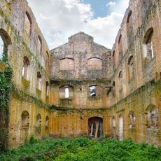
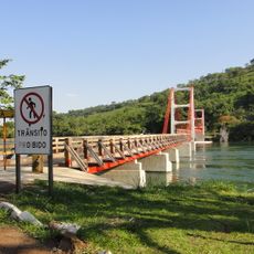
Several suspension bridges, including Ponte Alves Lima connecting to the nearby town of Chavantes, are notable structures in the region. These bridges have been reconstructed multiple times throughout history, reflecting the area's eventful past.
Location: Paraná
Elevation above the sea: 535 m
Shares border with: Jacarezinho, Carlópolis, Chavantes, Fartura, Joaquim Távora, Timburi
Website: http://ribeiraoclaro.com.br
GPS coordinates: -23.19389,-49.75778
Latest update: December 7, 2025 20:24
Indústrias Reunidas Fábricas Matarazzo
111.9 km
Museu de Paleontologia de Marília
110.1 km
Pico Agudo (Japira)
76.5 km
Alves Lima bridge
10.7 km
Cerrado State Park
108.7 km
Corumbataí-Botucatu-Tejupá Environmental Protection Area
124.8 km
Estação Assis
90.1 km
Jaguariaíva River Canyon
108.3 km
Caetetus Ecological Station
88.2 km
Kloster Hardehausen-Itatinga
118.7 km
Museum of Paleontology
110.1 km
Palace of the Cherry Trees
119.2 km
Catedral Basílica Menor de São Bento
110.7 km
(Histórico) Estação Ferroviária
123.5 km
Natural History Museum of Cornélio Procópio
91.4 km
Museu Alexandre Chitto
118.8 km
Tenrikyo Church of Dendotyo
117.6 km
Chapel of Santa Casa de Misericórdia of Bauru
119 km
Destilaria Central
119.2 km
Central
63 km
E.M.E.F. Paulo Thomas da Silva
117.9 km
Lago Municipal de Gália
101.9 km
Estação Ferroviária de Jaguariaíva
118.3 km
E.M.E.F. Coronel Leite
112.4 km
E.E. Tomé Teixeira
111.2 km
Ponte Pênsil de Chavantes
10.7 km
E.M.E.F. Coronel Acácio Piedade
125.9 km
Cathedral of St. Ann, Itapeva
125.7 kmVisited this place? Tap the stars to rate it and share your experience / photos with the community! Try now! You can cancel it anytime.
Discover hidden gems everywhere you go!
From secret cafés to breathtaking viewpoints, skip the crowded tourist spots and find places that match your style. Our app makes it easy with voice search, smart filtering, route optimization, and insider tips from travelers worldwide. Download now for the complete mobile experience.
A unique approach to discovering new places❞
— Le Figaro
All the places worth exploring❞
— France Info
A tailor-made excursion in just a few clicks❞
— 20 Minutes