Enable Location

We need your location to show you interesting places around you

Discover nearby places

Find interesting locations and hidden gems around you

Precise directions

Get accurate directions and distances to places

Your location is never shared with other users. It's only used when you tap the location button.

Rio–Niterói Bridge

Log in to your account

Start exploring — it's free

Trusted by 62,835 travelers worldwide

Continue with Google
Continue with Apple
or

We will send you a code to connect

By continuing, you accept our Terms and Conditions and our Privacy Policy

Check your inbox

We've sent a pincode in your inbox. Please enter the code below.

Rio–Niterói Bridge

Rio–Niterói Bridge, Road bridge in Rio de Janeiro, Brazil

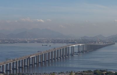
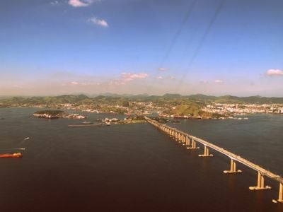
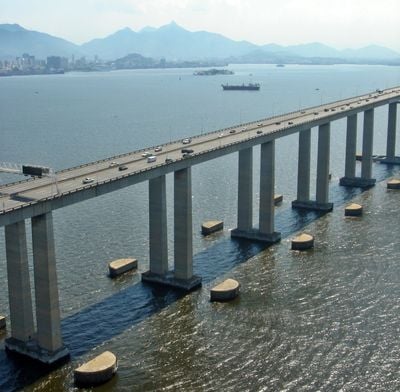
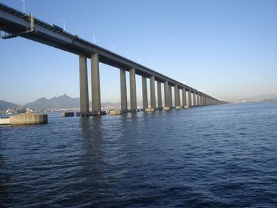
The Rio-Niterói Bridge stretches 13.3 kilometers (8.2 miles) across Guanabara Bay and reaches a height of 72 meters (236 feet) above the water. The concrete structure carries multiple traffic lanes over its entire length, with a central span of 300 meters (984 feet).

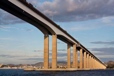
Construction began in January 1969 using modular components manufactured in England and shipped to Brazil. The project was completed after several years of intensive work, transforming the connection between Rio de Janeiro and Niterói.

The official name honors the Brazilian president who authorized its construction during the military period. Drivers experience the crossing as a direct connection between two major cities, cutting through the bay instead of circling around its shores.

The toll crossing serves more than 150,000 daily passengers and reduces the former 120-kilometer (74.5-mile) journey between the two cities to a direct route. Drivers should plan for peak traffic hours, as the route becomes especially busy during morning and evening commutes.

Until 1985, this crossing ranked as the second-longest bridge worldwide, surpassed only by Lake Pontchartrain Causeway in the United States. The modular construction system from England allowed for remarkably fast on-site assembly despite the enormous length.

The community of curious travelers

AroundUs brings together thousands of curated places, local tips, and hidden gems, enriched daily by 60,000 contributors worldwide.

Start exploring
Location
Inception
March 4, 1974
Official opening
March 4, 1974
Height
72 m
Length
13,300 m
Longest Span
300 m
GPS coordinates
-22.87111,-43.15669
Latest update
December 12, 2025 21:17
« Rio–Niterói Bridge - Road bridge in Rio de Janeiro, Brazil » is provided by Around Us (aroundus.com). Images and texts are derived from Wikimedia project under a Creative Commons license. You are allowed to copy, distribute, and modify copies of this page, under the conditions set by the license, as long as this note is clearly visible.

Discover hidden gems everywhere you go!

From secret cafés to breathtaking viewpoints, skip the crowded tourist spots and find places that match your style. Our app makes it easy with voice search, smart filtering, route optimization, and insider tips from travelers worldwide. Download now for the complete mobile experience.

Around Us App Screenshot

A unique approach to discovering new places

Le Figaro

All the places worth exploring

France Info

A tailor-made excursion in just a few clicks

20 Minutes

Around Us
Travel Guide & Maps
Download

Send to your phone

QR Code
1

Open the camera app on your mobile.

2

Point at the QR code with your camera. A notification will appear.

3

Tap the notification to open the link.