Enable Location

We need your location to show you interesting places around you

Discover nearby places

Find interesting locations and hidden gems around you

Precise directions

Get accurate directions and distances to places

Your location is never shared with other users. It's only used when you tap the location button.

Ribeirão Preto

Log in to your account

Start exploring — it's free

Trusted by 62,870 travelers worldwide

Continue with Google
Continue with Apple
or

We will send you a code to connect

By continuing, you accept our Terms and Conditions and our Privacy Policy

Check your inbox

We've sent a pincode in your inbox. Please enter the code below.

Ribeirão Preto, Metropolitan area in São Paulo, Brazil

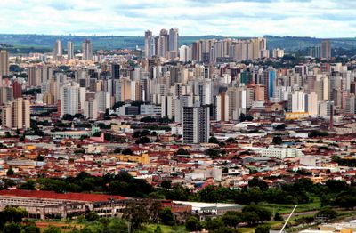
Ribeirão Preto is a large city in northeastern São Paulo state at 583 meters elevation, spreading over fertile land near the Black Creek and Pardo River. Three transportation companies operate over 300 buses on 113 lines, while Leite Lopes Airport offers connections to important destinations across the country.

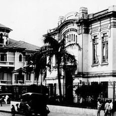
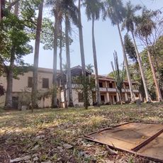
The area developed from a small settlement in 1856 into the world's largest coffee producer by 1880, attracting immigrants who arrived with the construction of the Mogiana Railway. After 1929, the agricultural focus shifted to sugarcane, leading to the emergence of a technology center for health and biotechnology.

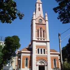
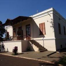
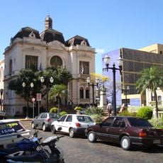
The Pedro II Theater ranks among Brazil's largest opera houses and hosts performances throughout the year in its classically designed halls. The building's architecture reflects the wealth that agriculture brought to the region.

Buses run regularly throughout the city, connecting residential areas with the center, while taxis and private ride services offer additional options for short distances. The airport is close enough to reach without long journeys, and connections to other cities are available directly.

Sugarcane plantations surround large parts of the city and shape the landscape, with fields releasing a strong smell of molasses during harvest season. The shift from coffee to sugar brought new factories that now produce ethanol and biofuels for national and international markets.

The community of curious travelers

AroundUs brings together thousands of curated places, local tips, and hidden gems, enriched daily by 60,000 contributors worldwide.

Start exploring
Location
Inception
June 19, 1856
Elevation above the sea
583 m
Shares border with
Brodowski, Cravinhos, Dumont, Guatapará, Jardinópolis, Serrana, Sertãozinho
GPS coordinates
-21.17763,-47.81010
Latest update
December 14, 2025 21:37
« Ribeirão Preto - Metropolitan area in São Paulo, Brazil » is provided by Around Us (aroundus.com). Images and texts are derived from Wikimedia project under a Creative Commons license. You are allowed to copy, distribute, and modify copies of this page, under the conditions set by the license, as long as this note is clearly visible.

Discover hidden gems everywhere you go!

From secret cafés to breathtaking viewpoints, skip the crowded tourist spots and find places that match your style. Our app makes it easy with voice search, smart filtering, route optimization, and insider tips from travelers worldwide. Download now for the complete mobile experience.

Around Us App Screenshot

A unique approach to discovering new places

Le Figaro

All the places worth exploring

France Info

A tailor-made excursion in just a few clicks

20 Minutes

Around Us
Travel Guide & Maps
Download

Send to your phone

QR Code
1

Open the camera app on your mobile.

2

Point at the QR code with your camera. A notification will appear.

3

Tap the notification to open the link.