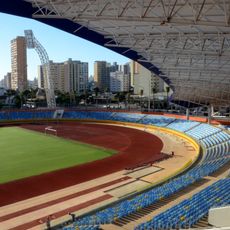
Acreúna, Municipality in western Goiás, Brazil
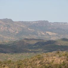
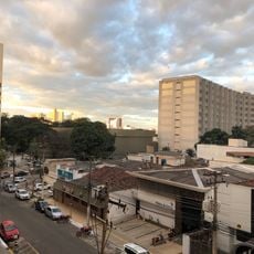
Acreúna is an administrative division in western Goiás located at about 650 meters elevation in the Vale do Rio dos Bois region. The landscape is shaped by extensive agricultural areas dedicated to sugarcane, cotton, corn, and soybean cultivation.
The settlement began in 1964 within Paraúna's territory under the initiative of Benedicto Arystogogo de Mello, then achieved municipal status in 1976. This transition to independence marked a turning point in local governance and development.
The name blends 'Acre', referencing the main highway connection, and 'Una' from the neighboring municipality of Paraúna, showing how the town sees itself in the regional transport network. Residents identify with this location as a crossroads between different parts of Goiás state.
Visitors will find the region dominated by farming activity with roads passing through crop fields and agricultural operations. Timing your visit outside harvest and planting seasons helps avoid heavy traffic on local roads.
The municipality has developed as a notable livestock production center with an unusually high literacy rate for a rural area. This combination of economic strength in animal husbandry alongside education investments sets it apart from surrounding communities.
Location: Goiás
Inception: May 14, 1976
Elevation above the sea: 650 m
Shares border with: Santo Antônio da Barra, Jandaia, Edéia, Indiara, Paraúna, Santa Helena de Goiás, Turvelândia
Website: http://acreunagoias.com.br
GPS coordinates: -17.39583,-50.37694
Latest update: December 10, 2025 15:52
Estádio da Serrinha
141.1 km
Estádio Olímpico Pedro Ludovico
143.5 km
Monumento às Três Raças
143.4 kmAutódromo Internacional Ayrton Senna
146.7 km
Praça Cívica
143.4 km
Estádio Annibal Batista de Toledo
136.4 km
Teatro Goiânia
143.2 km
Affonso Penna bridge
168.9 km
Estádio JK
164.7 km
Palácio Pedro Ludovico
143.4 km
Museu de Arte de Goiânia
142.8 km
Museu das Bandeiras
164.3 km
Lago das Rosas
141.9 km
Grande Hotel de Goiânia
143.6 km
Serra Dourada State Park
145.7 km
Museu Zoroastro Artiaga
143.6 km
Altamiro de Moura Pacheco State Park
162.8 km
Our Lady Help of Christians Cathedral, Goiânia
143.7 km
Museu Pedro Ludovico Teixeira
143.1 km
Holy Spirit Cathedral, Jataí
153 km
Fórum
142.6 km
Igreja do Sagrado Coração de Maria
144.3 km
Casa de Câmara e Cadeia
164.3 km
Fontes Luminosas
143.3 km
Latif Sebba Viaduct
142.2 km
Prédio da Justiça Federal
143.9 km
Coreto
143.4 km
Palácio do Governo
143.4 kmVisited this place? Tap the stars to rate it and share your experience / photos with the community! Try now! You can cancel it anytime.
Discover hidden gems everywhere you go!
From secret cafés to breathtaking viewpoints, skip the crowded tourist spots and find places that match your style. Our app makes it easy with voice search, smart filtering, route optimization, and insider tips from travelers worldwide. Download now for the complete mobile experience.
A unique approach to discovering new places❞
— Le Figaro
All the places worth exploring❞
— France Info
A tailor-made excursion in just a few clicks❞
— 20 Minutes