Enable Location

We need your location to show you interesting places around you

Discover nearby places

Find interesting locations and hidden gems around you

Precise directions

Get accurate directions and distances to places

Your location is never shared with other users. It's only used when you tap the location button.

Chapman's Peak

Log in to your account

Start exploring — it's free

Trusted by 61,319 travelers worldwide

Continue with Google
Continue with Apple
or

We will send you a code to connect

By continuing, you accept our Terms and Conditions and our Privacy Policy

Check your inbox

We've sent a pincode in your inbox. Please enter the code below.

Chapman's Peak

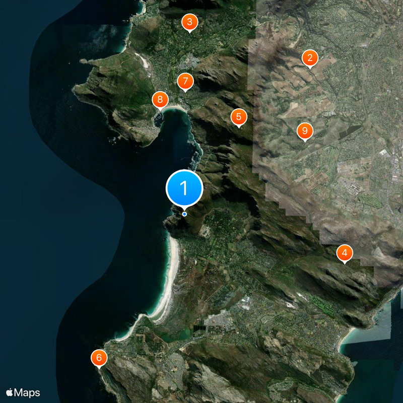
Chapman's Peak, Mountain pass road in Western Cape, South Africa

Description

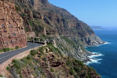
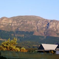
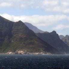
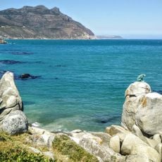
Chapman's Peak is a winding coastal road stretching 9 kilometers between Hout Bay and Noordhoek along Atlantic cliffs at about 600 meters elevation. The route features more than a hundred sharp turns carved into the mountainside, with pullouts and viewpoints where travelers can stop to look out at the ocean and rocky shoreline.

History

The road was constructed between 1915 and 1922 as a major engineering feat to connect two coastal towns that previously had no direct route between them. The project carved a path through challenging terrain and became one of the region's most important transportation links during the 20th century.

Culture

The road takes its name from an English maritime explorer who charted these waters centuries ago, and today visitors can see how the winding route hugs the cliffs in a way that feels almost like driving along the edge of the ocean itself. Many people stop at pullouts to photograph the rocky shoreline below or simply stand and watch how the light changes on the water throughout the day.

Practical

The drive is best enjoyed during daylight hours, and drivers should travel slowly as the numerous curves demand full attention on the road. Several marked stops and rest areas allow travelers to pause safely and enjoy the views without needing to pull over unexpectedly.

Did you know?

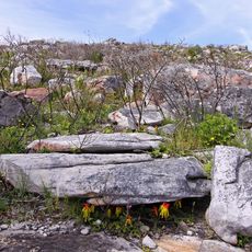
Despite its dramatic clifftop location and steep grades, the road was prone to rockfalls until extensive safety measures were installed with protective mesh and anchored systems to catch debris. These protective barriers remain visible today along the highest sections, making the engineering efforts to keep the route open quite apparent.

Location
Elevation above the sea
592 m
Address
Chapman's Peak, Hout Bay, Cape Town, South Africa
GPS coordinates
-34.08843,18.35961
Latest update
December 20, 2025 15:29

AroundUs brings together thousands of curated places, local tips, and hidden gems, enriched daily by 60,000 contributors worldwide. Discover all places nearby (Western Cape).

« Chapman's Peak - Mountain pass road in Western Cape, South Africa » is provided by Around Us (aroundus.com). Images and texts are derived from Wikimedia project under a Creative Commons license. You are allowed to copy, distribute, and modify copies of this page, under the conditions set by the license, as long as this note is clearly visible.

Discover hidden gems everywhere you go!

From secret cafés to breathtaking viewpoints, skip the crowded tourist spots and find places that match your style. Our app makes it easy with voice search, smart filtering, route optimization, and insider tips from travelers worldwide. Download now for the complete mobile experience.

Around Us App Screenshot

A unique approach to discovering new places

Le Figaro

All the places worth exploring

France Info

A tailor-made excursion in just a few clicks

20 Minutes

Around Us
Travel Guide & Maps
Download

Send to your phone

QR Code
1

Open the camera app on your mobile.

2

Point at the QR code with your camera. A notification will appear.

3

Tap the notification to open the link.