Augrabies Falls National Park
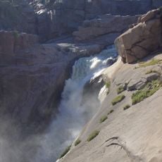
Augrabies Falls National Park, National park with 56-meter waterfall in Northern Cape, South Africa
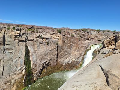
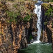
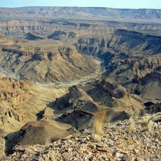
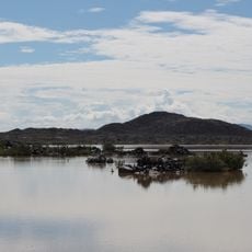
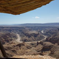
Augrabies Falls National Park is a protected area in Northern Cape where the Orange River plunges over a 56-meter-high waterfall with dramatic force. The river carves through a narrow granite gorge that spans roughly 18 kilometers and reaches depths of 240 meters in places.
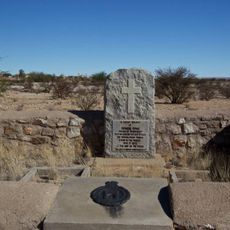
European explorers first encountered the falls in the early 1600s, but the Swedish mercenary Hendrik Jakob Wikar provided the first detailed record of the site in October 1778 after his journey through remote terrain. The area gained official protection status much later as conservation efforts expanded across South Africa.
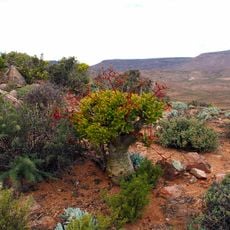
Local San and Khoikhoi communities named the falls after the roaring sound of water crashing against stone, a name that echoes through the landscape even today. This connection to the land remains visible in how the park honors and shares the stories of its first inhabitants.
The park opens daily from early morning through late afternoon with accommodations available on-site for overnight visits. Wear sturdy shoes and bring plenty of water, as trails cross rocky terrain and involve uneven walking surfaces.
During rainy seasons, water flow surges dramatically and exceeds the discharge rates of many famous waterfalls around the world. This seasonal variation means each visit can feel quite different depending on when you arrive.
Location: Northern Cape
Inception: 1966
Elevation above the sea: 621 m
Address: Augrabies, 8874, South Africa
Opening Hours: Monday-Sunday 07:00-18:30
Phone: 0544529205
Website: http://sanparks.org/parks/augrabies
GPS coordinates: -28.59111,20.33833
Latest update: December 6, 2025 16:03
South Africa offers very different landscapes, from the windy Cape to the blue mountains of the Drakensberg. You can spend a morning on the Table Mountain, an evening watching whales in Hermanus, and in between, explore red trails, deep canyons, lagoons, and vineyards. The nature parks host large animals that you can see. Kruger Park opens its roads at dawn, Pilanesberg shows an ancient crater, and iSimangaliso combines reefs and wetlands in one place. Further along, the wild coast shows its tall cliffs, the Richtersveld spreads its desert of succulents, and the Valley of Desolation keeps its lava columns for a long time. As you travel across this large country, you notice how the landscape shifts at every turn. The journey here moves with the rhythm of light and horizons, step by step through a land that keeps changing.
Square Kilometre Array
258.8 km
Fish River Canyon
287.7 km
Kgalagadi Transfrontier Park
314.4 km
MeerKAT
259.3 km
Richtersveld
306.4 km
Augrabies Falls
232 m
Quiver Tree Forest
313.4 km
Tswalu Kalahari Reserve
252.7 km
KAT-7
258.8 km
Hydrogen Epoch of Reionization Array
259.5 km
Goegap Nature Reserve
257.1 km
Giants' playground
312.4 km
Khomani Cultural Landscape
323.2 km
South African Radio Astronomy Observatory
259.3 km
Rhenish Mission Church
312.3 km
Schlangkopf
319.2 km
Historical Gateways
157.7 km
Erholungsgebiet Naute
300 km
Edward Cook's Commemorative Stone
158.2 km
Stone Rondavel
205.6 km
Quivertree Forest and Mesosaurus Fossiles
313.4 km
Hiker's Viewpoint
291.1 km
Klipkerk
266.9 km
C-BASS South
308.8 km
Kieliekrankie Wilderness Camp
269.2 km
Twee Rivieren Camp
237.5 km
Dutch Reformed Church, Williston
311.1 km
Carnarvon Museum
316.3 kmVisited this place? Tap the stars to rate it and share your experience / photos with the community! Try now! You can cancel it anytime.
Discover hidden gems everywhere you go!
From secret cafés to breathtaking viewpoints, skip the crowded tourist spots and find places that match your style. Our app makes it easy with voice search, smart filtering, route optimization, and insider tips from travelers worldwide. Download now for the complete mobile experience.
A unique approach to discovering new places❞
— Le Figaro
All the places worth exploring❞
— France Info
A tailor-made excursion in just a few clicks❞
— 20 Minutes