Chest opened
+${chestReward.xp} XP
Explorer
NOUVEAU ×${chestReward.collectible.quantity}
tapez pour fermer
Chest locked

Open chests in the app

Around Us is built for your phone — chests unlock when you walk, explore and capture nearby places.

Enable Location

We need your location to show you interesting places around you

Discover nearby places

Find interesting locations and hidden gems around you

Precise directions

Get accurate directions and distances to places

Your location is never shared with other users. It's only used when you tap the location button.

Log in to your account

Start exploring — it's free

Trusted by 74,663 travelers worldwide

Continue with Google
Continue with Apple
or

We will send you a code to connect

By continuing, you accept our Terms and Conditions and our Privacy Policy

Check your inbox

We've sent a pincode in your inbox. Please enter the code below.

Katanda
Discussion Reviews Photo
1.2k Popularity

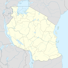
Katanda, Administrative territory in Kasai-Oriental, Democratic Republic of the Congo

Katanda is an administrative territory in Kasai-Oriental that comprises multiple sectors and rural communities spread across the region. The territory is organized into distinct administrative divisions that manage local governance and community affairs across different geographical zones.

Katanda emerged as an administrative territory from the colonial division of the region and developed into a distinct administrative unit. Over decades, the territory's modern structure took shape through various changes in regional governance and organization.

The territory includes four sectors - Baluba-Lubilanji, Bena Tshitolo, Mutuayi, and Nsangu - where Tshiluba serves as the primary language of communication.

The territory is most accessible during the dry season when roads are in better condition for travel. Getting oriented across the different sectors is easier with local guidance, as the territorial organization can be complex for visitors unfamiliar with the region.

Recent community conflicts in Katanda led to the burning of 421 houses across multiple incidents, causing substantial population displacement throughout the region.

The community of curious travelers

AroundUs brings together thousands of curated places, local tips, and hidden gems, enriched daily by 60,000 contributors worldwide.

Start exploring
Location
GPS coordinates
-6.33333,23.90000
Latest update
December 14, 2025 18:03
Around this place
Gombe National Park
Tanzania

Gombe National Park

661.8 km
Nyungwe Forest
Rwanda

Nyungwe Forest

731.6 km
Salonga National Park
Congo, Democratic Republic of the

Salonga National Park

558.9 km
Kahuzi-Biéga National Park
Congo, Democratic Republic of the

Kahuzi-Biéga National Park

643.9 km
Mahale Mountains National Park
Tanzania

Mahale Mountains National Park

667.6 km
Kibira National Park
Burundi

Kibira National Park

722.3 km
Upemba National Park
Congo, Democratic Republic of the

Upemba National Park

420.5 km
Livingstone–Stanley Monument
Burundi

Livingstone–Stanley Monument

682.9 km
Upemba Depression
Congo, Democratic Republic of the

Upemba Depression

373.9 km
Stade Frederic Kibassa Maliba
Congo, Democratic Republic of the

Stade Frederic Kibassa Maliba

716 km
Rusizi National Park
Burundi

Rusizi National Park

683.8 km
Lofoi Falls
Congo, Democratic Republic of the

Lofoi Falls

598.1 km
Sts. Peter and Paul Cathedral, Lubumbashi
Congo, Democratic Republic of the

Sts. Peter and Paul Cathedral, Lubumbashi

712.1 km
National Museum of Lubumbashi
Congo, Democratic Republic of the

National Museum of Lubumbashi

710.5 km
Our Lady of Peace Cathedral, Bukavu
Congo, Democratic Republic of the

Our Lady of Peace Cathedral, Bukavu

696.3 km
Chutes de la Kagera
Burundi

Chutes de la Kagera

739.7 km
Living Museum of Bujumbura
Burundi

Living Museum of Bujumbura

688 km
Lake Nzilo
Congo, Democratic Republic of the

Lake Nzilo

507.5 km
Regina Mundi Cathedral
Burundi

Regina Mundi Cathedral

688.8 km
Stade de la Concorde
Congo, Democratic Republic of the

Stade de la Concorde

694.5 km
Mumbuluma Falls
Zambia

Mumbuluma Falls

738.1 km
Pont Ruzizi I
Congo, Democratic Republic of the

Pont Ruzizi I

699.9 km
Stade des Jeunes
Congo, Democratic Republic of the

Stade des Jeunes

174.5 km
Pont Ruzizi II
Congo, Democratic Republic of the

Pont Ruzizi II

696.1 km
Our Lady of the Assumption Cathedral, Saurimo
Angola

Our Lady of the Assumption Cathedral, Saurimo

535 km
Ikamba
Tanzania

Ikamba

739.7 km
30 June Building
Congo, Democratic Republic of the

30 June Building

710.6 km
Monument de l'Unité Nationale
Burundi

Monument de l'Unité Nationale

691.1 km
Show the full map
Reviews
Share your experience

No review yet

Discussions
Start a discussion...

No discussion yet

« Katanda - Administrative territory in Kasai-Oriental, Democratic Republic of the Congo » is provided by Around Us (aroundus.com). Images and texts are derived from Wikimedia project under a Creative Commons license. You are allowed to copy, distribute, and modify copies of this page, under the conditions set by the license, as long as this note is clearly visible.

Discover hidden gems everywhere you go!

From secret cafés to breathtaking viewpoints, skip the crowded tourist spots and find places that match your style. Our app makes it easy with voice search, smart filtering, route optimization, and insider tips from travelers worldwide. Download now for the complete mobile experience.

Around Us App Screenshot

A unique approach to discovering new places

Le Figaro

All the places worth exploring

France Info

A tailor-made excursion in just a few clicks

20 Minutes

Around Us
Travel Guide & Maps
Download

Send to your phone

QR Code
1

Open the camera app on your mobile.

2

Point at the QR code with your camera. A notification will appear.

3

Tap the notification to open the link.