Chest opened
+${chestReward.xp} XP
Explorer
NOUVEAU ×${chestReward.collectible.quantity}
tapez pour fermer
Chest locked

Open chests in the app

Around Us is built for your phone — chests unlock when you walk, explore and capture nearby places.

Enable Location

We need your location to show you interesting places around you

Discover nearby places

Find interesting locations and hidden gems around you

Precise directions

Get accurate directions and distances to places

Your location is never shared with other users. It's only used when you tap the location button.

Ubangi River

Log in to your account

Start exploring — it's free

Trusted by 72,888 travelers worldwide

Continue with Google
Continue with Apple
or

We will send you a code to connect

By continuing, you accept our Terms and Conditions and our Privacy Policy

Check your inbox

We've sent a pincode in your inbox. Please enter the code below.

Discussion Reviews 2 Photos
24.4k Popularity

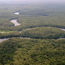
Ubangi River, Major river system in Central Africa

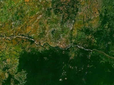
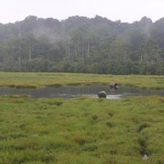
The Ubangi is a major river in Central Africa and one of the Congo River's most important tributaries. The waterway flows about 1,060 kilometers and forms natural boundaries between several countries, serving as a vital connection through the region.

European explorers first mapped the river in the 1800s and documented its connection to the Congo system. These early expeditions revealed the waterway's role as a major geographic link across Central Africa.

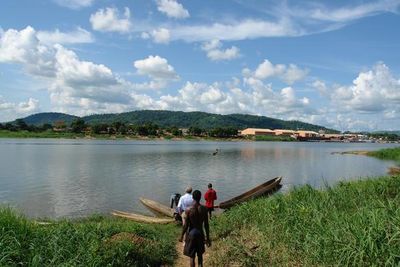
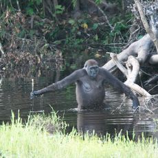
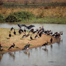
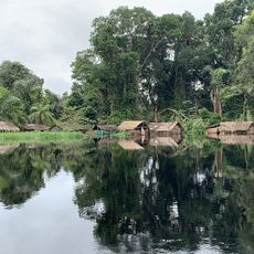
Fishing communities have lived along the river for generations, and you can see nets drying on the banks throughout the day. The waterway remains central to how local villages obtain food and water for their daily routines.

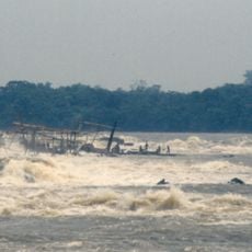
The waterway is navigable for larger boats and connects various settlements and trading centers throughout the region. Check local water conditions and seasonal levels before planning any journey on the river.

Millions of years ago, this waterway flowed in a completely different direction and belonged to an entirely separate river system. This ancient geological shift fundamentally changed the landscape of Central Africa.

The community of curious travelers

AroundUs brings together thousands of curated places, local tips, and hidden gems, enriched daily by 60,000 contributors worldwide.

Start exploring
Location
Elevation above the sea
335 m
GPS coordinates
4.12306,22.43528
Latest update
December 20, 2025 12:44
Around this place
Boyoma Falls
Congo, Democratic Republic of the

Boyoma Falls

508.3 km
Salonga National Park
Congo, Democratic Republic of the

Salonga National Park

657.1 km
Nouabalé-Ndoki National Park
Congo

Nouabalé-Ndoki National Park

679.8 km
Dzanga-Sangha Special Reserve
Central African Republic

Dzanga-Sangha Special Reserve

682.1 km
Central African Republic

Berengo's Palace

484.7 km
Dzanga-Ndoki National Park
Central African Republic

Dzanga-Ndoki National Park

719.7 km
Central African Republic

Chinko

268.9 km
Cathédrale Notre-Dame
Central African Republic

Cathédrale Notre-Dame

429.1 km
Mbeli Bai
Congo

Mbeli Bai

700.9 km
Lobéké National Park
Cameroon

Lobéké National Park

771.7 km
Odzala National Park
Congo

Odzala National Park

912.6 km
Manovo-Gounda St. Floris National Park
Central African Republic

Manovo-Gounda St. Floris National Park

498.1 km
Sangha Trinational
Central African Republic

Sangha Trinational

697.2 km
Central African Republic

Bamingui-Bangoran National Park and Biosphere Reserve

540.2 km
Jardin Botanique d'Eala
Congo, Democratic Republic of the

Jardin Botanique d'Eala

644.6 km
Gabon

Mont Bengoué

1034.8 km
Api Elephant Domestication Center
Congo, Democratic Republic of the

Api Elephant Domestication Center

332.1 km
Congo, Democratic Republic of the

Tshopo dam

505.2 km
Ntokou-Pikounda National Park
Congo

Ntokou-Pikounda National Park

777.7 km
Mont Nabemba
Congo

Mont Nabemba

972.5 km
Stade Lumumba
Congo, Democratic Republic of the

Stade Lumumba

504.4 km
Chutes de Boali
Central African Republic

Chutes de Boali

494.1 km
Congo

Dzanga-Sangha Complex of Protected Areas

725.5 km
Congo

Lake Télé Community Reserve

663.5 km
Congo, Democratic Republic of the

Ngiri Reserve

690.7 km
St. Peter Claver Cathedral, Bangassou
Central African Republic

St. Peter Claver Cathedral, Bangassou

80.9 km
Our Lady of the Rosary Cathedral, Kisangani
Congo, Democratic Republic of the

Our Lady of the Rosary Cathedral, Kisangani

505.4 km
Central African Republic

Nana Barya Faunal Reserve

672 km
Show the full map
Reviews
Share your experience

No review yet

Discussions
Start a discussion...

No discussion yet

« Ubangi River - Major river system in Central Africa » is provided by Around Us (aroundus.com). Images and texts are derived from Wikimedia project under a Creative Commons license. You are allowed to copy, distribute, and modify copies of this page, under the conditions set by the license, as long as this note is clearly visible.

Discover hidden gems everywhere you go!

From secret cafés to breathtaking viewpoints, skip the crowded tourist spots and find places that match your style. Our app makes it easy with voice search, smart filtering, route optimization, and insider tips from travelers worldwide. Download now for the complete mobile experience.

Around Us App Screenshot

A unique approach to discovering new places

Le Figaro

All the places worth exploring

France Info

A tailor-made excursion in just a few clicks

20 Minutes

Around Us
Travel Guide & Maps
Download

Send to your phone

QR Code
1

Open the camera app on your mobile.

2

Point at the QR code with your camera. A notification will appear.

3

Tap the notification to open the link.