Enable Location

We need your location to show you interesting places around you

Discover nearby places

Find interesting locations and hidden gems around you

Precise directions

Get accurate directions and distances to places

Your location is never shared with other users. It's only used when you tap the location button.

Cap Malheureux

Log in to your account

Start exploring — it's free

Trusted by 61,345 travelers worldwide

Continue with Google
Continue with Apple
or

We will send you a code to connect

By continuing, you accept our Terms and Conditions and our Privacy Policy

Check your inbox

We've sent a pincode in your inbox. Please enter the code below.

Cap Malheureux

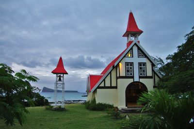
Cap Malheureux, Coastal village in Rivière du Rempart District, Mauritius.

Description

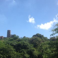
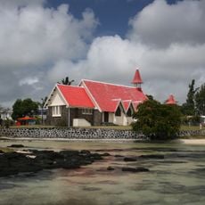
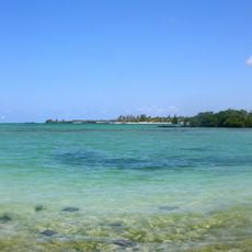
Cap Malheureux is a coastal village on the northern shore of Mauritius, home to around 5,000 people spread along the waterfront. The most striking feature is a church with a distinctive red roof that rises directly above the ocean, making it visible from far away.

History

This location served as the landing point for the British invasion of Mauritius in 1810, which ultimately ended French colonial control. The successful military campaign from this shore transformed the island's political fate and established British governance.

Culture

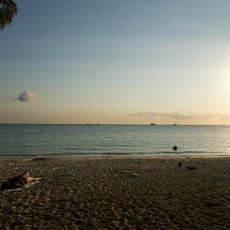
The fishing community forms the backbone of daily life here, with boats and nets being a common sight along the shore. Local families have maintained these maritime traditions for generations, creating a strong sense of place.

Practical

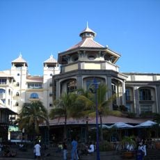
The village is accessible by road and has basic services and small shops scattered throughout the main streets. Early mornings and late afternoons are the best times to visit if you want to see the fishing activities and experience the authentic rhythm of the place.

Did you know?

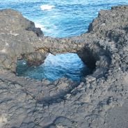
The name comes from the many shipwrecks that happened on the coral reefs surrounding the area, creating a darker chapter in local maritime history. The jagged coral formations visible from shore still serve as a reminder of those dangerous waters and past naval incidents.

Elevation above the sea
9 m
GPS coordinates
-19.98417,57.61417
Latest update
December 6, 2025 16:04

AroundUs brings together thousands of curated places, local tips, and hidden gems, enriched daily by 60,000 contributors worldwide. Discover all places nearby (Rivière du Rempart District).

Natural places and local culture in Mauritius

Mauritius offers natural places away from tourist centers. The island shows its geological diversity through beaches, waterfalls, and hiking paths. Black River Gorges National Park is home to rare animal and plant species. You can swim in clear water at beaches like La Cuvette and Pointe d'Esny. The...

« Cap Malheureux - Coastal village in Rivière du Rempart District, Mauritius » is provided by Around Us (aroundus.com). Images and texts are derived from Wikimedia project under a Creative Commons license. You are allowed to copy, distribute, and modify copies of this page, under the conditions set by the license, as long as this note is clearly visible.

Discover hidden gems everywhere you go!

From secret cafés to breathtaking viewpoints, skip the crowded tourist spots and find places that match your style. Our app makes it easy with voice search, smart filtering, route optimization, and insider tips from travelers worldwide. Download now for the complete mobile experience.

Around Us App Screenshot

A unique approach to discovering new places

Le Figaro

All the places worth exploring

France Info

A tailor-made excursion in just a few clicks

20 Minutes

Around Us
Travel Guide & Maps
Download

Send to your phone

QR Code
1

Open the camera app on your mobile.

2

Point at the QR code with your camera. A notification will appear.

3

Tap the notification to open the link.