Masoala National Park

Log in to your account

AroundUs is a community-driven map of interesting places, built by curious explorers like you. It grows with every review, story, and photo you share.
Connect to save your favorite spots, contribute locations, and create personalized routes.
By continuing, you accept our Terms and Conditions and our Privacy Policy
Add to collection
Map
Suggest a change
Share

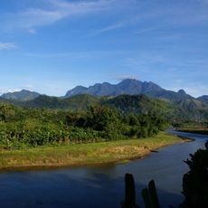
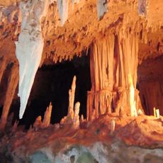
Masoala National Park, National park on Madagascar's northeastern coast.

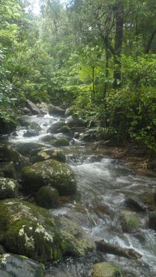
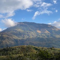
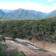
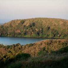
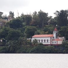
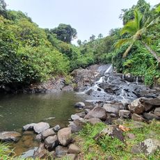
Masoala National Park is a protected area on Madagascar's northeastern coast comprising rainforests, mangrove swamps, and coral reefs. The terrain spans several kilometers and blends different habitats that together form a diverse ecosystem.

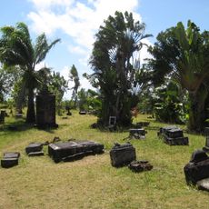
The protected area was established in 1997 to preserve Madagascar's native species and habitats. In 2007, it was designated as part of the Rainforests of Atsinanana UNESCO World Heritage Site.

Local communities like the Betsimisaraka have lived alongside these forests for generations, relying on sustainable practices for fishing and farming. Travelers can observe how daily life remains connected to the natural rhythms of the land and sea.

The park is best reached through the town of Maroantsetra, from where boats transport visitors to various sections. Physical preparation helps, as trails through wet areas and forests can be demanding.

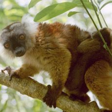
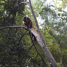
Certain primate species like red-ruffed lemurs exist nowhere else on Earth and live only within this forest area. This isolated population shows how species evolve differently in remote locations.

Inception: 1997

Part of: Rainforests of the Atsinanana

GPS coordinates: -15.65000,50.18333

Latest update: December 6, 2025 16:04

Madagascar photography: baobabs, Tsingy, national parks

Madagascar features natural landscapes ranging from the baobab avenues near Morondava to the limestone formations of the Tsingy and coastal areas with coral reefs. The country's national parks protect tropical rainforests inhabited by lemurs, along with geological features including crater lakes and sandstone formations. The highest peaks rise in the northern mountain ranges, while the southern regions are characterized by dry landscapes. Photogenic locations include the Isalo Massif with its eroded sandstone canyons, the Masoala Peninsula with its rainforests along the Indian Ocean, and the island of Nosy Be off the northwest coast. The beaches at Ifaty and Anakao attract visitors for their reefs, while Sainte-Marie Island is known for whale watching between July and September. The Kirindy forests in the west are home to nocturnal lemurs and fossas. Historic sites include the royal hill of Ambohimanga, a UNESCO World Heritage site, and the Rova palace in Antananarivo. The geysers at Ampefy and the crater lake Tritriva showcase the volcanic history of the highlands. The red Tsingy near Sadjoavato formed through erosion of iron-rich sandstone and contrast with the gray limestone Tsingy in the west.

Reviews

Visited this place? Tap the stars to rate it and share your experience / photos with the community! Try now! You can cancel it anytime.

« Masoala National Park - National park on Madagascar's northeastern coast » is provided by Around Us (aroundus.com). Images and texts are derived from Wikimedia project under a Creative Commons license. You are allowed to copy, distribute, and modify copies of this page, under the conditions set by the license, as long as this note is clearly visible.

Discover hidden gems everywhere you go!

From secret cafés to breathtaking viewpoints, skip the crowded tourist spots and find places that match your style. Our app makes it easy with voice search, smart filtering, route optimization, and insider tips from travelers worldwide. Download now for the complete mobile experience.

Around Us App Screenshot

A unique approach to discovering new places

Le Figaro

All the places worth exploring

France Info

A tailor-made excursion in just a few clicks

20 Minutes