Enable Location

We need your location to show you interesting places around you

Discover nearby places

Find interesting locations and hidden gems around you

Precise directions

Get accurate directions and distances to places

Your location is never shared with other users. It's only used when you tap the location button.

Maromokotro

Log in to your account

Join the adventure

Create your free account and start exploring (like 60k+ others)

We will send you a code to connect

or
Continue with Google
Continue with Apple
By continuing, you accept our Terms and Conditions and our Privacy Policy

Check your inbox

We've sent a pincode in your inbox. Please enter the code below.

Maromokotro

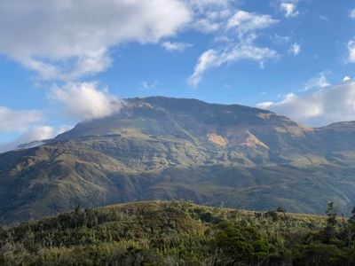
Maromokotro, Volcanic summit in Diana Region, Madagascar

Description

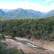
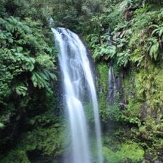
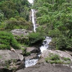
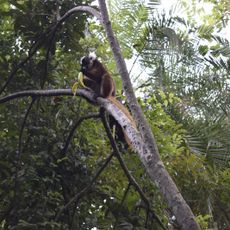
Maromokotro stands at 2,876 meters within the Tsaratanana Massif and is Madagascar's highest summit. The massif features steep terrain covered in dense forest that extends across several mountain ridges.

History

The first documented climb happened in 1936 when a French explorer reached the summit and built a small cairn there. This marked an early European exploration of this remote area.

Culture

The name Maromokotro comes from the Malagasy language and reflects how local communities see themselves connected to natural landmarks in this region. Stories and beliefs tied to the mountain remain important to the people who live nearby.

Practical

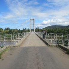
Getting there takes more than two days from the nearest towns of Bealanana and Ambanja through dense terrain. Visitors should be prepared for a multi-day trek with challenging conditions and bring appropriate gear.

Did you know?

The summit acts as a critical water divider, separating three major river basins that feed the Bermarivo, Mahavavy, and Sambirano rivers. This role as a watershed makes the peak an important but quiet part of the region's water cycle.

Location
Elevation above the sea
2,876 m
GPS coordinates
-14.02258,48.96765
Latest update
December 6, 2025 16:03

AroundUs brings together thousands of curated places, local tips, and hidden gems, enriched daily by 60,000 contributors worldwide. Discover all places nearby (Diana Region).

Madagascar photography: baobabs, Tsingy, national parks

Madagascar features natural landscapes ranging from the baobab avenues near Morondava to the limestone formations of the Tsingy and coastal areas with coral reefs. The country's national parks protect tropical rainforests inhabited by lemurs, along with geological features including crater lakes and...

« Maromokotro - Volcanic summit in Diana Region, Madagascar » is provided by Around Us (aroundus.com). Images and texts are derived from Wikimedia project under a Creative Commons license. You are allowed to copy, distribute, and modify copies of this page, under the conditions set by the license, as long as this note is clearly visible.

Discover hidden gems everywhere you go!

From secret cafés to breathtaking viewpoints, skip the crowded tourist spots and find places that match your style. Our app makes it easy with voice search, smart filtering, route optimization, and insider tips from travelers worldwide. Download now for the complete mobile experience.

Around Us App Screenshot

A unique approach to discovering new places

Le Figaro

All the places worth exploring

France Info

A tailor-made excursion in just a few clicks

20 Minutes

Around Us
Travel Guide & Maps
Download

Send to your phone

QR Code
1

Open the camera app on your mobile.

2

Point at the QR code with your camera. A notification will appear.

3

Tap the notification to open the link.