Marojejy National Park, National park in northeastern Madagascar
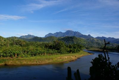
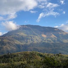
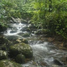
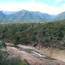
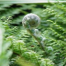
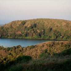
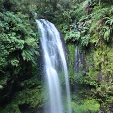
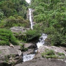
Marojejy is a protected area in northeastern Madagascar featuring rainforest and mountainous terrain that ranges from low valleys to high peaks. The landscape contains dense forest growth in the lower regions with more open vegetation as elevation increases.
The area was established as a reserve in 1948 and later designated a national park to protect its forest diversity and animal life. International recognition came in the early 2000s when it became part of a UNESCO World Heritage designation for rainforests.
Local communities around the park rely on forests for hunting and gathering, practices passed down through generations in the villages nearby. They navigate their connection to the land while respecting the boundaries that protect the wildlife living here.
Visitors enter through the village of Manantenina, where guided trips to established camps at various elevations can be arranged. Travel during drier months makes trails easier to walk and offers better conditions for exploration.
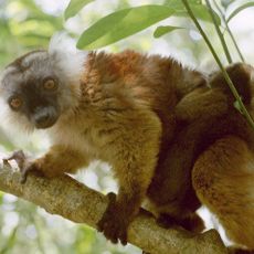
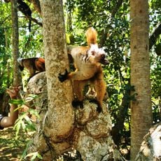
The park is home to a rare lemur called the white silky sifaka, found nowhere else on the island. This species depends on the specific forest conditions here and can only be seen in the wild in this one location.
GPS coordinates: -14.46145,49.67175
Latest update: December 6, 2025 16:03
Madagascar features natural landscapes ranging from the baobab avenues near Morondava to the limestone formations of the Tsingy and coastal areas with coral reefs. The country's national parks protect tropical rainforests inhabited by lemurs, along with geological features including crater lakes and sandstone formations. The highest peaks rise in the northern mountain ranges, while the southern regions are characterized by dry landscapes. Photogenic locations include the Isalo Massif with its eroded sandstone canyons, the Masoala Peninsula with its rainforests along the Indian Ocean, and the island of Nosy Be off the northwest coast. The beaches at Ifaty and Anakao attract visitors for their reefs, while Sainte-Marie Island is known for whale watching between July and September. The Kirindy forests in the west are home to nocturnal lemurs and fossas. Historic sites include the royal hill of Ambohimanga, a UNESCO World Heritage site, and the Rova palace in Antananarivo. The geysers at Ampefy and the crater lake Tritriva showcase the volcanic history of the highlands. The red Tsingy near Sadjoavato formed through erosion of iron-rich sandstone and contrast with the gray limestone Tsingy in the west.
Maromokotro
90.3 km
Masoala National Park
143.3 km
Rainforests of the Atsinanana
3.3 km
Amber Mountain National Park
215.2 km
Zahamena National Park
363.5 km
Red Tsingy
203.8 km
Lokobe Reserve
188.1 km
Tsaratanana Reserve
104.7 km
Parc naturel marin des Glorieuses
412.3 km
Leuchtturm l'île aux Prunes
400 km
Réserve naturelle nationale de l'archipel des Glorieuses
411.3 km
Mont Passot
201 km
Betsiboka Bridge
401.3 km
Нусі-Бе (вулкан)
180.9 km
Cascade d'Antomboka
216.6 km
Humbert Falls
9.8 km
Fanambana Bridge
107.5 km
Pont de la Kamoro
348.7 km
Antaninaomby
179.7 km
Saint Mary, Ambodifototra
283.9 km
Pointe Katsépé Lighthouse
396.7 km
Ramena Beach
248.9 km
Phare du Katsepy
396.7 km
Pirates Cemetery
284.5 km
Tanikely Lighthouse
189.5 km
Cap Miné Lighthouse
250.3 km
Anjohibe Cave
322.9 km
LemuriaLand
191.5 kmReviews
Visited this place? Tap the stars to rate it and share your experience / photos with the community! Try now! You can cancel it anytime.
Discover hidden gems everywhere you go!
From secret cafés to breathtaking viewpoints, skip the crowded tourist spots and find places that match your style. Our app makes it easy with voice search, smart filtering, route optimization, and insider tips from travelers worldwide. Download now for the complete mobile experience.
A unique approach to discovering new places❞
— Le Figaro
All the places worth exploring❞
— France Info
A tailor-made excursion in just a few clicks❞
— 20 Minutes