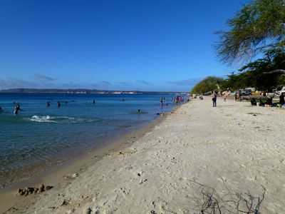
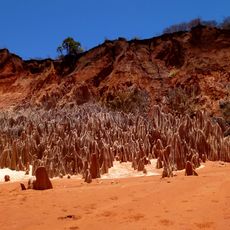
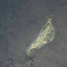
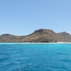
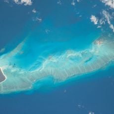
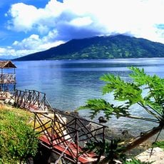
Ramena Beach, Beach in Diana Region, Madagascar.
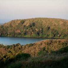
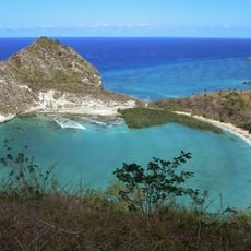
Ramena Beach is a sandy coastline in the Diana Region on Madagascar's northern shore, with palm trees, fishing boats, and several kilometers of waterfront. The water here offers three distinct zones for swimming and exploring: the protected bay, the open Indian Ocean, and an emerald-colored lagoon.
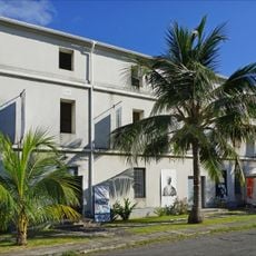
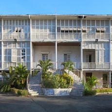
The area evolved from a small fishing settlement into a destination after French naval forces established a presence in nearby Antsiranana. This external influence gradually shaped its growth and importance.
Local fishermen launch wooden boats daily from the sand and sell their catches directly to visitors and residents. This working tradition shapes how the beach looks and feels throughout the day.
Reach the beach via an 18-kilometer paved road from Antsiranana using taxi services or organized tours. Plan time for the drive and ask locally about the best times for water activities and observing the fishing boats.
The beach provides access to three water zones that feel completely different from one another, each offering distinct swimming and exploration experiences. This arrangement lets you encounter multiple marine settings in one location.
Location: Diana Region
GPS coordinates: -12.24911,49.34154
Latest update: December 6, 2025 19:07
Madagascar features natural landscapes ranging from the baobab avenues near Morondava to the limestone formations of the Tsingy and coastal areas with coral reefs. The country's national parks protect tropical rainforests inhabited by lemurs, along with geological features including crater lakes and sandstone formations. The highest peaks rise in the northern mountain ranges, while the southern regions are characterized by dry landscapes. Photogenic locations include the Isalo Massif with its eroded sandstone canyons, the Masoala Peninsula with its rainforests along the Indian Ocean, and the island of Nosy Be off the northwest coast. The beaches at Ifaty and Anakao attract visitors for their reefs, while Sainte-Marie Island is known for whale watching between July and September. The Kirindy forests in the west are home to nocturnal lemurs and fossas. Historic sites include the royal hill of Ambohimanga, a UNESCO World Heritage site, and the Rova palace in Antananarivo. The geysers at Ampefy and the crater lake Tritriva showcase the volcanic history of the highlands. The red Tsingy near Sadjoavato formed through erosion of iron-rich sandstone and contrast with the gray limestone Tsingy in the west.
Maromokotro
201.5 km
Marojejy National Park
248.9 km
Masoala National Park
389.3 km
Rainforests of the Atsinanana
249.2 km
Farquhar Atoll
303.3 km
Amber Mountain National Park
43.5 km
Cosmoledo
341.7 km
Red Tsingy
46.6 km
Lokobe Reserve
169.5 km
Providence Atoll
370.4 km
Parc naturel marin de Mayotte
376.7 km
Tsaratanana Reserve
198.1 km
Parc naturel marin des Glorieuses
250.1 km
Musée de Mayotte
447.9 km
Réserve naturelle nationale de l'archipel des Glorieuses
234.8 km
Résidence du gouverneur
448 km
Mont Passot
169.8 km
Plage de Moya
443.7 km
Нусі-Бе (вулкан)
151 km
St. Michael's Church, Dzaoudzi
448 km
Cascade d'Antomboka
42.6 km
Humbert Falls
245.3 km
Fanambana Bridge
160.4 km
Antaninaomby
173.7 km
Barracks of Petite Terre (Dzaoudzi, Mayotte)
448 km
Cap Miné Lighthouse
3.2 km
Tanikely Lighthouse
182.3 km
LemuriaLand
171.6 kmVisited this place? Tap the stars to rate it and share your experience / photos with the community! Try now! You can cancel it anytime.
Discover hidden gems everywhere you go!
From secret cafés to breathtaking viewpoints, skip the crowded tourist spots and find places that match your style. Our app makes it easy with voice search, smart filtering, route optimization, and insider tips from travelers worldwide. Download now for the complete mobile experience.
A unique approach to discovering new places❞
— Le Figaro
All the places worth exploring❞
— France Info
A tailor-made excursion in just a few clicks❞
— 20 Minutes