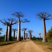
Red Tsingy, Protected rock formation in northern Madagascar
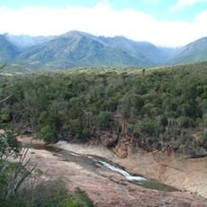
The Red Tsingy features tall red laterite spires and canyons rising from the ground, forming natural stone columns across the landscape.
The formation emerged through millions of years of erosion and weathering processes, transforming ancient seabed deposits into the current geological structure.
Local communities maintain traditional practices and share knowledge about the Red Tsingy formations through generations of guides and storytellers.
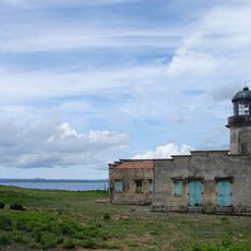
Visitors need sturdy shoes and sun protection when exploring the site, which requires a 50-kilometer journey south from Diego Suarez.
The distinct red coloration of these formations results from the combination of different mineral oxides in the laterite soil composition.
GPS coordinates: -12.63890,49.49720
Latest update: March 3, 2025 09:35
Madagascar features natural landscapes ranging from the baobab avenues near Morondava to the limestone formations of the Tsingy and coastal areas with coral reefs. The country's national parks protect tropical rainforests inhabited by lemurs, along with geological features including crater lakes and sandstone formations. The highest peaks rise in the northern mountain ranges, while the southern regions are characterized by dry landscapes. Photogenic locations include the Isalo Massif with its eroded sandstone canyons, the Masoala Peninsula with its rainforests along the Indian Ocean, and the island of Nosy Be off the northwest coast. The beaches at Ifaty and Anakao attract visitors for their reefs, while Sainte-Marie Island is known for whale watching between July and September. The Kirindy forests in the west are home to nocturnal lemurs and fossas. Historic sites include the royal hill of Ambohimanga, a UNESCO World Heritage site, and the Rova palace in Antananarivo. The geysers at Ampefy and the crater lake Tritriva showcase the volcanic history of the highlands. The red Tsingy near Sadjoavato formed through erosion of iron-rich sandstone and contrast with the gray limestone Tsingy in the west.
Maromokotro
164.4 km
Marojejy National Park
203.8 km
Masoala National Park
343.3 km
Rainforests of the Atsinanana
203.9 km
Farquhar Atoll
328 km
Amber Mountain National Park
37.5 km
Cosmoledo
387.2 km
Lokobe Reserve
153.3 km
Providence Atoll
401.1 km
Parc naturel marin de Mayotte
388.2 km
Tsaratanana Reserve
163.3 km
Parc naturel marin des Glorieuses
279.1 km
Musée de Mayotte
460.8 km
Réserve naturelle nationale de l'archipel des Glorieuses
266.9 km
Résidence du gouverneur
460.9 km
Mont Passot
157.2 km
Plage de Moya
456.5 km
Нусі-Бе (вулкан)
133.4 km
Cascade d'Antomboka
38.2 km
Humbert Falls
199.8 km
Fanambana Bridge
114.1 km
Antaninaomby
155.2 km
Barracks of Petite Terre (Dzaoudzi, Mayotte)
460.8 km
Ramena Beach
46.6 km
Cap Miné Lighthouse
47.4 km
Tanikely Lighthouse
165.9 km
Anjohibe Cave
428.9 km
LemuriaLand
156.2 kmReviews
Visited this place? Tap the stars to rate it and share your experience / photos with the community! Try now! You can cancel it anytime.
Discover hidden gems everywhere you go!
From secret cafés to breathtaking viewpoints, skip the crowded tourist spots and find places that match your style. Our app makes it easy with voice search, smart filtering, route optimization, and insider tips from travelers worldwide. Download now for the complete mobile experience.
A unique approach to discovering new places❞
— Le Figaro
All the places worth exploring❞
— France Info
A tailor-made excursion in just a few clicks❞
— 20 Minutes