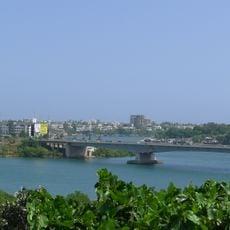
Makupa Causeway, Transportation bridge in Mombasa, Kenya.
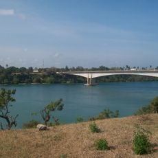
The Makupa Causeway is a road and rail causeway linking Mombasa island to the Kenyan mainland, running about one and a half miles between Magongo Circus and Makupa Circus. It separates Tudor Creek to the east from Port Reitz Creek to the west. The south-bound carriageway is elevated on an embankment, giving the road a two-level layout.
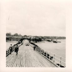
The causeway was built in 1929 by British colonial authorities to replace an older crossing known as the Britannia Bridge. The new structure allowed heavier loads and faster movement of goods between Mombasa and the interior of Kenya.
The causeway carries both the A109 Mombasa–Nairobi trunk road and the Uganda Railway, so road and rail traffic share the same corridor. Its name comes from the Swahili word Makupa, pronounced [maˈkupa]. The south end holds an armed police checkpoint used mainly for immigration and traffic policing.
The south end of the causeway holds an armed police checkpoint, used mainly for immigration and also for traffic policing, so carry identification when crossing. The road is limited to fifty miles per hour, and the south-bound carriageway runs elevated on an embankment.
The causeway's name was originally spelled "Macupa" when the British colonial government built it in 1929. It replaced the Britannia Bridge, completed in 1899, and spans roughly 1,200 feet (365 m). An armed police checkpoint at its south end handles immigration as well as traffic policing.
The community of curious travelers
AroundUs brings together thousands of curated places, local tips, and hidden gems, enriched daily by 93,123 contributors worldwide.