Chest opened
+${chestReward.xp} XP
Explorer
NOUVEAU ×${chestReward.collectible.quantity}
tapez pour fermer
Chest locked

Open chests in the app

Around Us is built for your phone — chests unlock when you walk, explore and capture nearby places.

Enable Location

We need your location to show you interesting places around you

Discover nearby places

Find interesting locations and hidden gems around you

Precise directions

Get accurate directions and distances to places

Your location is never shared with other users. It's only used when you tap the location button.

Log in to your account

Start exploring — it's free

Trusted by 72,985 travelers worldwide

Continue with Google
Continue with Apple
or

We will send you a code to connect

By continuing, you accept our Terms and Conditions and our Privacy Policy

Check your inbox

We've sent a pincode in your inbox. Please enter the code below.

Ujung Harbour, Surabaya
Discussion Reviews Photo
3.7k Popularity

Ujung Harbour, Surabaya, Maritime port in North Surabaya, Indonesia

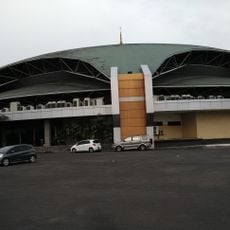
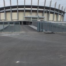
Ujung Harbour is a port facility located at the Mas River mouth where it meets the Madura Strait, featuring multiple docks and operational zones. The complex accommodates cargo ships, passenger vessels, and other maritime operations across its waterfront area.

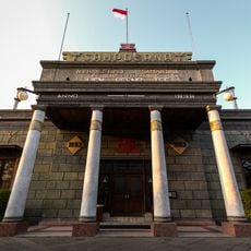
The harbour was established during colonial times and has continued to serve as a central trading point between East Java and maritime routes. Its growth reflects the broader expansion of regional commerce over more than a century.

The port embodies the maritime character of Surabaya, where seafarers and traders from different regions gather and conduct business. The daily activity along the docks reflects how central this place remains to local commerce and identity.

The facility operates continuously around the clock with designated zones for different vessel types, from container ships to passenger ferries. Access to operational areas can be limited due to ongoing maritime activities and safety regulations.

The facility includes a graving dock capable of handling vessels up to 50,000 deadweight tonnage, making it a major repair center for the eastern Indonesian region. This capacity draws maritime traffic from across the broader area.

The community of curious travelers

AroundUs brings together thousands of curated places, local tips, and hidden gems, enriched daily by 60,000 contributors worldwide.

Start exploring
GPS coordinates
-7.19844,112.73493
Latest update
December 11, 2025 18:09
Reviews
Share your experience

No review yet

Discussions
Start a discussion...

No discussion yet

« Ujung Harbour, Surabaya - Maritime port in North Surabaya, Indonesia » is provided by Around Us (aroundus.com). Images and texts are derived from Wikimedia project under a Creative Commons license. You are allowed to copy, distribute, and modify copies of this page, under the conditions set by the license, as long as this note is clearly visible.

Discover hidden gems everywhere you go!

From secret cafés to breathtaking viewpoints, skip the crowded tourist spots and find places that match your style. Our app makes it easy with voice search, smart filtering, route optimization, and insider tips from travelers worldwide. Download now for the complete mobile experience.

Around Us App Screenshot

A unique approach to discovering new places

Le Figaro

All the places worth exploring

France Info

A tailor-made excursion in just a few clicks

20 Minutes

Around Us
Travel Guide & Maps
Download

Send to your phone

QR Code
1

Open the camera app on your mobile.

2

Point at the QR code with your camera. A notification will appear.

3

Tap the notification to open the link.