North Morowali, Administrative region in Central Sulawesi, Indonesia.
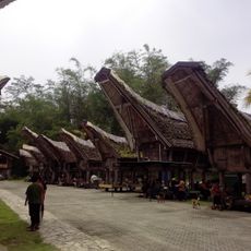
North Morowali is an administrative regency in Central Sulawesi with Kolonodale serving as its administrative center. The territory comprises ten districts spread across lowlands and highlands with varying terrain.
The regency was established in 2013 when seven northern districts separated from the original Morowali territory. This administrative division created a new independent government unit in the region.
The name reflects its position as the northern section of the former Morowali territory. Local communities identify with this geographic distinction and it shapes how they see themselves as a distinct group.
The region is remote from Indonesia's major urban centers and requires planning for travel. Visitors should familiarize themselves with local transportation options and road conditions before arriving.
The regency experienced rapid economic changes following its establishment through mining operations. This growth significantly altered the local landscape and economic opportunities for residents.
Location: Central Sulawesi
Inception: April 12, 2013
Capital city: Kolonodale
Elevation above the sea: 1,309 m
Shares border with: Banggai, Tojo Una Una, Poso, Morowali, East Luwu
GPS coordinates: -1.72070,121.24649
Latest update: December 7, 2025 10:08
Bantimurung – Bulusaraung National Park
391 km
Pettakere cave
404 km
Lore Lindu National Park
120.2 kmJesus Buntu Burake
216.2 km
Kete Kesu
205.8 km
Buntu Rantemario
229.8 km
Kepulauan Togean National Park
173.2 kmAl-Alam Kendari Mosque
289.8 km
Otanaha Fortress
319.8 km
Palopo Old Mosque
183.7 km
Palu IV Bridge
180.3 km
Al-Markaz Al-Islami Mosque
430 km
Bogani Nani Wartabone National Park
371.3 km
Floating Mosque of Palu
180.8 km
Colo
177.2 km
Rawa Aopa Watumohai National Park
307.5 km
Pokekea Megalithic Site
115 km
Pantai Indah Modisi
428.9 km
Kassi Kebo Stadium
410.3 km
Rumah Katu Marine Park
87.3 km
Sintuwu Maroso Square
65.7 km
Museum dan Monumen Pendaratan Pesawat Ampibi Catalina
319.8 km
Gereja GMIBM Efrata Modisi
429.5 km
Taman Nasional Hutan Mangrove
429.2 km
Modisi Beach
427.7 km
Gereja GPDI Modisi
429.8 km
Benteng weir
280 km
Gereja KGPM Modisi
429.4 kmVisited this place? Tap the stars to rate it and share your experience / photos with the community! Try now! You can cancel it anytime.
Discover hidden gems everywhere you go!
From secret cafés to breathtaking viewpoints, skip the crowded tourist spots and find places that match your style. Our app makes it easy with voice search, smart filtering, route optimization, and insider tips from travelers worldwide. Download now for the complete mobile experience.
A unique approach to discovering new places❞
— Le Figaro
All the places worth exploring❞
— France Info
A tailor-made excursion in just a few clicks❞
— 20 Minutes