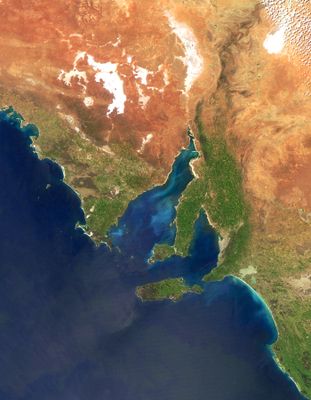
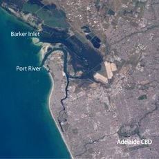
Gulf St Vincent, Bay in South Australia
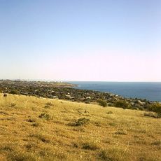
Gulf St Vincent is a bay off the coast of South Australia, located between the Fleurieu Peninsula and Yorke Peninsula. The waters contain soft sandy bottoms where sea grasses and crustaceans live in shallow areas.
British explorer Matthew Flinders charted and named the bay in 1802 in honor of Admiral John Jervis. French explorer Nicolas Baudin also mapped the waters during the same period.
The Kaurna people called this water Wongajerla, meaning western sea, and their connection to these waters remains strong in their traditions today. This name reflects how the local Indigenous people understood and valued the bay.
The bay is accessible from coastal roads along both peninsulas and from Adelaide's waterfront areas. Water conditions and visibility change with the seasons, so timing your visit can affect what you see.
The bay supplies water to Adelaide through a desalination plant that processes its salt water into fresh water for the city. This connection between the bay and the city's water supply is something most visitors don't realize while viewing the water.
The community of curious travelers
AroundUs brings together thousands of curated places, local tips, and hidden gems, enriched daily by 60,000 contributors worldwide.