Mount Tambo, Mountain summit in Victoria, Australia
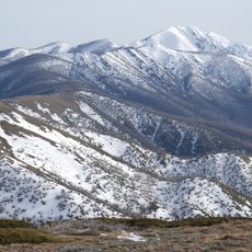
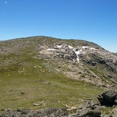
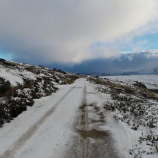
Mount Tambo is a 1,430-metre summit in the 6,050-hectare Marble Gully – Mount Tambo Nature Conservation Reserve, north-east of Omeo in Victoria. Its south-east slopes hold the headwaters of Deep Creek, which feeds the Tambo River, and Little Mount Tambo (1,227 m) rises to the near north-east.
The mountain was documented in 1862 by painter Eugene von Guerard during an expedition led by Georg Neumayer, who created sketches and an oil painting of the landscape. These artworks offer a rare glimpse into how the region looked during that period.
The mountain marks the intersection of three Australian counties: Benambra, Dargo, and Tambo, representing territorial boundaries in Victoria's administrative geography.
Mount Tambo lies within the 6,050-hectare Marble Gully – Mount Tambo Nature Conservation Reserve, northeast of Omeo. The headwaters of Deep Creek, which feeds the Tambo River, rise on the south-east slopes. The separate 2,740-hectare Mount Tambo Reserve was listed on the Register of the National Estate in 1990.
Mount Tambo marks the meeting point of the counties of Benambra, Dargo and Tambo, a boundary junction that appears on no sign at the summit. The 2,740-hectare Mount Tambo Reserve was listed on the Register of the National Estate in 1990, within today's 6,050-hectare Marble Gully – Mount Tambo Nature Conservation Reserve.
The community of curious travelers
AroundUs brings together thousands of curated places, local tips, and hidden gems, enriched daily by 94,069 contributors worldwide.