Mount Matthews, Mountain summit in Wellington region, New Zealand.
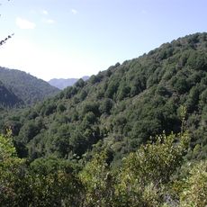
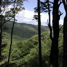
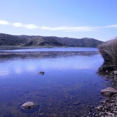
Mount Matthews is a 941 meter summit in the Remutaka Range near Wellington, surrounded by dense forest and characterized by steep, challenging pathways. The landscape transitions from lowland vegetation to thick woodland, with the terrain growing progressively steeper as elevation increases.
The summit served as a crucial navigation landmark for Maori tribes moving through the Wellington region for generations. Its prominent position in the landscape made it an important reference point for travel and seasonal movements.
The mountain holds significance for Maori communities as a place where cultural knowledge and connection to the land remains alive through ongoing practice. Local people use the summit and surrounding area as part of their spiritual and cultural relationship with this region.
The hiking trail from Catchpool Valley car park covers roughly 26 kilometers and demands solid footwear and plenty of water throughout the journey. Starting early in the day gives you adequate time to complete the walk at a comfortable pace without rushing.
In the final stretch toward the summit, the forest transforms into a tunnel of twisted, moss-covered trees that lean and interlock overhead. This unusual woodland growth happens because of the harsh wind and weather at altitude, creating an otherworldly passage through the vegetation.
The community of curious travelers
AroundUs brings together thousands of curated places, local tips, and hidden gems, enriched daily by 60,000 contributors worldwide.