Baring Head Lighthouse, Navigation lighthouse on Wellington Harbour entrance, New Zealand
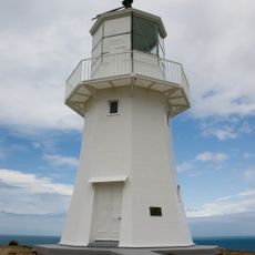
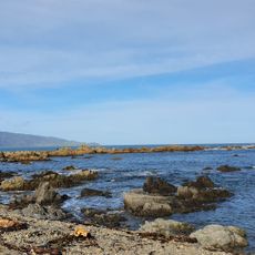
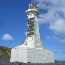
Baring Head Lighthouse is an octagonal concrete tower 12.2 m tall on a hilltop at Baring Head, giving its light a focal height of 87 m. It marks the approach to Wellington Harbour and the Cook Strait coast, and is reached by walking tracks in the southern part of East Harbour Regional Park, south of Wainuiomata.
Lit on 18 June 1935, the lighthouse replaced the Pencarrow Head light, which was decommissioned later that year. A diesel generator powered it until 1950, when it was connected to mains electricity. The 1000 W light was fully automated and demanned in 1989, and in February 2005 a flashing LED beacon replaced the original lens.
The lighthouse stands within East Harbour Regional Park, reached on foot via walking tracks south of Wainuiomata. Its light is one of the navigation marks shipping uses at the Cook Strait end of the approach into Wellington Harbour, and the site is owned and run by Maritime New Zealand.
The LED beacon operates automatically and is visible from about 18 kilometers away, serving as an essential navigation aid for ships. The location is accessible from the coastal area, allowing visitors to appreciate its role in maritime operations.
Near the lighthouse, a research station conducts atmospheric measurements and maintains the longest continuous record of carbon dioxide levels in the Southern Hemisphere. This scientific work often goes unnoticed compared to the beacon itself.
The community of curious travelers
AroundUs brings together thousands of curated places, local tips, and hidden gems, enriched daily by 93,411 contributors worldwide.