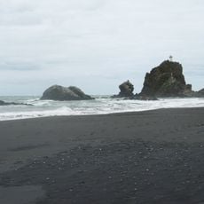
North Piha Beach, beach in New Zealand
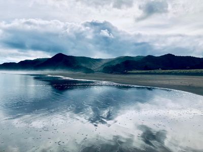
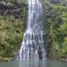
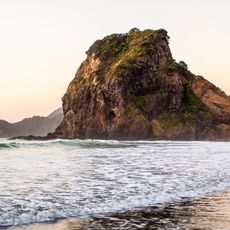
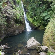
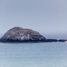
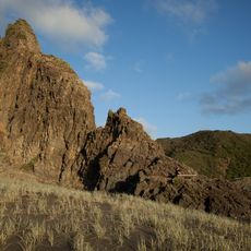
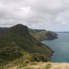
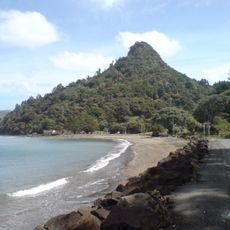
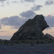
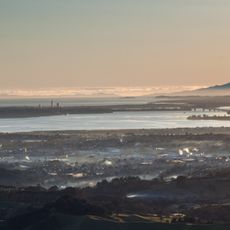
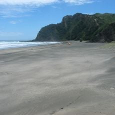
North Piha Beach is an olive sand beach on the west coast in the Auckland Region. The shoreline stretches over a substantial distance and is framed by dark rocky cliffs and formations that jut directly into the water.
The beach remained relatively quiet until it gained popularity as a recreational destination in the mid-20th century. The rocky formations have always been a defining feature of this coastal landscape.
Water temperatures are cold and currents are often strong, so caution is needed when swimming. It's easier to explore when the tide is low, as more sand becomes exposed and movement around the beach is less restricted.
Location: Auckland Region
GPS coordinates: -36.94611,174.46490
Latest update: December 6, 2025 19:07
Auckland sits between the Pacific Ocean and the Tasman Sea on a narrow isthmus marked by roughly 50 extinct volcanic cones. Mount Eden and One Tree Hill rise above the neighborhoods and offer views across the harbor, while Rangitoto stands as the largest volcanic island in the region and can be reached by ferry. The coastline shifts between the sheltered eastern beaches such as Mission Bay and Takapuna Beach and the black sand western shores at Piha and Bethells Beach, where the Pacific meets the Waitakere Ranges directly. The Auckland War Memorial Museum in Auckland Domain holds Polynesian collections and New Zealand military history, while Auckland Art Gallery displays European and indigenous art. Viaduct Harbour serves as a dining precinct and departure point for harbor cruises, and the New Zealand Maritime Museum documents the country's seafaring past. Karangahape Road gathers alternative shops and nightlife, Ponsonby draws an older crowd with cafés and boutiques. Britomart clusters restaurants and design stores in converted waterfront buildings. Waiheke Island hosts wineries such as Mudbrick Vineyard and Man O' War Vineyards scattered among vineyards and bays, while Tantalus Estate operates in West Auckland. Auckland Botanic Gardens present native plant species across 158 acres, and Auckland Zoo keeps over 1,400 animals. Queen Street runs through the center from the harbor to the University of Auckland, and Sky Tower stands 1,076 feet (328 meters) above the city. This selection covers the main sites for understanding Auckland's geography and range.
Kitekite Falls
2.7 km
Pukematekeo
9.6 km
Whites Beach
1.9 km
Arataki Visitor Centre
12.6 km
Upper Nihotupu Reservoir
8.8 km
Te Toiokawharu
7.7 km
Ninepin Rock
12.1 km
Ruaotuwhenua
8.2 km
Mokoroa Falls
12.3 km
Mount Donald McLean
10.2 km
Goldie Bush Scenic Reserve
11.2 km
Ark in the Park
8.5 km
Karekare Falls
4.7 km
Opal Pool Stream Cascade
4.8 km
Lion Rock
890 m
The Cascades
8.1 km
Karamatura Falls
9.3 km
Nihotupu Falls
8.4 km
Oaia Island
12.7 km
Panatahi Island
5.4 km
The Watchman
4.5 km
Clay Hill
11.4 km
Te Kā-a-Maki / Jackie Hill
11.5 km
Waiatarua TV Tower
9.4 km
Cutter Rock
11.5 km
Parkinsons Lookout
9.4 km
Huia Settlers Museum
10.9 km
Karekare Beach
4.8 kmReviews
Visited this place? Tap the stars to rate it and share your experience / photos with the community! Try now! You can cancel it anytime.
Discover hidden gems everywhere you go!
From secret cafés to breathtaking viewpoints, skip the crowded tourist spots and find places that match your style. Our app makes it easy with voice search, smart filtering, route optimization, and insider tips from travelers worldwide. Download now for the complete mobile experience.
A unique approach to discovering new places❞
— Le Figaro
All the places worth exploring❞
— France Info
A tailor-made excursion in just a few clicks❞
— 20 Minutes