Totley Township, Heritage mining site in Charters Towers Region, Australia.
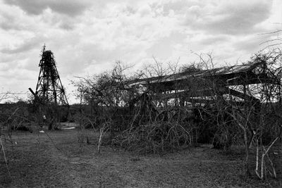
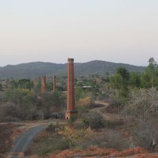
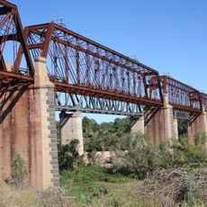
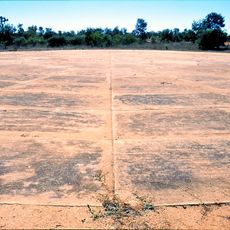
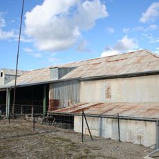
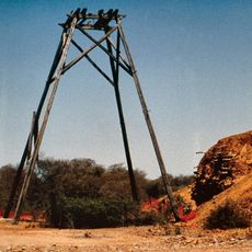
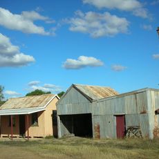
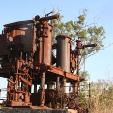
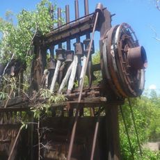
Totley Township is a mining site where industrial infrastructure remains scattered across a 50-meter square area in Queensland's mining region. Visible features include a steel headframe, an engine shed, and foundations where machinery once stood.
A silver mine was established in 1881 and led to the formation of the mining company the following year with substantial capital investment. Operations continued through distinct periods, reflecting the site's long-term importance to the region's economy.
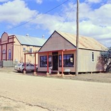
The settlement streets were surveyed and named to honor the King family, who shaped mining operations in the region for decades. This choice reflects how local mining families influenced the development and identity of the community.
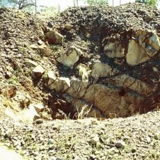
Visitors should approach the site carefully as historical mine shafts and structural remains can present hazards to those walking around. Exploring from the edges and staying alert to uneven ground and open structures will help ensure a safer visit.
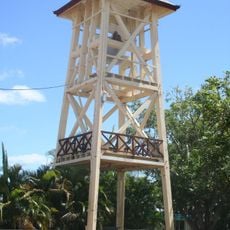
The steel headframe here displays an asymmetrical design that differs from typical mining structures of its era in North Queensland. This unusual construction method makes it a distinctive example among the region's mining heritage sites.
Location: Queensland
GPS coordinates: -20.07940,146.88210
Latest update: December 14, 2025 18:09
Ravenswood Mining Landscape and Chinese Settlement Area
2.7 km
Charters Towers mine shafts
64.6 km
Burdekin River Rail Bridge
47.2 km
Railway Hotel, Ravenswood
2.3 km
Imperial Hotel, Ravenswood
2.5 km
Boer War Veterans Memorial Kiosk and Lissner Park
65 km
Ambulance Building, Charters Towers
64.4 km
Ay Ot Lookout
64.7 km
Charters Towers Courthouse
64.9 km
Bore Sight Range and Compass Swinging Platform at Charters Towers Airfield
64.2 km
Ravenswood Community Church
2.5 km
Venus State Battery
61.6 km
Cake Shop, Ravenswood
2.6 km
Stone kerbing, channels and footbridges of Charters Towers
63.8 km
St Columba's Church Bell Tower
64.9 km
Civic Club, Charters Towers
64.8 km
Church of Christ, Charters Towers
64.7 km
London North Mine
2.2 km
Mabel Mill
2.3 km
Ravenswood School and Residence
2.9 km
Burdekin River Pumping Station
60.9 km
Thorps Building
2.5 km
Ravenswood Post Office
2.4 km
Ravenswood Court House and Police Station
2.3 km
Ravenswood Ambulance Station
2.5 km
Ravenswood School of Arts
2.6 km
Pandanus Creek Battery
25.4 km
Shop adjacent to Thorps Building
2.5 kmVisited this place? Tap the stars to rate it and share your experience / photos with the community! Try now! You can cancel it anytime.
Discover hidden gems everywhere you go!
From secret cafés to breathtaking viewpoints, skip the crowded tourist spots and find places that match your style. Our app makes it easy with voice search, smart filtering, route optimization, and insider tips from travelers worldwide. Download now for the complete mobile experience.
A unique approach to discovering new places❞
— Le Figaro
All the places worth exploring❞
— France Info
A tailor-made excursion in just a few clicks❞
— 20 Minutes