Enable Location

We need your location to show you interesting places around you

Discover nearby places

Find interesting locations and hidden gems around you

Precise directions

Get accurate directions and distances to places

Your location is never shared with other users. It's only used when you tap the location button.

Ala Wai Canal

Log in to your account

Start exploring — it's free

Trusted by 62,901 travelers worldwide

Continue with Google
Continue with Apple
or

We will send you a code to connect

By continuing, you accept our Terms and Conditions and our Privacy Policy

Check your inbox

We've sent a pincode in your inbox. Please enter the code below.

Ala Wai Canal
Discussion Reviews 1 Photos
17.3k Popularity

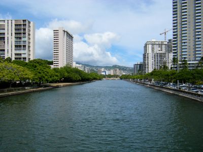
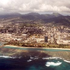
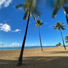
Ala Wai Canal, Major drainage canal in Waikiki, Honolulu, United States.

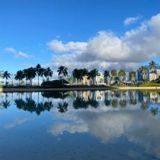
The Ala Wai Canal is an artificial waterway running roughly 2 miles along the northern edge of Waikiki, collecting water from multiple streams in central and eastern Honolulu before emptying into the Pacific Ocean. The canal is crossed by several bridges and bordered by walking paths that follow its entire length through the urban landscape.

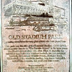
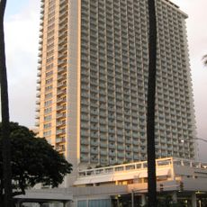
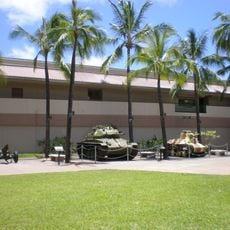
The canal was constructed between 1921 and 1928 by Hawaiian Dredging Construction Company under Walter F. Dillingham's leadership to convert Waikiki's swamplands into developable land. This engineering project transformed the area from wetlands into the modern urban and tourist center it is today.

The canal marks a clear boundary between the tourist-oriented Waikiki area and residential neighborhoods like McCully and Moiliili. Local residents and visitors alike use the waterfront paths as part of their daily routines.

Main access points with walking paths and bridges are located at McCully Street, Kalakaua Avenue, and Ala Moana Boulevard, making the waterway easy to explore on foot. Paths run along the entire length of the canal, though shade is limited during midday hours in the tropical sun.

The waters host Hawaiian seahorses that have developed brown coloring to blend with the canal's murky bottom, a rare adaptation to urban waterways. Observing these creatures reveals how marine animals adjust to survive in built environments.

The community of curious travelers

AroundUs brings together thousands of curated places, local tips, and hidden gems, enriched daily by 60,000 contributors worldwide.

Start exploring
Location
GPS coordinates
21.28720,-157.83100
Latest update
December 7, 2025 19:25
Around this place
IBM Building
United States of America

IBM Building

2.2 km
Trump International Hotel and Tower
United States of America

Trump International Hotel and Tower

914 m
Honolulu Zoo
United States of America

Honolulu Zoo

2.2 km
Honolulu Stadium
United States of America

Honolulu Stadium

907 m
Ala Moana Beach Park
United States of America

Ala Moana Beach Park

1.8 km
Queen Kapiʻolani Regional Park
United States of America

Queen Kapiʻolani Regional Park

2.4 km
Kuhio Beach Park
United States of America

Kuhio Beach Park

1.8 km
Ala Moana Hotel
United States of America

Ala Moana Hotel

899 m
Hawaii Shingon Mission
United States of America

Hawaii Shingon Mission

1.9 km
U.S. Army Museum of Hawaii
United States of America

U.S. Army Museum of Hawaii

758 m
Royal Hawaiian Center
United States of America

Royal Hawaiian Center

888 m
'Alohilani Resort Waikiki Beach
United States of America

'Alohilani Resort Waikiki Beach

1.6 km
John Young Museum of Art
United States of America

John Young Museum of Art

1.8 km
Punahou Circle apartments
United States of America

Punahou Circle apartments

1.3 km
Sacred Heart Church-Punahou
United States of America

Sacred Heart Church-Punahou

1.6 km
Hiroshima to Honolulu Friendship Torii
United States of America

Hiroshima to Honolulu Friendship Torii

1 km
John Guild House
United States of America

John Guild House

2.1 km
George D. Oakley House
United States of America

George D. Oakley House

2.3 km
Hawaii Cinerama
United States of America

Hawaii Cinerama

1.3 km
Library for the Blind and Physically Handicap
United States of America

Library for the Blind and Physically Handicap

2.1 km
Kahanamoku Beach
United States of America

Kahanamoku Beach

1.1 km
Fort DeRussy Beach Park
United States of America

Fort DeRussy Beach Park

924 m
Moiliili Neighborhood Park
United States of America

Moiliili Neighborhood Park

971 m
Waikiki-Kapahulu Public Library
United States of America

Waikiki-Kapahulu Public Library

2.1 km
Battery Randolph
United States of America

Battery Randolph

964 m
Cresent Beach
United States of America

Cresent Beach

1 km
Grays Beach
United States of America

Grays Beach

1.1 km
Royal-Moana Beach
United States of America

Royal-Moana Beach

1.4 km
Show the full map
« Ala Wai Canal - Major drainage canal in Waikiki, Honolulu, United States » is provided by Around Us (aroundus.com). Images and texts are derived from Wikimedia project under a Creative Commons license. You are allowed to copy, distribute, and modify copies of this page, under the conditions set by the license, as long as this note is clearly visible.

Discover hidden gems everywhere you go!

From secret cafés to breathtaking viewpoints, skip the crowded tourist spots and find places that match your style. Our app makes it easy with voice search, smart filtering, route optimization, and insider tips from travelers worldwide. Download now for the complete mobile experience.

Around Us App Screenshot

A unique approach to discovering new places

Le Figaro

All the places worth exploring

France Info

A tailor-made excursion in just a few clicks

20 Minutes

Around Us
Travel Guide & Maps
Download

Send to your phone

QR Code
1

Open the camera app on your mobile.

2

Point at the QR code with your camera. A notification will appear.

3

Tap the notification to open the link.