Chest opened
+${chestReward.xp} XP
Explorer
NOUVEAU ×${chestReward.collectible.quantity}
tapez pour fermer
Chest locked

Open chests in the app

Around Us is built for your phone — chests unlock when you walk, explore and capture nearby places.

Enable Location

We need your location to show you interesting places around you

Discover nearby places

Find interesting locations and hidden gems around you

Precise directions

Get accurate directions and distances to places

Your location is never shared with other users. It's only used when you tap the location button.

Teklanika River

Log in to your account

Start exploring — it's free

Trusted by 72,893 travelers worldwide

Continue with Google
Continue with Apple
or

We will send you a code to connect

By continuing, you accept our Terms and Conditions and our Privacy Policy

Check your inbox

We've sent a pincode in your inbox. Please enter the code below.

Teklanika River
Discussion Reviews 1 Photos
28.8k Popularity

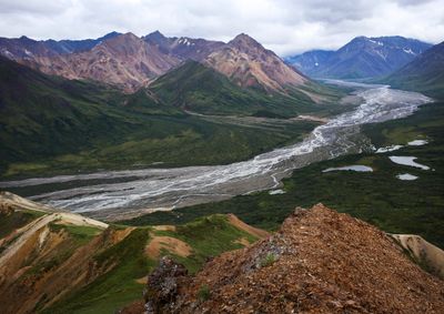
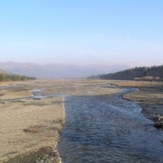
Teklanika River, River system in Denali National Park, United States

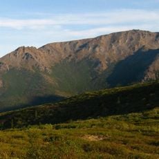
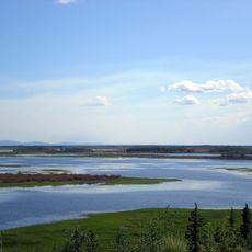
The Teklanika River is a river system flowing through Denali National Park in Alaska, extending from Cantwell Glacier northward to its junction with the Nenana River. The river cuts through varied terrain, creating a visible waterway that marks the park's geography.

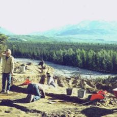
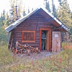
Early prospectors came to the river in the 1900s searching for valuable minerals along its banks. Their efforts left marks on the landscape, revealing how people once worked the land in this remote area.

The Lower Tanana Athabascan people named this waterway Tach'edhaneek'a, meaning water-amulet river in their language. You can sense this connection when traveling through the area and noticing how the river shapes the land around it.

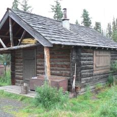
A campground near the river offers camping sites for visitors traveling by private vehicle. Plan to spend several nights in the area if you want to camp there, as this is typically required for stays.

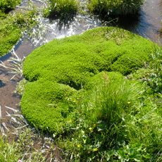
The river shifts its appearance as it travels, beginning as a braided stream, then narrowing between ridges, and finally forming oxbow curves in the open valley. This transformation shows how water reshapes itself according to the land.

The community of curious travelers

AroundUs brings together thousands of curated places, local tips, and hidden gems, enriched daily by 60,000 contributors worldwide.

Start exploring
Location
Location
GPS coordinates
64.47080,-149.31700
Latest update
December 20, 2025 12:09
Around this place
Stampede Trail
United States of America

Stampede Trail

70.6 km
Magic Bus
United States of America

Magic Bus

69.1 km
Carlson Center
United States of America

Carlson Center

84.8 km
Mears Memorial Bridge
United States of America

Mears Memorial Bridge

15.6 km
University of Alaska Museum of the North
United States of America

University of Alaska Museum of the North

82.4 km
West Valley High School
United States of America

West Valley High School

82.7 km
Growden Memorial Park
United States of America

Growden Memorial Park

84.8 km
Mount McKinley National Park Headquarters District
United States of America

Mount McKinley National Park Headquarters District

85.1 km
Harding Railroad Car
United States of America

Harding Railroad Car

84.4 km
Nenana
United States of America

Nenana

84.2 km
Chena Pump House
United States of America

Chena Pump House

79.1 km
Pioneer Park
United States of America

Pioneer Park

84.2 km
Georgeson Botanical Garden
United States of America

Georgeson Botanical Garden

81.6 km
Elmer E. Rasmuson Library
United States of America

Elmer E. Rasmuson Library

83.2 km
Dry Creek Archeological Site
United States of America

Dry Creek Archeological Site

64.2 km
Lower East Fork Ranger Cabin No. 9
United States of America

Lower East Fork Ranger Cabin No. 9

81.4 km
Sushana River Ranger Cabin No. 17
United States of America

Sushana River Ranger Cabin No. 17

77.8 km
Constitution Hall
United States of America

Constitution Hall

83.3 km
Falcon Joslin House
United States of America

Falcon Joslin House

86.3 km
Mount Margaret
United States of America

Mount Margaret

80 km
John Trigg Ester Library
United States of America

John Trigg Ester Library

74.6 km
Wickersham House
United States of America

Wickersham House

84.3 km
Rainey's Cabin
United States of America

Rainey's Cabin

82.9 km
Sanctuary River Cabin No. 31
United States of America

Sanctuary River Cabin No. 31

83.6 km
Ewe Creek Ranger Cabin No. 8
United States of America

Ewe Creek Ranger Cabin No. 8

74.6 km
Tolovana River
United States of America

Tolovana River

81.3 km
Ester Camp Historic District
United States of America

Ester Camp Historic District

74.7 km
Denali Visitor Center
United States of America

Denali Visitor Center

84.6 km
Show the full map
Reviews
Share your experience

No review yet

Discussions
Start a discussion...

No discussion yet

« Teklanika River - River system in Denali National Park, United States » is provided by Around Us (aroundus.com). Images and texts are derived from Wikimedia project under a Creative Commons license. You are allowed to copy, distribute, and modify copies of this page, under the conditions set by the license, as long as this note is clearly visible.

Discover hidden gems everywhere you go!

From secret cafés to breathtaking viewpoints, skip the crowded tourist spots and find places that match your style. Our app makes it easy with voice search, smart filtering, route optimization, and insider tips from travelers worldwide. Download now for the complete mobile experience.

Around Us App Screenshot

A unique approach to discovering new places

Le Figaro

All the places worth exploring

France Info

A tailor-made excursion in just a few clicks

20 Minutes

Around Us
Travel Guide & Maps
Download

Send to your phone

QR Code
1

Open the camera app on your mobile.

2

Point at the QR code with your camera. A notification will appear.

3

Tap the notification to open the link.