Yukon-Koyukuk Census Area
Yukon-Koyukuk Census Area, Census-designated place in Alaska, United States.
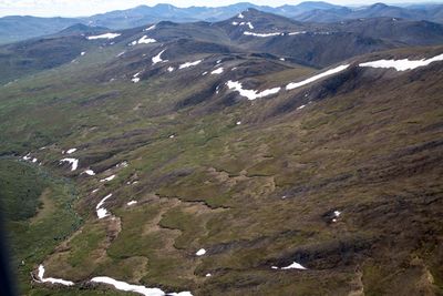
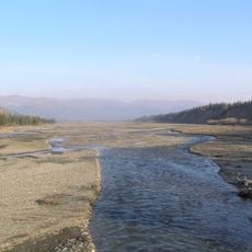
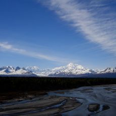
The Yukon-Koyukuk Census Area is a vast administrative region in Alaska encompassing diverse landscapes, river systems, and communities scattered across the terrain. The territory's character is defined by its waterways, which serve as the main routes connecting the scattered settlements.
Native peoples, particularly Athabaskan groups, were the first to settle along the river valleys of the region. European traders and explorers later arrived, which transformed how the territory developed and was used.
The region's communities rely on hunting, fishing, and gathering as ways of life that shape daily routines and connect people to the land. These practices remain central to how residents understand their place in this vast territory.
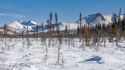
Getting around this vast territory depends mainly on rivers and limited roads, with seasons changing what is passable. Planning a visit requires flexibility and realistic expectations about travel conditions.
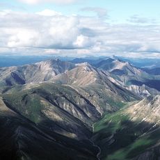
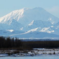
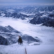
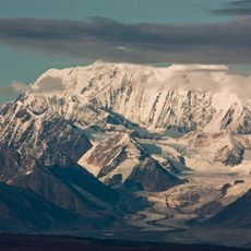
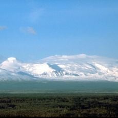
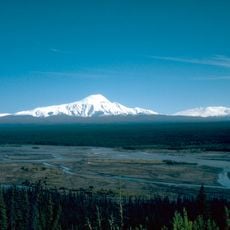
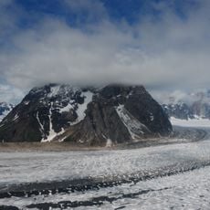
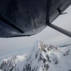
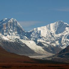
Large portions of two national parks and a major wildlife refuge sit within this census area, providing habitat for wild animals with few settlements. These protected lands define much of the territory's character and draw visitors interested in remote wilderness.
Location: Unorganized Borough
Inception: 1980
Shares border with: North Slope Borough, Southeast Fairbanks Census Area, Fairbanks North Star Borough, Denali Borough, Matanuska-Susitna Borough, Bethel Census Area, Kusilvak Census Area, Nome Census Area, Northwest Arctic Borough, Yukon
GPS coordinates: 65.29000,-151.65000
Latest update: December 13, 2025 19:50
Stampede Trail
182 km
Denali National Park and Preserve
241.6 km
Gates of the Arctic National Park and Preserve
287 km
Kobuk Valley National Park
422.4 km
Mount Foraker
259.6 km
Mount Hunter
261.7 km
Magic Bus
202.6 km
Mount Hayes
300.9 km
Mount Wrangell
524.5 km
Mount Sanford
503.8 km
The Moose's Tooth
263.2 km
Carlson Center
189 km
Mears Memorial Bridge
145.5 km
University of Alaska Museum of the North
184.9 km
Ruth Glacier
285.4 km
Mount Huntington
261.1 km
Denali State Park
293.6 km
E. L. Patton Yukon River Bridge
110.4 km
Kahiltna Glacier
281.5 km
Gates of the Arctic Wilderness
318.9 km
West Valley High School
186 km
Hurricane Gulch Bridge
271.8 km
Mount Deborah
280.4 km
HIPAS Observatory
230.2 km
Fake Peak
271.2 km
Growden Memorial Park
189.3 km
Mount Silverthrone
246.6 km
Tanana River Bridge
230.8 kmVisited this place? Tap the stars to rate it and share your experience / photos with the community! Try now! You can cancel it anytime.
Discover hidden gems everywhere you go!
From secret cafés to breathtaking viewpoints, skip the crowded tourist spots and find places that match your style. Our app makes it easy with voice search, smart filtering, route optimization, and insider tips from travelers worldwide. Download now for the complete mobile experience.
A unique approach to discovering new places❞
— Le Figaro
All the places worth exploring❞
— France Info
A tailor-made excursion in just a few clicks❞
— 20 Minutes