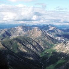
Eagle Cliff, cliff in Yukon–Koyukuk Census Area, United States of America
Location: Yukon-Koyukuk Census Area
GPS coordinates: 67.05139,-150.01639
Latest update: November 8, 2025 16:47
Gates of the Arctic National Park and Preserve
162.3 km
Gates of the Arctic Wilderness
174.3 km
Yukon Flats National Wildlife Refuge
194 km
Arrigetch Peaks
183.9 km
Kanuti National Wildlife Refuge
106.6 km
Walker Lake
188.5 km
Bettles Lodge
66.9 km
Kanuti Hot Springs
87 km
East Alapah Glacier
125.9 km
McLellan Peak
95.5 km
Arrigetch Creek
184.2 km
Klaluthyiit Bluff
149.6 km
Chuttoh Bluffs
121.5 km
Hulgothen Bluffs
73.4 km
Arrigetch Peaks
185.6 km
Gobblers Knob
44.6 km
Northernmost Spruce Tree
110.2 km
Crashed plane
151.4 km
Finger Mountain Wayside
79.7 km
Arctic Circle Wayside
65.2 km
Hess Creek Overlook
163.7 km
Scenic viewpoint
131.3 km
Scenic viewpoint
79.6 km
Chandalar Shelf
112.4 km
Scenic viewpoint
112.1 km
Scenic viewpoint
67.7 km
Waterfall
92.5 km
Waterfall
112.1 kmReviews
Visited this place? Tap the stars to rate it and share your experience / photos with the community! Try now! You can cancel it anytime.
Discover hidden gems everywhere you go!
From secret cafés to breathtaking viewpoints, skip the crowded tourist spots and find places that match your style. Our app makes it easy with voice search, smart filtering, route optimization, and insider tips from travelers worldwide. Download now for the complete mobile experience.

A unique approach to discovering new places❞
— Le Figaro
All the places worth exploring❞
— France Info
A tailor-made excursion in just a few clicks❞
— 20 Minutes