Enable Location

We need your location to show you interesting places around you

Discover nearby places

Find interesting locations and hidden gems around you

Precise directions

Get accurate directions and distances to places

Your location is never shared with other users. It's only used when you tap the location button.

Henry T. Oxnard Historic District

Log in to your account

Start exploring — it's free

Trusted by 61,990 travelers worldwide

Continue with Google
Continue with Apple
or

We will send you a code to connect

By continuing, you accept our Terms and Conditions and our Privacy Policy

Check your inbox

We've sent a pincode in your inbox. Please enter the code below.

Henry T. Oxnard Historic District, Historic residential district in Oxnard, United States

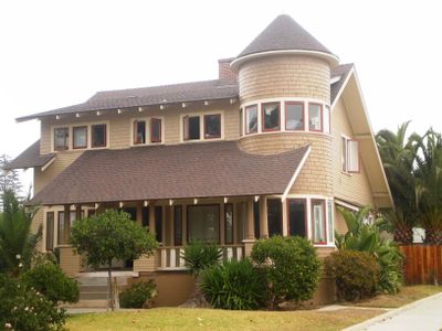
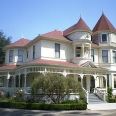
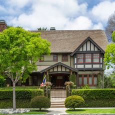
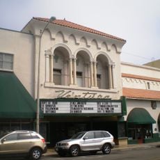
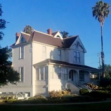
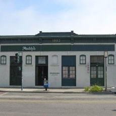
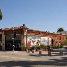
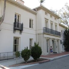
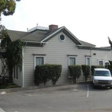
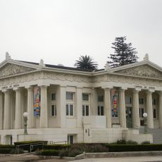
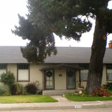
The Henry T. Oxnard Historic District is a residential neighborhood featuring roughly 140 buildings in Mission Revival, Colonial Revival, and Craftsman architectural styles. Most structures were built in the early decades of the 20th century and stand between F and G Streets in downtown Oxnard.

The neighborhood developed from 1909 to 1941 through two separate subdivisions: the Henry T. Oxnard Tract on F Street and the Walter H. Lathrop Tract on G Street. These two development phases established the foundation of today's residential district.

Jewish immigrants from Alsace settled in these streets and became influential figures in shaping Oxnard's early growth through business and community involvement. Their presence remains woven into the neighborhood's identity and character.

The district spreads across several blocks between Palm and 5th Streets in downtown Oxnard and is best explored on foot. Walking slowly through the streets allows you to observe the architectural details of individual houses and understand the neighborhood's layout.

Each winter the neighborhood transforms into Christmas Tree Lane when residents decorate their homes with festive displays throughout the streets. This seasonal tradition has made the district a popular destination during the holiday season.

The community of curious travelers

AroundUs brings together thousands of curated places, local tips, and hidden gems, enriched daily by 60,000 contributors worldwide.

Start exploring
Location
GPS coordinates
34.20028,-119.18639
Latest update
December 14, 2025 09:47
Around this place
Mission San Buenaventura
United States of America

Mission San Buenaventura

13.7 km
Emma Wood State Beach
United States of America

Emma Wood State Beach

16 km
Mullin Automotive Museum
United States of America

Mullin Automotive Museum

2.8 km
Camarillo Ranch House
United States of America

Camarillo Ranch House

15.7 km
Henry Levy House
United States of America

Henry Levy House

197 m
San Buenaventura State Beach
United States of America

San Buenaventura State Beach

11.3 km
McGrath State Beach
United States of America

McGrath State Beach

7.2 km
Majestic Ventura Theatre
United States of America

Majestic Ventura Theatre

13.1 km
Mandalay State Beach
United States of America

Mandalay State Beach

5.8 km
The Collection at RiverPark
United States of America

The Collection at RiverPark

4.6 km
Ventura County Courthouse
United States of America

Ventura County Courthouse

13.4 km
Statues of Junípero Serra
United States of America

Statues of Junípero Serra

13.4 km
Point Hueneme Light
United States of America

Point Hueneme Light

6.5 km
Blessed Junipero Serra Catholic Church, Camarillo
United States of America

Blessed Junipero Serra Catholic Church, Camarillo

17.6 km
San Buenaventura Mission Aqueduct
United States of America

San Buenaventura Mission Aqueduct

18.4 km
First Baptist Church of Ventura
United States of America

First Baptist Church of Ventura

12.6 km
George Washington Faulkner House
United States of America

George Washington Faulkner House

15.9 km
Dudley House
United States of America

Dudley House

9.7 km
Feraud General Merchandise Store
United States of America

Feraud General Merchandise Store

13.8 km
San Miguel Chapel Site
United States of America

San Miguel Chapel Site

13.3 km
Peirano Market
United States of America

Peirano Market

13.6 km
Berylwood
United States of America

Berylwood

4.8 km
Emmanuel Franz House
United States of America

Emmanuel Franz House

13.4 km
Carnegie Art Museum
United States of America

Carnegie Art Museum

554 m
Women's Improvement Club of Hueneme
United States of America

Women's Improvement Club of Hueneme

5.7 km
Campus del Ventura County Community College District
United States of America

Campus del Ventura County Community College District

9.6 km
Robert J. Lagomarsino Visitor Center
United States of America

Robert J. Lagomarsino Visitor Center

9.1 km
Camarillo Public Library
United States of America

Camarillo Public Library

16.6 km
Show the full map
« Henry T. Oxnard Historic District - Historic residential district in Oxnard, United States » is provided by Around Us (aroundus.com). Images and texts are derived from Wikimedia project under a Creative Commons license. You are allowed to copy, distribute, and modify copies of this page, under the conditions set by the license, as long as this note is clearly visible.

Discover hidden gems everywhere you go!

From secret cafés to breathtaking viewpoints, skip the crowded tourist spots and find places that match your style. Our app makes it easy with voice search, smart filtering, route optimization, and insider tips from travelers worldwide. Download now for the complete mobile experience.

Around Us App Screenshot

A unique approach to discovering new places

Le Figaro

All the places worth exploring

France Info

A tailor-made excursion in just a few clicks

20 Minutes

Around Us
Travel Guide & Maps
Download

Send to your phone

QR Code
1

Open the camera app on your mobile.

2

Point at the QR code with your camera. A notification will appear.

3

Tap the notification to open the link.