Chest opened
+${chestReward.xp} XP
Explorer
NOUVEAU ×${chestReward.collectible.quantity}
tapez pour fermer
Chest locked

Open chests in the app

Around Us is built for your phone — chests unlock when you walk, explore and capture nearby places.

Enable Location

We need your location to show you interesting places around you

Discover nearby places

Find interesting locations and hidden gems around you

Precise directions

Get accurate directions and distances to places

Your location is never shared with other users. It's only used when you tap the location button.

Log in to your account

Start exploring — it's free

Trusted by 73,018 travelers worldwide

Continue with Google
Continue with Apple
or

We will send you a code to connect

By continuing, you accept our Terms and Conditions and our Privacy Policy

Check your inbox

We've sent a pincode in your inbox. Please enter the code below.

Santa Gertrudis Asistencia
Discussion Reviews Photo
1.6k Popularity

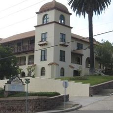
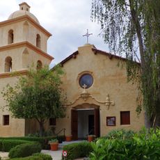
Santa Gertrudis Asistencia, Spanish colonial religious outpost in Ventura County, US

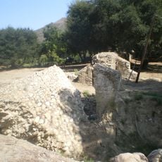
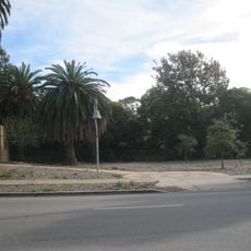
Santa Gertrudis Asistencia is a Spanish colonial religious outpost in Ventura County, of which only the foundation stones remain as a monument today. The structure stood about 500 feet south of where it originally existed along California State Route 33.

Built between 1792 and 1809 as a sub-mission of Mission San Buenaventura, it became a refuge for priests after the 1812 earthquake damaged the main mission. The earthquake marked a turning point when padres needed shelter away from the damaged main compound.

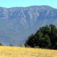
The site served as a gathering place for Chumash families who built a village beside a sacred sycamore tree central to their traditional ceremonies. The natural features of the land held deep meaning for these communities.

The monument is located at 6712 North Ventura Avenue and is marked as Ventura County Historic Landmark Number 11. The site sits near the highway, making it accessible, though visitors should note that the original location was largely covered by road construction.

Archaeological excavations in 1966 uncovered a U-shaped structure with adobe walls before modern highway construction buried the site. These findings documented how the original buildings were arranged before being demolished.

The community of curious travelers

AroundUs brings together thousands of curated places, local tips, and hidden gems, enriched daily by 60,000 contributors worldwide.

Start exploring
GPS coordinates
34.34750,-119.29708
Latest update
December 14, 2025 13:00
Around this place
Mission San Buenaventura
United States of America

Mission San Buenaventura

7.4 km
Emma Wood State Beach
United States of America

Emma Wood State Beach

7.4 km
Carpinteria State Beach
United States of America

Carpinteria State Beach

21.2 km
Ventura Pier
United States of America

Ventura Pier

8.2 km
Henry Levy House
United States of America

Henry Levy House

19.1 km
San Buenaventura State Beach
United States of America

San Buenaventura State Beach

9.1 km
McGrath State Beach
United States of America

McGrath State Beach

14.1 km
Majestic Ventura Theatre
United States of America

Majestic Ventura Theatre

7.5 km
Mandalay State Beach
United States of America

Mandalay State Beach

17 km
Ventura County Courthouse
United States of America

Ventura County Courthouse

7.3 km
Statues of Junípero Serra
United States of America

Statues of Junípero Serra

7.3 km
Charles M. Pratt House
United States of America

Charles M. Pratt House

13.3 km
Elizabeth Bard Memorial Hospital
United States of America

Elizabeth Bard Memorial Hospital

7.3 km
Bart's Books
United States of America

Bart's Books

12.1 km
Foster Park Bowl
United States of America

Foster Park Bowl

1.4 km
San Buenaventura Mission Aqueduct
United States of America

San Buenaventura Mission Aqueduct

917 m
Henry T. Oxnard Historic District
United States of America

Henry T. Oxnard Historic District

19.3 km
St. Thomas Aquinas Chapel
United States of America

St. Thomas Aquinas Chapel

12.1 km
Golf 'N' Stuff
United States of America

Golf 'N' Stuff

12.7 km
First Baptist Church of Ventura
United States of America

First Baptist Church of Ventura

7.7 km
George Washington Faulkner House
United States of America

George Washington Faulkner House

17.6 km
Meher Mount
United States of America

Meher Mount

13.7 km
Dudley House
United States of America

Dudley House

9.6 km
Feraud General Merchandise Store
United States of America

Feraud General Merchandise Store

7.4 km
San Miguel Chapel Site
United States of America

San Miguel Chapel Site

7.7 km
Peirano Market
United States of America

Peirano Market

7.4 km
Emmanuel Franz House
United States of America

Emmanuel Franz House

7.4 km
Carnegie Art Museum
United States of America

Carnegie Art Museum

19.7 km
Show the full map
Reviews
Share your experience

No review yet

Discussions
Start a discussion...

No discussion yet

« Santa Gertrudis Asistencia - Spanish colonial religious outpost in Ventura County, US » is provided by Around Us (aroundus.com). Images and texts are derived from Wikimedia project under a Creative Commons license. You are allowed to copy, distribute, and modify copies of this page, under the conditions set by the license, as long as this note is clearly visible.

Discover hidden gems everywhere you go!

From secret cafés to breathtaking viewpoints, skip the crowded tourist spots and find places that match your style. Our app makes it easy with voice search, smart filtering, route optimization, and insider tips from travelers worldwide. Download now for the complete mobile experience.

Around Us App Screenshot

A unique approach to discovering new places

Le Figaro

All the places worth exploring

France Info

A tailor-made excursion in just a few clicks

20 Minutes

Around Us
Travel Guide & Maps
Download

Send to your phone

QR Code
1

Open the camera app on your mobile.

2

Point at the QR code with your camera. A notification will appear.

3

Tap the notification to open the link.