Chest opened
+${chestReward.xp} XP
Explorer
NOUVEAU ×${chestReward.collectible.quantity}
tapez pour fermer
Chest locked

Open chests in the app

Around Us is built for your phone — chests unlock when you walk, explore and capture nearby places.

Enable Location

We need your location to show you interesting places around you

Discover nearby places

Find interesting locations and hidden gems around you

Precise directions

Get accurate directions and distances to places

Your location is never shared with other users. It's only used when you tap the location button.

Log in to your account

Start exploring — it's free

Trusted by 72,877 travelers worldwide

Continue with Google
Continue with Apple
or

We will send you a code to connect

By continuing, you accept our Terms and Conditions and our Privacy Policy

Check your inbox

We've sent a pincode in your inbox. Please enter the code below.

Discussion Reviews Photo
11.4k Popularity

Walnut Park, Census-designated place in Los Angeles County, United States

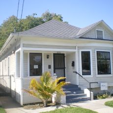
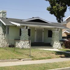
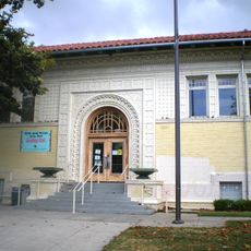
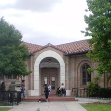
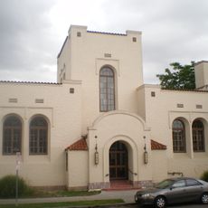
Walnut Park is a residential community in Los Angeles County composed of single-family homes and apartment buildings spread across multiple blocks. The neighborhood features local schools, small parks, and street-level commercial areas that serve daily needs.

The area became officially designated for census tracking in 2000, helping improve demographic data collection across Los Angeles County. This classification reflects the growth patterns of residential communities in the greater metropolitan region.

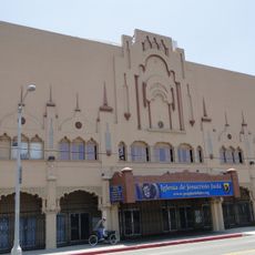
Spanish-language traditions shape the daily rhythm of the neighborhood, visible in local shops, restaurants, and community spaces. Visitors encounter this cultural character naturally while walking through the residential streets.

Exploring the area works best on foot or by car since it is a sprawling residential neighborhood spread across multiple blocks. Navigation is straightforward, with major streets forming clear boundaries that serve as reference points.

La Alameda Shopping Center was built on former industrial land, transforming an older part of the neighborhood into a modern retail hub. This conversion shows how the community has adapted and evolved its use of local spaces.

The community of curious travelers

AroundUs brings together thousands of curated places, local tips, and hidden gems, enriched daily by 60,000 contributors worldwide.

Start exploring
Elevation above the sea
45 m
GPS coordinates
33.96889,-118.22389
Latest update
December 8, 2025 13:41
Around this place
Watts Towers
United States of America

Watts Towers

3.7 km
Wrigley Field
United States of America

Wrigley Field

5.8 km
Atchison, Topeka and Santa Fe Railway 3751
United States of America

Atchison, Topeka and Santa Fe Railway 3751

5.4 km
United States of America

Imperial Courts

4.3 km
United States of America

South Central Farm

4.7 km
Dunbar Hotel
United States of America

Dunbar Hotel

5.2 km
King Estates
United States of America

King Estates

7.6 km
Sears, Roebuck & Company Mail Order Building
United States of America

Sears, Roebuck & Company Mail Order Building

6.1 km
Johnie's Broiler
United States of America

Johnie's Broiler

7.5 km
Coca-Cola Building
United States of America

Coca-Cola Building

6.9 km
California African American Museum
United States of America

California African American Museum

7.6 km
28th Street YMCA
United States of America

28th Street YMCA

6.2 km
Wallis Annenberg Building
United States of America

Wallis Annenberg Building

7.5 km
Fire Station No. 30, Engine Company No. 30
United States of America

Fire Station No. 30, Engine Company No. 30

6.9 km
27th Street Historic District
United States of America

27th Street Historic District

6.3 km
Ralph J. Bunche House
United States of America

Ralph J. Bunche House

5.3 km
Lincoln Theatre
United States of America

Lincoln Theatre

6.4 km
Space Shuttle Endeavour
United States of America

Space Shuttle Endeavour

7.7 km
52nd Place Historic District
United States of America

52nd Place Historic District

4.6 km
Punchbowl Formation
United States of America

Punchbowl Formation

4.1 km
Roosevelt Building
United States of America

Roosevelt Building

6.2 km
Prince Hall Masonic Temple
United States of America

Prince Hall Masonic Temple

4.4 km
Bethlehem Baptist Church
United States of America

Bethlehem Baptist Church

4 km
Golden State Mutual Life Insurance Building
United States of America

Golden State Mutual Life Insurance Building

5.1 km
Vermont Square Branch
United States of America

Vermont Square Branch

7.4 km
John Muir Branch Library
United States of America

John Muir Branch Library

6.5 km
Robert Louis Stevenson Branch
United States of America

Robert Louis Stevenson Branch

7 km
Moneta Branch
United States of America

Moneta Branch

6.5 km
Show the full map
Reviews
Share your experience

No review yet

Discussions
Start a discussion...

No discussion yet

« Walnut Park - Census-designated place in Los Angeles County, United States » is provided by Around Us (aroundus.com). Images and texts are derived from Wikimedia project under a Creative Commons license. You are allowed to copy, distribute, and modify copies of this page, under the conditions set by the license, as long as this note is clearly visible.

Discover hidden gems everywhere you go!

From secret cafés to breathtaking viewpoints, skip the crowded tourist spots and find places that match your style. Our app makes it easy with voice search, smart filtering, route optimization, and insider tips from travelers worldwide. Download now for the complete mobile experience.

Around Us App Screenshot

A unique approach to discovering new places

Le Figaro

All the places worth exploring

France Info

A tailor-made excursion in just a few clicks

20 Minutes

Around Us
Travel Guide & Maps
Download

Send to your phone

QR Code
1

Open the camera app on your mobile.

2

Point at the QR code with your camera. A notification will appear.

3

Tap the notification to open the link.