·

Enable Location

We need your location to show you interesting places around you

Discover nearby places

Find interesting locations and hidden gems around you

Precise directions

Get accurate directions and distances to places

Your location is never shared with other users. It's only used when you tap the location button.

Oxford Basin

Log in to your account

Start exploring — it's free

Trusted by 62,673 travelers worldwide

Continue with Google
Continue with Apple
or

We will send you a code to connect

By continuing, you accept our Terms and Conditions and our Privacy Policy

Check your inbox

We've sent a pincode in your inbox. Please enter the code below.

Oxford Basin

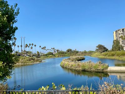
Oxford Basin, Wetland and conservation area in Marina del Rey, Los Angeles County, US

Oxford Basin is a constructed wetland located between Washington Boulevard and Admiralty Way that manages stormwater from the surrounding urban area. The site includes viewing platforms, walking paths, and planted areas with native vegetation.

The site came about when the Marina del Rey harbor was developed in the 1950s and a former landfill was converted into a water management system. This transformation later protected surrounding neighborhoods from flooding.

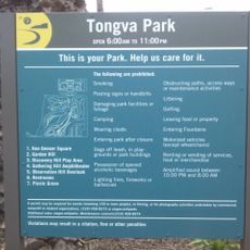
The site serves as a place where people learn about wetland ecosystems through interpretive displays and guided walks along its pathways. Visitors can observe how water and wildlife interact in this restored environment.

The area is easy to walk around with designated pathways and has parking available at nearby park and beach lots. It is best visited during daylight hours when the viewing areas are fully accessible.

The basin attracts numerous bird species and supports plants that are essential for monarch butterfly reproduction. These butterflies pass through the region during their annual migration.

The community of curious travelers

AroundUs brings together thousands of curated places, local tips, and hidden gems, enriched daily by 60,000 contributors worldwide.

Start exploring
GPS coordinates
33.98500,-118.45611
Latest update
December 14, 2025 14:20
« Oxford Basin - Wetland and conservation area in Marina del Rey, Los Angeles County, US » is provided by Around Us (aroundus.com). Images and texts are derived from Wikimedia project under a Creative Commons license. You are allowed to copy, distribute, and modify copies of this page, under the conditions set by the license, as long as this note is clearly visible.

Discover hidden gems everywhere you go!

From secret cafés to breathtaking viewpoints, skip the crowded tourist spots and find places that match your style. Our app makes it easy with voice search, smart filtering, route optimization, and insider tips from travelers worldwide. Download now for the complete mobile experience.

Around Us App Screenshot

A unique approach to discovering new places

Le Figaro

All the places worth exploring

France Info

A tailor-made excursion in just a few clicks

20 Minutes

Around Us
Travel Guide & Maps
Download

Send to your phone

QR Code
1

Open the camera app on your mobile.

2

Point at the QR code with your camera. A notification will appear.

3

Tap the notification to open the link.