Enable Location

We need your location to show you interesting places around you

Discover nearby places

Find interesting locations and hidden gems around you

Precise directions

Get accurate directions and distances to places

Your location is never shared with other users. It's only used when you tap the location button.

Arroyo Seco bicycle path

Log in to your account

Start exploring — it's free

Trusted by 62,467 travelers worldwide

Continue with Google
Continue with Apple
or

We will send you a code to connect

By continuing, you accept our Terms and Conditions and our Privacy Policy

Check your inbox

We've sent a pincode in your inbox. Please enter the code below.

Arroyo Seco bicycle path

Arroyo Seco bicycle path, cycling route in California, USA

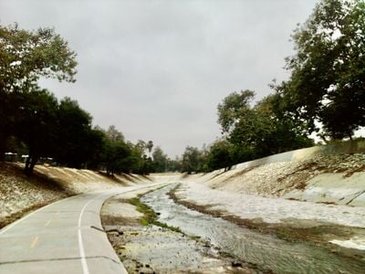
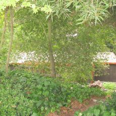
The Arroyo Seco bicycle path is a trail for cyclists and pedestrians that runs along a river channel in Northeast Los Angeles, stretching about two miles through different neighborhoods. The path has an asphalt surface, remains mostly flat and easy to navigate, passes under several bridges, and connects multiple parks including Hermon Park and Sycamore Grove Park.

The path originated from old railroad tracks that once ran through the region and were later removed to create recreational space. This transformation from industrial transportation route to community recreation area shaped the local development of the area.

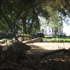
The bicycle path is part of how residents enjoy outdoor recreation and connect with their neighborhoods in Los Angeles. People use it regularly to get exercise and spend time with family and friends in a peaceful setting away from busy streets.

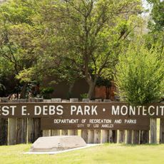
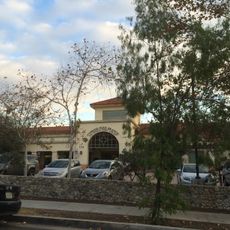
Access the path from several entry points including Hermon Park, Sycamore Grove Park, and the Montecito Heights Community Center, with parking available near each location. After heavy rain or dam water release, the path closes temporarily for safety, so sunny days are best for your visit.

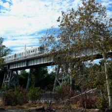
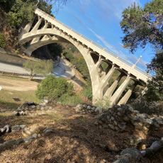
The path passes under the Santa Fe Bridge, a prominent concrete structure that creates an interesting perspective when viewed from below. This experience of cycling under bridges makes visitors momentarily forget the busy roads above and feel like they have escaped into nature within the city.

The community of curious travelers

AroundUs brings together thousands of curated places, local tips, and hidden gems, enriched daily by 60,000 contributors worldwide.

Start exploring
Location
GPS coordinates
34.09650,-118.19000
Latest update
February 9, 2026 08:22
Around this place
Show the full map
« Arroyo Seco bicycle path - cycling route in California, USA » is provided by Around Us (aroundus.com). Images and texts are derived from Wikimedia project under a Creative Commons license. You are allowed to copy, distribute, and modify copies of this page, under the conditions set by the license, as long as this note is clearly visible.

Discover hidden gems everywhere you go!

From secret cafés to breathtaking viewpoints, skip the crowded tourist spots and find places that match your style. Our app makes it easy with voice search, smart filtering, route optimization, and insider tips from travelers worldwide. Download now for the complete mobile experience.

Around Us App Screenshot

A unique approach to discovering new places

Le Figaro

All the places worth exploring

France Info

A tailor-made excursion in just a few clicks

20 Minutes

Around Us
Travel Guide & Maps
Download

Send to your phone

QR Code
1

Open the camera app on your mobile.

2

Point at the QR code with your camera. A notification will appear.

3

Tap the notification to open the link.