Chest opened
+${chestReward.xp} XP
Explorer
NOUVEAU ×${chestReward.collectible.quantity}
tapez pour fermer
Chest locked

Open chests in the app

Around Us is built for your phone — chests unlock when you walk, explore and capture nearby places.

Enable Location

We need your location to show you interesting places around you

Discover nearby places

Find interesting locations and hidden gems around you

Precise directions

Get accurate directions and distances to places

Your location is never shared with other users. It's only used when you tap the location button.

Ventura Freeway

Log in to your account

Start exploring — it's free

Trusted by 72,881 travelers worldwide

Continue with Google
Continue with Apple
or

We will send you a code to connect

By continuing, you accept our Terms and Conditions and our Privacy Policy

Check your inbox

We've sent a pincode in your inbox. Please enter the code below.

Ventura Freeway
Discussion Reviews 1 Photos
34.7k Popularity

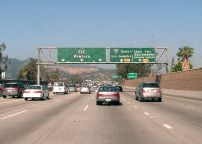
Ventura Freeway, Multi-lane highway in Southern California, United States

The Ventura Freeway is a multi-lane divided highway that runs from the Santa Barbara county line eastward through Ventura County and into Los Angeles County as State Route 134. The corridor connects residential neighborhoods with commercial areas and serves as a major transportation link across Southern California's sprawling metropolitan region.

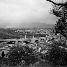
The highway section designated as State Route 134 opened to traffic in 1971, replacing an older road that had followed Colorado Boulevard. This reconstruction was part of Southern California's major freeway expansion during the mid-20th century.

Different sections carry names honoring military units and political figures important to California's history. These designations show how the region marks its infrastructure with recognition of national importance.

The freeway handles over 200,000 vehicles daily at major interchanges, with congestion particularly heavy during rush hours. Travelers should plan flexible timing and consider alternate routes if possible to navigate this busy corridor efficiently.

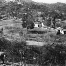
A major wildlife crossing project creates a natural bridge over the freeway to allow animals to safely move between habitats. This engineering solution shows how modern infrastructure can be designed to support animal movement across otherwise impassable barriers.

The community of curious travelers

AroundUs brings together thousands of curated places, local tips, and hidden gems, enriched daily by 60,000 contributors worldwide.

Start exploring
Location
Inception
1971
GPS coordinates
34.15655,-118.25366
Latest update
December 19, 2025 22:32
Around this place
Griffith Park
United States of America

Griffith Park

5 km
Ennis House
United States of America

Ennis House

5.8 km
Mount Sinai Memorial Park Cemetery
United States of America

Mount Sinai Memorial Park Cemetery

5.7 km
Greek Theatre
United States of America

Greek Theatre

5.7 km
Los Angeles Zoo
United States of America

Los Angeles Zoo

2.9 km
Griffith Park Zoo
United States of America

Griffith Park Zoo

4.1 km
Lovell House
United States of America

Lovell House

5.3 km
Grand Central Airport
United States of America

Grand Central Airport

3.2 km
Travel Town Museum
United States of America

Travel Town Museum

5 km
Autry Museum of the American West
United States of America

Autry Museum of the American West

2.7 km
Alex Theatre
United States of America

Alex Theatre

870 m
Los Angeles River bicycle path
United States of America

Los Angeles River bicycle path

41 km
Museum of Neon Art
United States of America

Museum of Neon Art

1.4 km
Glendale-Hyperion Bridge
United States of America

Glendale-Hyperion Bridge

4.9 km
Catalina Verdugo Adobe
United States of America

Catalina Verdugo Adobe

3.3 km
St. Mark's Episcopal Church
United States of America

St. Mark's Episcopal Church

531 m
Burbank City Hall
United States of America

Burbank City Hall

5.7 km
Equidome
United States of America

Equidome

5 km
Avenel Cooperative Housing Project
United States of America

Avenel Cooperative Housing Project

5.3 km
Eagle Rock Community Cultural Center
United States of America

Eagle Rock Community Cultural Center

4 km
James Daniel Derby House
United States of America

James Daniel Derby House

4 km
Ard Eevin
United States of America

Ard Eevin

2.7 km
Grand Central Creative Campus
United States of America

Grand Central Creative Campus

3 km
United States of America

Glendale Main Post Office

1.1 km
Reservoir Dogs - Pat and Lorraine's Coffee Shop
United States of America

Reservoir Dogs - Pat and Lorraine's Coffee Shop

4.5 km
Mount Hollywood
United States of America

Mount Hollywood

5.4 km
Zeiss telescope
United States of America

Zeiss telescope

6 km
Glendale Central Library
United States of America

Glendale Central Library

1.4 km
Show the full map
Reviews
Share your experience

No review yet

Discussions
Start a discussion...

No discussion yet

« Ventura Freeway - Multi-lane highway in Southern California, United States » is provided by Around Us (aroundus.com). Images and texts are derived from Wikimedia project under a Creative Commons license. You are allowed to copy, distribute, and modify copies of this page, under the conditions set by the license, as long as this note is clearly visible.

Discover hidden gems everywhere you go!

From secret cafés to breathtaking viewpoints, skip the crowded tourist spots and find places that match your style. Our app makes it easy with voice search, smart filtering, route optimization, and insider tips from travelers worldwide. Download now for the complete mobile experience.

Around Us App Screenshot

A unique approach to discovering new places

Le Figaro

All the places worth exploring

France Info

A tailor-made excursion in just a few clicks

20 Minutes

Around Us
Travel Guide & Maps
Download

Send to your phone

QR Code
1

Open the camera app on your mobile.

2

Point at the QR code with your camera. A notification will appear.

3

Tap the notification to open the link.