Chest opened
+${chestReward.xp} XP
Explorer
NOUVEAU ×${chestReward.collectible.quantity}
tapez pour fermer
Chest locked

Open chests in the app

Around Us is built for your phone — chests unlock when you walk, explore and capture nearby places.

Enable Location

We need your location to show you interesting places around you

Discover nearby places

Find interesting locations and hidden gems around you

Precise directions

Get accurate directions and distances to places

Your location is never shared with other users. It's only used when you tap the location button.

Log in to your account

Start exploring — it's free

Trusted by 72,881 travelers worldwide

Continue with Google
Continue with Apple
or

We will send you a code to connect

By continuing, you accept our Terms and Conditions and our Privacy Policy

Check your inbox

We've sent a pincode in your inbox. Please enter the code below.

Los Peñasquitos Creek Arch Bridge
Discussion Reviews Photo
4.2k Popularity

Los Peñasquitos Creek Arch Bridge, Deck arch bridge in San Diego, California, United States.

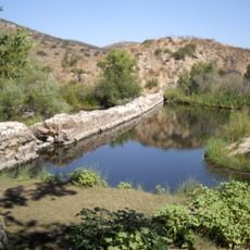
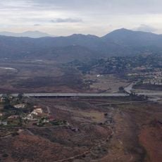
Los Peñasquitos Creek Arch Bridge is a concrete deck arch bridge in San Diego, California, that crosses the Los Peñasquitos Creek valley on the western edge of the canyon preserve. The structure features an open-spandrel design and sits alongside a newer parallel bridge that was added to carry additional traffic.

The bridge opened in 1949 and for decades was the main crossing over the creek valley in this part of San Diego. When the nearby interstate expanded, a second bridge was built alongside it, and the original was converted to serve pedestrians and cyclists.

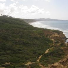
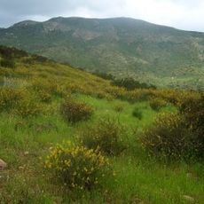
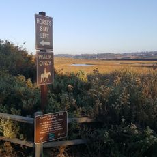
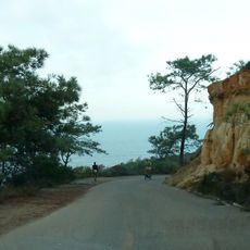
The bridge sits along a trail that local walkers and cyclists use to move through the creek valley and connect to the wider Los Peñasquitos Canyon Preserve. On weekends, the path sees a steady flow of people heading deeper into the canyon on foot or by bike.

The bridge is open to pedestrians and cyclists and can be reached via the trails of Los Peñasquitos Canyon Preserve. Visiting during daylight makes it much easier to find your way along the surrounding paths.

The original 1949 concrete arches are still fully intact and visible from the canyon floor below, where the creek runs underneath. Standing on the trail beneath the bridge gives a clear view of both the old and new structures side by side.

The community of curious travelers

AroundUs brings together thousands of curated places, local tips, and hidden gems, enriched daily by 60,000 contributors worldwide.

Start exploring
Location
Official opening
1949
GPS coordinates
32.94430,-117.10800
Latest update
March 3, 2026 10:06
Around this place
Torrey Pines Golf Course
United States of America

Torrey Pines Golf Course

13.5 km
Torrey Pines State Natural Reserve
United States of America

Torrey Pines State Natural Reserve

13.8 km
Westfield UTC
United States of America

Westfield UTC

12.8 km
Mission Trails Regional Park
United States of America

Mission Trails Regional Park

13.9 km
Flying Leatherneck Aviation Museum
United States of America

Flying Leatherneck Aviation Museum

6.5 km
Miramar Reservoir
United States of America

Miramar Reservoir

3.3 km
Black Mountain Open Space Park
United States of America

Black Mountain Open Space Park

3.7 km
Los Peñasquitos Canyon Preserve
United States of America

Los Peñasquitos Canyon Preserve

7.3 km
Old Mission Dam
United States of America

Old Mission Dam

13.1 km
Congregation Beth Israel
United States of America

Congregation Beth Israel

12.3 km
Lake Hodges Bridge
United States of America

Lake Hodges Bridge

13.3 km
UCSD Moores Cancer Center
United States of America

UCSD Moores Cancer Center

13 km
Canyonview Aquatic Center
United States of America

Canyonview Aquatic Center

13.6 km
Rancho Santa Maria de Los Peñasquitos
United States of America

Rancho Santa Maria de Los Peñasquitos

1.9 km
San Dieguito River Park
United States of America

San Dieguito River Park

13.6 km
Santee Boulders
United States of America

Santee Boulders

13.2 km
Rancho Santa Fe Land and Improvement Company Office
United States of America

Rancho Santa Fe Land and Improvement Company Office

12.2 km
Casa Pearl Baker Row
United States of America

Casa Pearl Baker Row

12.2 km
Torrey Pines Lodge
United States of America

Torrey Pines Lodge

13.8 km
Casa Norman and Florence B. Carmichael
United States of America

Casa Norman and Florence B. Carmichael

11.5 km
Torrey Pines Park Road
United States of America

Torrey Pines Park Road

13.6 km
Casa Reginald M. and Constance Clotfelter Row
United States of America

Casa Reginald M. and Constance Clotfelter Row

12.2 km
Casa Samuel Bingham
United States of America

Casa Samuel Bingham

11.8 km
Johnson-Taylor Ranch Headquarters
United States of America

Johnson-Taylor Ranch Headquarters

2.9 km
Rancho Santa Fe Golf Club
United States of America

Rancho Santa Fe Golf Club

13.7 km
MCAS Miramar Commissioned Officer's Club
United States of America

MCAS Miramar Commissioned Officer's Club

6.6 km
Heritage Park
United States of America

Heritage Park

8 km
Patriot Park
United States of America

Patriot Park

9 km
Show the full map
Reviews
Share your experience

No review yet

Discussions
Start a discussion...

No discussion yet

« Los Peñasquitos Creek Arch Bridge - Deck arch bridge in San Diego, California, United States » is provided by Around Us (aroundus.com). Images and texts are derived from Wikimedia project under a Creative Commons license. You are allowed to copy, distribute, and modify copies of this page, under the conditions set by the license, as long as this note is clearly visible.

Discover hidden gems everywhere you go!

From secret cafés to breathtaking viewpoints, skip the crowded tourist spots and find places that match your style. Our app makes it easy with voice search, smart filtering, route optimization, and insider tips from travelers worldwide. Download now for the complete mobile experience.

Around Us App Screenshot

A unique approach to discovering new places

Le Figaro

All the places worth exploring

France Info

A tailor-made excursion in just a few clicks

20 Minutes

Around Us
Travel Guide & Maps
Download

Send to your phone

QR Code
1

Open the camera app on your mobile.

2

Point at the QR code with your camera. A notification will appear.

3

Tap the notification to open the link.