Chest opened
+${chestReward.xp} XP
Explorer
NOUVEAU ×${chestReward.collectible.quantity}
tapez pour fermer
Chest locked

Open chests in the app

Around Us is built for your phone — chests unlock when you walk, explore and capture nearby places.

Enable Location

We need your location to show you interesting places around you

Discover nearby places

Find interesting locations and hidden gems around you

Precise directions

Get accurate directions and distances to places

Your location is never shared with other users. It's only used when you tap the location button.

Log in to your account

Start exploring — it's free

Trusted by 72,889 travelers worldwide

Continue with Google
Continue with Apple
or

We will send you a code to connect

By continuing, you accept our Terms and Conditions and our Privacy Policy

Check your inbox

We've sent a pincode in your inbox. Please enter the code below.

Tustin High School
Discussion Reviews Photo
16k Popularity

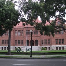
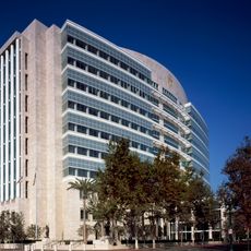
Tustin High School, public secondary school in Tustin, California, USA

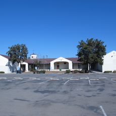
Tustin High School is a school in Tustin, California, spanning a large campus with classrooms, sports fields for baseball, softball, and football, plus tennis courts. The grounds also include a theater, specialized science and arts spaces, and a wellness room for students.

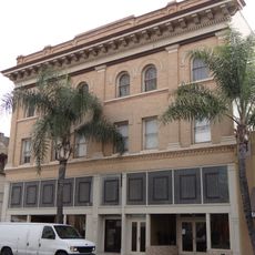
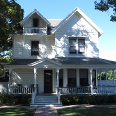
The school was founded in the early 1900s as a two-story building in a region once dominated by orange groves. Over the decades, it was rebuilt and expanded multiple times to include new classrooms, a theater, and sports facilities.

The school is known by its mascot, the Tillers, a name rooted in the area's farming heritage. This identity connects students and alumni through shared symbols and traditions that foster a sense of belonging.

The campus is large with multiple entrances, so checking a map upon arrival helps orientation. Visiting on weekends or after school hours works best if you want to explore the grounds with fewer people around.

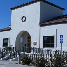
The school features a dedicated wellness room where students can take a break and learn stress management techniques. This quiet retreat space reflects thoughtful planning to support student emotional well-being.

The community of curious travelers

AroundUs brings together thousands of curated places, local tips, and hidden gems, enriched daily by 60,000 contributors worldwide.

Start exploring
Location
Tustin
GPS coordinates
33.73747,-117.81731
Latest update
February 19, 2026 23:00
Around this place
South Coast Plaza
United States of America

South Coast Plaza

8.4 km
Marine Corps Air Station Tustin
United States of America

Marine Corps Air Station Tustin

3.4 km
Bowers Museum
United States of America

Bowers Museum

5.5 km
Discovery Science Center
United States of America

Discovery Science Center

5.9 km
Santa Ana Stadium
United States of America

Santa Ana Stadium

5.8 km
Santa Ana Zoo
United States of America

Santa Ana Zoo

2.5 km
South Coast Repertory
United States of America

South Coast Repertory

7.8 km
Yost Theater
United States of America

Yost Theater

4.6 km
Old Towne Orange Historic District
United States of America

Old Towne Orange Historic District

6 km
Islamic Center of Irvine
United States of America

Islamic Center of Irvine

6.6 km
Downtown Santa Ana Historic Districts
United States of America

Downtown Santa Ana Historic Districts

4.9 km
San Joaquin Wildlife Sanctuary
United States of America

San Joaquin Wildlife Sanctuary

8.7 km
Pao Fa Temple
United States of America

Pao Fa Temple

5.2 km
Howe-Waffle House and Carriage House
United States of America

Howe-Waffle House and Carriage House

4.7 km
Ronald Reagan Federal Building and Courthouse
United States of America

Ronald Reagan Federal Building and Courthouse

5.1 km
Boomers! Irvine
United States of America

Boomers! Irvine

7.4 km
Encore Dinner Theatre
United States of America

Encore Dinner Theatre

675 m
Lewis Ainsworth House
United States of America

Lewis Ainsworth House

6.3 km
Santora Building
United States of America

Santora Building

4.9 km
Silkwood Park
United States of America

Silkwood Park

5 km
First Baptist Church of Orange
United States of America

First Baptist Church of Orange

6.3 km
Odd Fellows Hall
United States of America

Odd Fellows Hall

4.7 km
Lydia D. Killefer School
United States of America

Lydia D. Killefer School

7.4 km
Frances Packing House
United States of America

Frances Packing House

5.8 km
Cypress Street Schoolhouse
United States of America

Cypress Street Schoolhouse

6.1 km
C. Z. Culver House
United States of America

C. Z. Culver House

6.1 km
Builders Exchange Building
United States of America

Builders Exchange Building

4.7 km
Orange County Museum of Art
United States of America

Orange County Museum of Art

7.8 km
Show the full map
Reviews
Share your experience

No review yet

Discussions
Start a discussion...

No discussion yet

« Tustin High School - public secondary school in Tustin, California, USA » is provided by Around Us (aroundus.com). Images and texts are derived from Wikimedia project under a Creative Commons license. You are allowed to copy, distribute, and modify copies of this page, under the conditions set by the license, as long as this note is clearly visible.

Discover hidden gems everywhere you go!

From secret cafés to breathtaking viewpoints, skip the crowded tourist spots and find places that match your style. Our app makes it easy with voice search, smart filtering, route optimization, and insider tips from travelers worldwide. Download now for the complete mobile experience.

Around Us App Screenshot

A unique approach to discovering new places

Le Figaro

All the places worth exploring

France Info

A tailor-made excursion in just a few clicks

20 Minutes

Around Us
Travel Guide & Maps
Download

Send to your phone

QR Code
1

Open the camera app on your mobile.

2

Point at the QR code with your camera. A notification will appear.

3

Tap the notification to open the link.