Enable Location

We need your location to show you interesting places around you

Discover nearby places

Find interesting locations and hidden gems around you

Precise directions

Get accurate directions and distances to places

Your location is never shared with other users. It's only used when you tap the location button.

Cucamonga Peak

Log in to your account

Start exploring — it's free

Trusted by 62,016 travelers worldwide

Continue with Google
Continue with Apple
or

We will send you a code to connect

By continuing, you accept our Terms and Conditions and our Privacy Policy

Check your inbox

We've sent a pincode in your inbox. Please enter the code below.

Cucamonga Peak

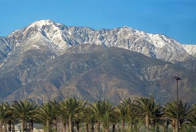
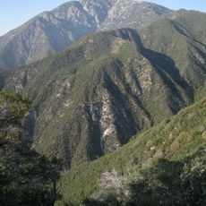
Cucamonga Peak, Mountain summit in San Gabriel Mountains, California, US.

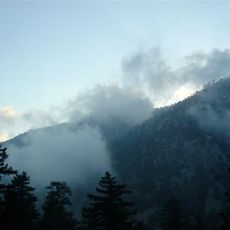
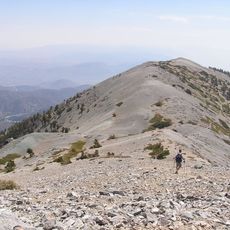
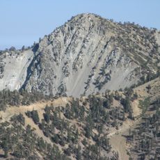
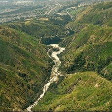
Cucamonga Peak is a granite summit in the San Gabriel Mountains that stands at 8,862 feet. The mountain sits within the San Bernardino National Forest and provides expansive views across the surrounding landscape toward Los Angeles and the Inland Empire.

The peak's name comes from Rancho Cucamonga, a Mexican land grant from the 19th century that covered the valley below the mountain. This territorial concession shaped the region's early history long before the slopes became a hiking destination.

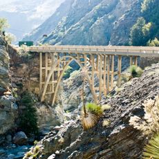
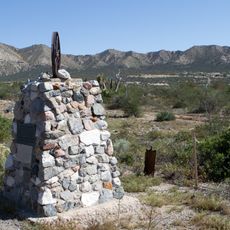
The mountain trails contain remnants of early 1900s cabins, with approximately 25 structures remaining from the original settlement in Icehouse Canyon.

The hike is demanding and typically takes five to seven hours for a complete round trip. Start early in the day, bring plenty of water, and be prepared for weather changes as you climb higher.

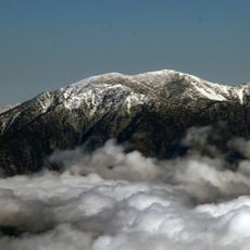
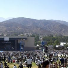
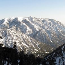
On clear days, hikers can see Mount San Jacinto and distant urban areas from the summit, revealing the expansive sight line across Southern California. This panorama demonstrates how close the peak sits to major population centers despite being surrounded by untouched wilderness.

The community of curious travelers

AroundUs brings together thousands of curated places, local tips, and hidden gems, enriched daily by 60,000 contributors worldwide.

Start exploring
Location
GPS coordinates
34.22279,-117.58541
Latest update
December 8, 2025 13:43
Around this place
Mount San Antonio
United States of America

Mount San Antonio

9.3 km
Auto Club Speedway
United States of America

Auto Club Speedway

16.9 km
Bridge to Nowhere
United States of America

Bridge to Nowhere

16.3 km
Prometheus
United States of America

Prometheus

17.8 km
Glen Helen Amphitheater
United States of America

Glen Helen Amphitheater

17 km
Mount Baldy Zen Center
United States of America

Mount Baldy Zen Center

5.8 km
Glen Helen Regional Park
United States of America

Glen Helen Regional Park

16.5 km
Padua Hills Theatre
United States of America

Padua Hills Theatre

13.3 km
California Botanic Garden
United States of America

California Botanic Garden

17.3 km
Dividing the Light
United States of America

Dividing the Light

18 km
Bonita Falls
United States of America

Bonita Falls

7.5 km
John Rains House
United States of America

John Rains House

12.6 km
Iron Mountain
United States of America

Iron Mountain

13.9 km
Ontario Peak
United States of America

Ontario Peak

3.6 km
Raymond M. Alf Museum of Paleontology
United States of America

Raymond M. Alf Museum of Paleontology

17.9 km
Bridges Auditorium
United States of America

Bridges Auditorium

18.1 km
Mount Harwood
United States of America

Mount Harwood

8.3 km
Victoria Gardens Cultural Center
United States of America

Victoria Gardens Cultural Center

13.2 km
Cucamonga Service Station
United States of America

Cucamonga Service Station

12.9 km
Tapia Adobe
United States of America

Tapia Adobe

13.1 km
Telegraph Peak
United States of America

Telegraph Peak

4.5 km
Santa Fe And Salt Lake Trail Monument
United States of America

Santa Fe And Salt Lake Trail Monument

14.4 km
John R. Rodman Arboretum
United States of America

John R. Rodman Arboretum

17.2 km
Mormon Trail Monument
United States of America

Mormon Trail Monument

15.3 km
San Dimas Experimental Forest
United States of America

San Dimas Experimental Forest

16.3 km
Cucamonga Service Station
United States of America

Cucamonga Service Station

12.9 km
Marston Quadrangle
United States of America

Marston Quadrangle

18.2 km
Center for Athletics, Recreation, and Wellness
United States of America

Center for Athletics, Recreation, and Wellness

18 km
Show the full map
« Cucamonga Peak - Mountain summit in San Gabriel Mountains, California, US » is provided by Around Us (aroundus.com). Images and texts are derived from Wikimedia project under a Creative Commons license. You are allowed to copy, distribute, and modify copies of this page, under the conditions set by the license, as long as this note is clearly visible.

Discover hidden gems everywhere you go!

From secret cafés to breathtaking viewpoints, skip the crowded tourist spots and find places that match your style. Our app makes it easy with voice search, smart filtering, route optimization, and insider tips from travelers worldwide. Download now for the complete mobile experience.

Around Us App Screenshot

A unique approach to discovering new places

Le Figaro

All the places worth exploring

France Info

A tailor-made excursion in just a few clicks

20 Minutes

Around Us
Travel Guide & Maps
Download

Send to your phone

QR Code
1

Open the camera app on your mobile.

2

Point at the QR code with your camera. A notification will appear.

3

Tap the notification to open the link.