Chest opened
+${chestReward.xp} XP
Explorer
NOUVEAU ×${chestReward.collectible.quantity}
tapez pour fermer

See the monuments around you in AR Open chests in the app

Around Us is built for your phone — point your camera at the streets and discover the monuments and places around you in augmented reality. Around Us is built for your phone — chests unlock when you walk, explore and capture nearby places.

Enable Location

We need your location to show you interesting places around you

Discover nearby places

Find interesting locations and hidden gems around you

Precise directions

Get accurate directions and distances to places

Your location is never shared with other users. It's only used when you tap the location button.

Log in to your account

Start exploring — it's free

Trusted by 80,666 travelers worldwide

Continue with Google
Continue with Apple
or

We will send you a code to connect

By continuing, you accept our Terms and Conditions and our Privacy Policy

Check your inbox

We've sent a pincode in your inbox. Please enter the code below.

Mae West Peaks
Discussion Reviews Photo
1.1k Popularity

Mae West Peaks, Mountain summit in Little Dragoon Mountains, Arizona, United States.

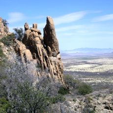
Mae West Peaks are two summits in the Little Dragoon Mountains with white limestone formations that reach 2,050 meters in elevation. The pair of peaks have a vertical prominence of roughly 620 meters above the surrounding landscape.

The mountains were named after their silhouette, which resembles the actress Mae West from the 1930s. The first documented climbing expedition took place in 2007, when one participant had to turn back due to injuries while ascending the steep terrain.

The twin peaks earned their name because their profile resembles the curves of 1930s actress Mae West, a reference that has stuck with locals and hikers over the decades.

The path to the summit winds through dense vegetation and scratchy brush over a trail that spans roughly 8 kilometers with about 600 meters of elevation gain. Visitors should prepare for rough terrain and bring plenty of water for this demanding hike.

The taller of the two peaks was once known as Lime Peak before it received its current name as part of the dual designation. This shift shows how geographic features sometimes gain fresh identities based on local perception and cultural references.

The community of curious travelers

AroundUs brings together thousands of curated places, local tips, and hidden gems, enriched daily by 60,000 contributors worldwide.

Start exploring
Location
GPS coordinates
32.10008,-110.12229
Latest update
July 24, 2026 00:05
Around this place
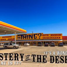
The Thing?
United States of America

The Thing?

7.1 km
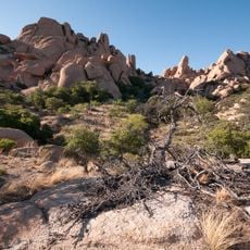
Texas Canyon
United States of America

Texas Canyon

6.3 km
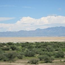
Willcox Playa
United States of America

Willcox Playa

26.3 km
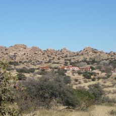
Amerind Foundation
United States of America

Amerind Foundation

7.3 km
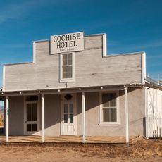
Cochise Hotel
United States of America

Cochise Hotel

18.9 km
United States of America

Mount Glenn

20.8 km
United States of America

Vega–Bray Observatory

21.8 km
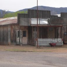
J.H. Smith Grocery Store and Filling Station
United States of America

J.H. Smith Grocery Store and Filling Station

11.4 km
United States of America

Lime Peak

2.9 km
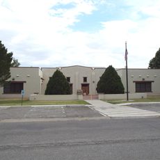
Willcox Women's Club
United States of America

Willcox Women's Club

32.1 km
United States of America

San Pedro Valley Observatory

21.8 km
Benson Railroad Historic District
United States of America

Benson Railroad Historic District

21.8 km
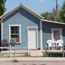
Johnson-Tillotson House
United States of America

Johnson-Tillotson House

32.1 km
John Gung'l House
United States of America

John Gung'l House

31.8 km
United States of America

Schilling Ranch Historic District

25.8 km
Benjamin E. Briscoe House
United States of America

Benjamin E. Briscoe House

31.9 km
Apache Powder Historic Residential District
United States of America

Apache Powder Historic Residential District

22.4 km
San Pedro Golf Course
United States of America

San Pedro Golf Course

20.3 km
United States of America

Dragoon Springs Cemetery

14.8 km
United States of America

Sonoran Skies observatory

19.7 km
United States of America

Moka Observatory

21.9 km
United States of America

North Star Peak

28.5 km
San Pedro River Railroad Bridge
United States of America

San Pedro River Railroad Bridge

21.1 km
Cochise Trail
United States of America

Cochise Trail

23.8 km
United States of America

Twin Lakes Municipal Golf Course

31.6 km
United States of America

Turquoise Hills Family Golf Center

22.2 km
United States of America

Statue, Work of art

26.1 km
United States of America

Scenic viewpoint

24.5 km
Show the full map
Reviews
Share your experience

No review yet

Discussions
Start a discussion...

No discussion yet

« Mae West Peaks - Mountain summit in Little Dragoon Mountains, Arizona, United States » is provided by Around Us (aroundus.com). Images and texts are derived from Wikimedia project under a Creative Commons license. You are allowed to copy, distribute, and modify copies of this page, under the conditions set by the license, as long as this note is clearly visible.

Discover hidden gems everywhere you go!

From secret cafés to breathtaking viewpoints, skip the crowded tourist spots and find places that match your style. Our app makes it easy with voice search, smart filtering, route optimization, and insider tips from travelers worldwide. Download now for the complete mobile experience.

Around Us App Screenshot

A unique approach to discovering new places

Le Figaro

All the places worth exploring

France Info

A tailor-made excursion in just a few clicks

20 Minutes

Around Us
Travel Guide & Maps
Download

Send to your phone

QR Code
1

Open the camera app on your mobile.

2

Point at the QR code with your camera. A notification will appear.

3

Tap the notification to open the link.