Enable Location

We need your location to show you interesting places around you

Discover nearby places

Find interesting locations and hidden gems around you

Precise directions

Get accurate directions and distances to places

Your location is never shared with other users. It's only used when you tap the location button.

Arizona State Route 202

Log in to your account

Start exploring — it's free

Trusted by 62,466 travelers worldwide

Continue with Google
Continue with Apple
or

We will send you a code to connect

By continuing, you accept our Terms and Conditions and our Privacy Policy

Check your inbox

We've sent a pincode in your inbox. Please enter the code below.

Arizona State Route 202

Arizona State Route 202, State highway in Phoenix metropolitan area, United States

Arizona State Route 202 is a state highway stretching roughly 55 miles through Maricopa County, primarily serving as a rapid connection between the northern and southern portions of the Phoenix metropolitan area. The route passes through or near several populated cities and connects multiple major roads and commercial zones.

Planning for this highway began in the late 1980s in response to growing traffic demands in the expanding Phoenix metropolitan region. The official opening in 1990 marked a significant milestone in developing infrastructure for the rapidly growing area.

This highway serves as a daily route for commuters moving between residential areas and employment centers across the region. It has become part of the typical driving experience for people living and working in the Phoenix area.

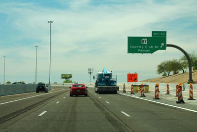
The route includes multiple exits and connections to other major roads, making navigation straightforward and access to different parts of the region easy. Traffic can be heavy during commute hours, so it is wise to plan travel time accordingly.

The highway forms a partial loop around the Phoenix metropolitan area, offering a time-saving alternative route for crossing the region. This layout allows drivers to move between eastern and western sections without having to go through downtown Phoenix.

The community of curious travelers

AroundUs brings together thousands of curated places, local tips, and hidden gems, enriched daily by 60,000 contributors worldwide.

Start exploring
Location
Inception
1990
GPS coordinates
33.39354,-111.64583
Latest update
December 20, 2025 12:33
Around this place
Lost Dutchman State Park
United States of America

Lost Dutchman State Park

17.2 km
HoHoKam Stadium
United States of America

HoHoKam Stadium

17.8 km
Gilbert Arizona Temple
United States of America

Gilbert Arizona Temple

14.2 km
Mesa Grande
United States of America

Mesa Grande

19.1 km
Golfland Sunsplash
United States of America

Golfland Sunsplash

17.9 km
Mesa Arts Center
United States of America

Mesa Arts Center

17.3 km
Arizona Museum of Natural History
United States of America

Arizona Museum of Natural History

17.6 km
United States of America

Mount McDowell

17 km
Mesa Arts Center
United States of America

Mesa Arts Center

17.3 km
Arizona Railway Museum
United States of America

Arizona Railway Museum

22.4 km
Arizona Commemorative Air Force Museum
United States of America

Arizona Commemorative Air Force Museum

10.6 km
Stewart Mountain Dam
United States of America

Stewart Mountain Dam

21.8 km
I.d.e.a. Museum
United States of America

I.d.e.a. Museum

17.9 km
Mesa Historical Museum
United States of America

Mesa Historical Museum

17.1 km
Rittenhouse Elementary School
United States of America

Rittenhouse Elementary School

14.8 km
United States of America

Buckhorn Hot Mineral Wells

5.7 km
Gold Canyon Golf Resort
United States of America

Gold Canyon Golf Resort

18.6 km
Our Lady of Guadalupe Church
United States of America

Our Lady of Guadalupe Church

16.1 km
West Second Street Historic District
United States of America

West Second Street Historic District

17.7 km
Las Sendas Golf Club
United States of America

Las Sendas Golf Club

10.1 km
Wilbur Street Historic District
United States of America

Wilbur Street Historic District

16.9 km
Desert Sands Golf Course
United States of America

Desert Sands Golf Course

2.8 km
Sunland Springs Golf
United States of America

Sunland Springs Golf

5.6 km
Dobson Ranch Golf Course
United States of America

Dobson Ranch Golf Course

20.9 km
Desert Canyon Golf Course
United States of America

Desert Canyon Golf Course

22.2 km
Falcon Field Airport
United States of America

Falcon Field Airport

10.4 km
Rowena Theatre
United States of America

Rowena Theatre

20.9 km
Temple Historic District
United States of America

Temple Historic District

16.4 km
Show the full map
« Arizona State Route 202 - State highway in Phoenix metropolitan area, United States » is provided by Around Us (aroundus.com). Images and texts are derived from Wikimedia project under a Creative Commons license. You are allowed to copy, distribute, and modify copies of this page, under the conditions set by the license, as long as this note is clearly visible.

Discover hidden gems everywhere you go!

From secret cafés to breathtaking viewpoints, skip the crowded tourist spots and find places that match your style. Our app makes it easy with voice search, smart filtering, route optimization, and insider tips from travelers worldwide. Download now for the complete mobile experience.

Around Us App Screenshot

A unique approach to discovering new places

Le Figaro

All the places worth exploring

France Info

A tailor-made excursion in just a few clicks

20 Minutes

Around Us
Travel Guide & Maps
Download

Send to your phone

QR Code
1

Open the camera app on your mobile.

2

Point at the QR code with your camera. A notification will appear.

3

Tap the notification to open the link.