Chest opened
+${chestReward.xp} XP
Explorer
NOUVEAU ×${chestReward.collectible.quantity}
tapez pour fermer
Chest locked

Open chests in the app

Around Us is built for your phone — chests unlock when you walk, explore and capture nearby places.

Enable Location

We need your location to show you interesting places around you

Discover nearby places

Find interesting locations and hidden gems around you

Precise directions

Get accurate directions and distances to places

Your location is never shared with other users. It's only used when you tap the location button.

Verde River

Log in to your account

Start exploring — it's free

Trusted by 72,881 travelers worldwide

Continue with Google
Continue with Apple
or

We will send you a code to connect

By continuing, you accept our Terms and Conditions and our Privacy Policy

Check your inbox

We've sent a pincode in your inbox. Please enter the code below.

Verde River
Discussion Reviews 1 Photos
20.4k Popularity

Verde River, River system in Maricopa and Yavapai Counties, United States

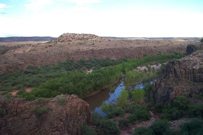
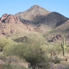
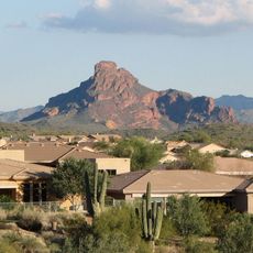
The Verde River stretches 170 miles through Arizona, flowing from the Mogollon Rim through narrow canyons, forests, and desert terrain before joining the Salt River. Its course reveals varied landscapes, from rocky cliffs and wooded sections to open plains where different habitats support distinct communities of plants and animals.

Indigenous peoples relied on these waters for agriculture and settlement for centuries before European arrival transformed the region. The river's flow and natural systems gradually changed as development expanded across Arizona.

The Yavapai-Apache communities have deep ties to these waters, which remain central to their way of life and spiritual practices. Local residents view the river as woven into their identity and continue traditions that connect them to its flow.

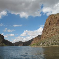
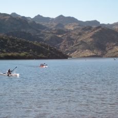
Several access points with parking and seasonal camping facilities allow visitors to kayak, fish, and hike along the river. Check water conditions and weather before visiting, as seasons affect flow rates and trail accessibility throughout the year.

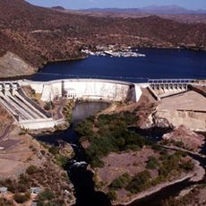
This is Arizona's last river where water flows freely with minimal human control, maintaining natural patterns that support diverse wildlife. Few other rivers in the state preserve such natural water rhythms without major dams or extensive water management.

The community of curious travelers

AroundUs brings together thousands of curated places, local tips, and hidden gems, enriched daily by 60,000 contributors worldwide.

Start exploring
Location
Location
Location
GPS coordinates
33.54690,-111.66100
Latest update
December 7, 2025 10:06
Around this place
Taliesin West
United States of America

Taliesin West

18.3 km
Canyon Lake
United States of America

Canyon Lake

20.8 km
Lost Dutchman State Park
United States of America

Lost Dutchman State Park

19.8 km
Salt River Fields at Talking Stick
United States of America

Salt River Fields at Talking Stick

20.8 km
OdySea Aquarium
United States of America

OdySea Aquarium

20.1 km
HoHoKam Stadium
United States of America

HoHoKam Stadium

19.8 km
Saguaro Lake
United States of America

Saguaro Lake

12.8 km
Butterfly Wonderland

Butterfly Wonderland

20 km
United States of America

Mount McDowell

3.1 km
Arizona Commemorative Air Force Museum
United States of America

Arizona Commemorative Air Force Museum

12.5 km
Buckhorn Baths Motel
United States of America

Buckhorn Baths Motel

15 km
Stewart Mountain Dam
United States of America

Stewart Mountain Dam

11.8 km
Mormon Flat Dam
United States of America

Mormon Flat Dam

20.3 km
Thompson Peak
United States of America

Thompson Peak

17.7 km
Mesa Historical Museum
United States of America

Mesa Historical Museum

17.2 km
United States of America

Buckhorn Hot Mineral Wells

15 km
Fountain Hills Observatory
United States of America

Fountain Hills Observatory

12.3 km
Las Sendas Golf Club
United States of America

Las Sendas Golf Club

7.3 km
Wilbur Street Historic District
United States of America

Wilbur Street Historic District

20.9 km
Kino Aquatic Center
United States of America

Kino Aquatic Center

19.1 km
Desert Sands Golf Course
United States of America

Desert Sands Golf Course

18.3 km
Brimhall Aquatic Complex
United States of America

Brimhall Aquatic Complex

18.1 km
Sunland Springs Golf
United States of America

Sunland Springs Golf

20.6 km
Stapley Aquatic Center
United States of America

Stapley Aquatic Center

13.2 km
Desert Canyon Golf Course
United States of America

Desert Canyon Golf Course

6.5 km
Falcon Field Airport
United States of America

Falcon Field Airport

11.7 km
Goldfield Ghost Town
United States of America

Goldfield Ghost Town

18.9 km
Shepherd Aquatic Complex
United States of America

Shepherd Aquatic Complex

12.4 km
Show the full map
Reviews
Share your experience

No review yet

Discussions
Start a discussion...

No discussion yet

« Verde River - River system in Maricopa and Yavapai Counties, United States » is provided by Around Us (aroundus.com). Images and texts are derived from Wikimedia project under a Creative Commons license. You are allowed to copy, distribute, and modify copies of this page, under the conditions set by the license, as long as this note is clearly visible.

Discover hidden gems everywhere you go!

From secret cafés to breathtaking viewpoints, skip the crowded tourist spots and find places that match your style. Our app makes it easy with voice search, smart filtering, route optimization, and insider tips from travelers worldwide. Download now for the complete mobile experience.

Around Us App Screenshot

A unique approach to discovering new places

Le Figaro

All the places worth exploring

France Info

A tailor-made excursion in just a few clicks

20 Minutes

Around Us
Travel Guide & Maps
Download

Send to your phone

QR Code
1

Open the camera app on your mobile.

2

Point at the QR code with your camera. A notification will appear.

3

Tap the notification to open the link.