Globe

Log in to your account

AroundUs is a community-driven map of interesting places, built by curious explorers like you. It grows with every review, story, and photo you share.
Connect to save your favorite spots, contribute locations, and create personalized routes.
Continue with Google
Continue with Apple
Continue with X
Continue with Facebook
Continue with email
By continuing, you accept our Terms and Conditions and our Privacy Policy
Create an account
Add to collection
Map
Suggest a change
Share

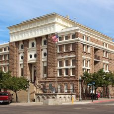
Globe, Mining city and county seat in Eastern Arizona, United States

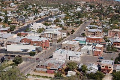
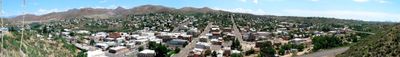
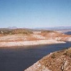
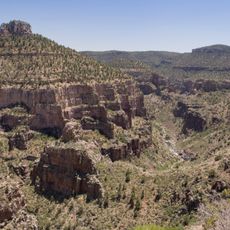
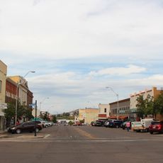
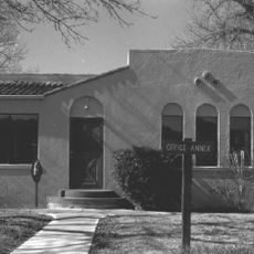
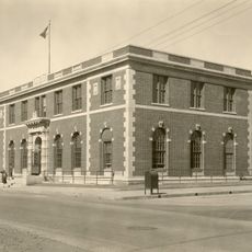
Globe is a city in Gila County in eastern Arizona, situated between the Pinal and Apache mountains in a valley shaped by Pinal Creek. The settlement follows the natural curves of the creek, with buildings positioned along the contours of the landscape.

The town was founded in 1875 when silver deposits were discovered, with its name inspired by a spherical silver formation found by early miners. Later the region shifted toward copper extraction, which became the main economic driver for decades.

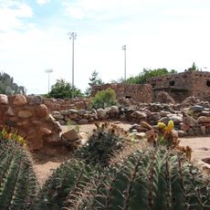
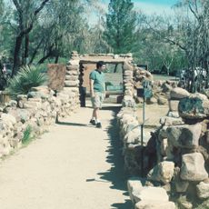
The Besh-ba-gowah Archaeological Park displays structures built by Hohokam and Salado peoples, with artifacts showing how they lived in this region centuries ago. Walking through the site gives visitors a sense of the daily life and skills of those early communities.

The city is connected to surrounding regions through U.S. Routes 60 and 70, with the Arizona Eastern Railway offering additional travel options. Visitors have multiple ways to reach the area and explore both the town and nearby attractions.

The Old Dominion copper mine opened in 1880 and operated for more than five decades, transforming the town's economy from silver to copper production. This shift proved crucial for the community's long-term survival and growth.

Location: Gila County

Inception: 1875

Elevation above the sea: 1,070 m

Part of: Eastern Arizona

Website: http://globeaz.gov

GPS coordinates: 33.39972,-110.78167

Latest update: December 14, 2025 18:22

Photos
Around this place
Weaver's Needle
United States of America

Weaver's Needle

54.9 km
San Carlos Lake
United States of America

San Carlos Lake

40.2 km
Salt River Canyon Wilderness
United States of America

Salt River Canyon Wilderness

28.5 km
Boyce Thompson Arboretum
United States of America

Boyce Thompson Arboretum

37.5 km
United States of America

Picketpost Mountain

38.4 km
Besh-Ba-Gowah
United States of America

Besh-Ba-Gowah

2.2 km
Roosevelt Lake Bridge
United States of America

Roosevelt Lake Bridge

46.3 km
Globe Downtown Historic District
United States of America

Globe Downtown Historic District

650 m
Gila County Courthouse
United States of America

Gila County Courthouse

595 m
United States of America

Peralta Canyon

53.8 km
Our Lady of the Blessed Sacrament Church
United States of America

Our Lady of the Blessed Sacrament Church

8.6 km
Sierra Ancha Wilderness
United States of America

Sierra Ancha Wilderness

47.8 km
Holy Angels Church
United States of America

Holy Angels Church

664 m
Gila Valley Bank and Trust Building
United States of America

Gila Valley Bank and Trust Building

644 m
Elks Building
United States of America

Elks Building

595 m
Winkelman Bridge
United States of America

Winkelman Bridge

46.2 km
Miami Community Church
United States of America

Miami Community Church

8 km
Globe Ranger Station
United States of America

Globe Ranger Station

2.7 km
United States Post Office and Courthouse–Globe Main
United States of America

United States Post Office and Courthouse–Globe Main

1.5 km
Besh-Ba-Gowah Museum
United States of America

Besh-Ba-Gowah Museum

2.1 km
Tonto National Monument Visitor Center
United States of America

Tonto National Monument Visitor Center

41.1 km
Bullion Plaza Cultural Center and Museum
United States of America

Bullion Plaza Cultural Center and Museum

9.1 km
Gila County Historical Museum
United States of America

Gila County Historical Museum

1.7 km
Coolidge Dam
United States of America

Coolidge Dam

34.5 km
Aztec Peak Lookout
United States of America

Aztec Peak Lookout

47.4 km
Pinto Creek Bridge
United States of America

Pinto Creek Bridge

16.7 km
Queen Creek Bridge
United States of America

Queen Creek Bridge

52.4 km
Alchesay Canyon Bridge
United States of America

Alchesay Canyon Bridge

46 km
Show the full map
Reviews

Visited this place? Tap the stars to rate it and share your experience / photos with the community! Try now! You can cancel it anytime.

« Globe - Mining city and county seat in Eastern Arizona, United States » is provided by Around Us (aroundus.com). Images and texts are derived from Wikimedia project under a Creative Commons license. You are allowed to copy, distribute, and modify copies of this page, under the conditions set by the license, as long as this note is clearly visible.

Discover hidden gems everywhere you go!

From secret cafés to breathtaking viewpoints, skip the crowded tourist spots and find places that match your style. Our app makes it easy with voice search, smart filtering, route optimization, and insider tips from travelers worldwide. Download now for the complete mobile experience.

Around Us App Screenshot

A unique approach to discovering new places

Le Figaro

All the places worth exploring

France Info

A tailor-made excursion in just a few clicks

20 Minutes