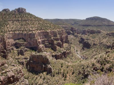
Salt River Canyon Wilderness, Protected wilderness area in Gila County, Arizona
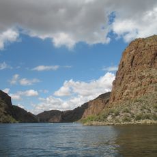
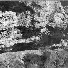
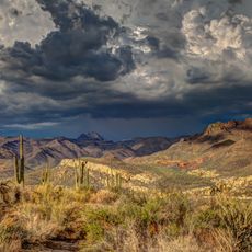
Salt River Canyon Wilderness is a protected area in Gila County featuring dramatic canyon walls with dense saguaro forests throughout. The Upper Salt River flows through the deep gorge, creating a striking geographic division between the plateaus on either side of the canyon.
The area received federal protection status in 1984, preserving this natural corridor for the future. The designation was granted to safeguard the ecological importance of the canyon system.
The Salt River serves as a boundary between the Fort Apache Indian Reservation to the north and the San Carlos Apache Indian Reservation to the south.
Visitors should know that water flows are most powerful between March and May and require special permits for river travel. Elevation varies significantly from low desert to higher forest areas, which will affect physical demands.
Apache Falls drops with substantial water volumes through the arid Sonoran Desert landscape. This waterfall stands out because it exists in one of the driest regions of the continent, creating a striking contrast with the surrounding aridity.
Location: Gila County
GPS coordinates: 33.65440,-110.81500
Latest update: December 9, 2025 18:49
Canyon Lake
59 km
Four Peaks
47.4 km
Weaver's Needle
57.1 km
Skeleton Cave
52 km
Boyce Thompson Arboretum
52.5 km
Sears-Kay Ruin
48.3 km
Picketpost Mountain
54.5 km
Besh-Ba-Gowah
30.6 km
Roosevelt Lake Bridge
31.8 km
Globe Downtown Historic District
29 km
Gila County Courthouse
28.9 km
Our Lady of the Blessed Sacrament Church
29.1 km
Sierra Ancha Wilderness
19.5 km
Holy Angels Church
29 km
Gila Valley Bank and Trust Building
28.9 km
Elks Building
28.9 km
Pleasant Valley Ranger Station
52.5 km
Miami Community Church
28.8 km
Globe Ranger Station
31.1 km
United States Post Office and Courthouse–Globe Main
29.9 km
Besh-Ba-Gowah Museum
30.6 km
Tonto National Monument Visitor Center
27.6 km
Bullion Plaza Cultural Center and Museum
29.6 km
Gila County Historical Museum
27.3 km
Boulder Creek Bridge
58 km
Aztec Peak Lookout
19.6 km
Pinto Creek Bridge
35.1 km
Alchesay Canyon Bridge
31.9 kmVisited this place? Tap the stars to rate it and share your experience / photos with the community! Try now! You can cancel it anytime.
Discover hidden gems everywhere you go!
From secret cafés to breathtaking viewpoints, skip the crowded tourist spots and find places that match your style. Our app makes it easy with voice search, smart filtering, route optimization, and insider tips from travelers worldwide. Download now for the complete mobile experience.
A unique approach to discovering new places❞
— Le Figaro
All the places worth exploring❞
— France Info
A tailor-made excursion in just a few clicks❞
— 20 Minutes