Eagar, town in Apache County, Arizona, United States
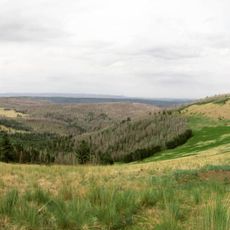
Eagar is a small town in Arizona located below the White Mountains at about 7,000 feet elevation and surrounded by dense forest, lakes, and mountain trails. The landscape features meadows, streams stocked with trout, and thick woodlands with numerous outdoor recreation areas nearby.
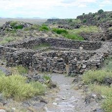
Eagar was founded by the Eagar family of homesteaders in the late 1800s, who gave the town its name. The area was also visited by explorer Francisco Coronado in the 1540s during his expedition, leaving traces of early Spanish contact in the region.
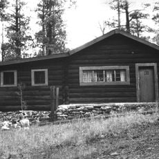
Eagar reflects a strong connection to ranching and outdoor traditions that shaped the community for over a century. Visitors notice how daily life centers around natural activities like fishing, hunting, and exploring the surrounding forests and mountains.
The best time to visit is spring through fall when hiking trails are clear and weather is mild, though winter brings snow sports opportunities at nearby ski resorts. Most attractions and outdoor activities are accessible from the town center without needing specialized equipment, making it easy to explore at your own pace.
Nearby Zuni Salt Lake is a shallow, sacred body of water revered by the Zuni people as home to a spiritual presence called the Salt Mother. The site is protected as historically important and offers visitors a quiet place to experience the area's spiritual and cultural dimensions.
The community of curious travelers
AroundUs brings together thousands of curated places, local tips, and hidden gems, enriched daily by 60,000 contributors worldwide.