Chest opened
+${chestReward.xp} XP
Explorer
NOUVEAU ×${chestReward.collectible.quantity}
tapez pour fermer
Chest locked

Open chests in the app

Around Us is built for your phone — chests unlock when you walk, explore and capture nearby places.

Enable Location

We need your location to show you interesting places around you

Discover nearby places

Find interesting locations and hidden gems around you

Precise directions

Get accurate directions and distances to places

Your location is never shared with other users. It's only used when you tap the location button.

Log in to your account

Start exploring — it's free

Trusted by 72,994 travelers worldwide

Continue with Google
Continue with Apple
or

We will send you a code to connect

By continuing, you accept our Terms and Conditions and our Privacy Policy

Check your inbox

We've sent a pincode in your inbox. Please enter the code below.

San Solomon Springs
Discussion Reviews Photo
3.7k Popularity

San Solomon Springs, Natural springs group in Reeves County, Texas, US

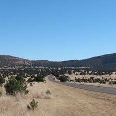
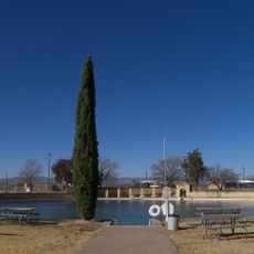
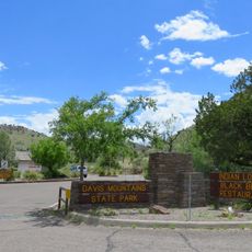
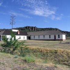
San Solomon Springs is a group of natural water sources in the Chihuahuan Desert that discharge between 20 and 28 million gallons of water daily. The flow fills a large swimming area in Balmorhea State Park while also supplying irrigation water to extensive agricultural land nearby.

For centuries, Jumano and Mescalero communities relied on the springs to grow crops and fruit trees in this desert region. The sources have been valued as a vital resource in this water-scarce area since pre-Columbian times.

The springs network consists of six separate water sources in the Chihuahuan Desert, supporting local farming activities and maintaining regional agricultural traditions.

The water maintains a steady temperature year-round, making it a pleasant place to swim in the desert heat. The park is easy to reach and welcomes visitors looking to cool off or explore the surrounding landscape.

The springs emerge from the sandy bottom about 25 feet down and harbor rare fish species like the endangered Comanche Springs pupfish. These underwater habitats are scientifically important for preserving these distinctive desert species.

The community of curious travelers

AroundUs brings together thousands of curated places, local tips, and hidden gems, enriched daily by 60,000 contributors worldwide.

Start exploring
Location
GPS coordinates
30.94427,-103.78836
Latest update
December 11, 2025 18:09
Around this place
McDonald Observatory
United States of America

McDonald Observatory

37.7 km
Balmorhea State Park
United States of America

Balmorhea State Park

512 m
Davis Mountains State Park
United States of America

Davis Mountains State Park

41.2 km
Hobby–Eberly Telescope
United States of America

Hobby–Eberly Telescope

36.4 km
Harlan J. Smith Telescope
United States of America

Harlan J. Smith Telescope

37.7 km
El Paisano Hotel
United States of America

El Paisano Hotel

73.8 km
The Holland Hotel
United States of America

The Holland Hotel

66.4 km
Otto Struve Telescope
United States of America

Otto Struve Telescope

37.7 km
Chihuahuan Desert Nature Center and Botanical Gardens
United States of America

Chihuahuan Desert Nature Center and Botanical Gardens

45.2 km
Presidio County Courthouse
United States of America

Presidio County Courthouse

73.7 km
Jeff Davis County Courthouse
United States of America

Jeff Davis County Courthouse

40.9 km
Henry M. and Annie V. Trueheart House
United States of America

Henry M. and Annie V. Trueheart House

41 km
Grierson-Sproul House
United States of America

Grierson-Sproul House

40.9 km
Hotel Limpia
United States of America

Hotel Limpia

40.8 km
Museum of the Big Bend
United States of America

Museum of the Big Bend

65.9 km
Rattlers and Reptiles
United States of America

Rattlers and Reptiles

39.4 km
Frank N. Bash Visitors Center
United States of America

Frank N. Bash Visitors Center

37.1 km
Fort Davis
United States of America

Fort Davis

39.8 km
Palace Theater
United States of America

Palace Theater

73.6 km
Granada Theatre
United States of America

Granada Theatre

66.4 km
Rangra Theatres
United States of America

Rangra Theatres

66.4 km
Texas Theater
United States of America

Texas Theater

73.6 km
Brewster County Courthouse
United States of America

Brewster County Courthouse

66.3 km
Fort Davis VLBA station
United States of America

Fort Davis VLBA station

37.5 km
Fort Davis National Historic Site Visitor Center
United States of America

Fort Davis National Historic Site Visitor Center

39.9 km
Fort Davis Quarters HB-14
United States of America

Fort Davis Quarters HB-14

39.6 km
Rebecca Gale Telescope Park Amphitheater
United States of America

Rebecca Gale Telescope Park Amphitheater

37.2 km
Fort Davis Post Chapel
United States of America

Fort Davis Post Chapel

39.6 km
Show the full map
Reviews
Share your experience

No review yet

Discussions
Start a discussion...

No discussion yet

« San Solomon Springs - Natural springs group in Reeves County, Texas, US » is provided by Around Us (aroundus.com). Images and texts are derived from Wikimedia project under a Creative Commons license. You are allowed to copy, distribute, and modify copies of this page, under the conditions set by the license, as long as this note is clearly visible.

Discover hidden gems everywhere you go!

From secret cafés to breathtaking viewpoints, skip the crowded tourist spots and find places that match your style. Our app makes it easy with voice search, smart filtering, route optimization, and insider tips from travelers worldwide. Download now for the complete mobile experience.

Around Us App Screenshot

A unique approach to discovering new places

Le Figaro

All the places worth exploring

France Info

A tailor-made excursion in just a few clicks

20 Minutes

Around Us
Travel Guide & Maps
Download

Send to your phone

QR Code
1

Open the camera app on your mobile.

2

Point at the QR code with your camera. A notification will appear.

3

Tap the notification to open the link.