Chest opened
+${chestReward.xp} XP
Explorer
NOUVEAU ×${chestReward.collectible.quantity}
tapez pour fermer
Chest locked

Open chests in the app

Around Us is built for your phone — chests unlock when you walk, explore and capture nearby places.

Enable Location

We need your location to show you interesting places around you

Discover nearby places

Find interesting locations and hidden gems around you

Precise directions

Get accurate directions and distances to places

Your location is never shared with other users. It's only used when you tap the location button.

Log in to your account

Start exploring — it's free

Trusted by 72,884 travelers worldwide

Continue with Google
Continue with Apple
or

We will send you a code to connect

By continuing, you accept our Terms and Conditions and our Privacy Policy

Check your inbox

We've sent a pincode in your inbox. Please enter the code below.

Blackwater Draw
Discussion Reviews Photo
16.9k Popularity

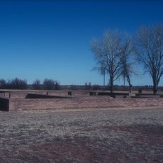
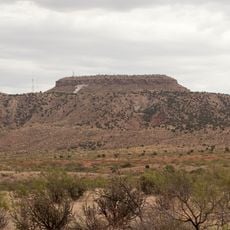
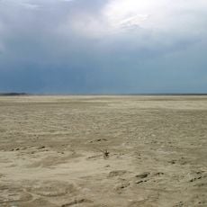
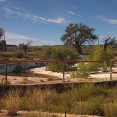
Blackwater Draw, Stream channel in Roosevelt County, New Mexico.

Blackwater Draw is a stream channel in Roosevelt County that extends through the dry plains of eastern New Mexico for many kilometers. The watercourse cuts through the flat highlands and connects with other waterways that flow into neighboring states.

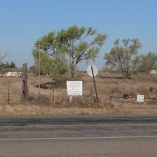
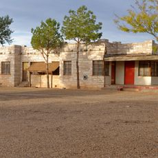
The location saw early human hunting activity several thousand years ago when people pursued large animals here. Systematic excavations beginning in the 1930s uncovered substantial evidence of these ancient hunting stations.

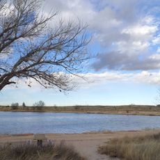
The stream's surroundings show layers of occupation from different ancient peoples who lived and hunted in this region. Visitors can observe how settlements changed and adapted over many centuries of human presence here.

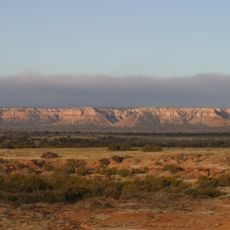
The location sits in a dry, flat area in eastern New Mexico that is typically open and isolated. The best time to visit is during cooler months when weather conditions are less extreme.

Archaeological research discovered protein residues on ancient tools that prove hunters used them to kill large extinct animals. These findings provide rare direct evidence of how these early people actually hunted.

The community of curious travelers

AroundUs brings together thousands of curated places, local tips, and hidden gems, enriched daily by 60,000 contributors worldwide.

Start exploring
Location
GPS coordinates
34.27787,-103.32458
Latest update
December 7, 2025 19:26
Around this place
Fort Sumner
United States of America

Fort Sumner

81.2 km
Caprock Escarpment
United States of America

Caprock Escarpment

98 km
Glenrio
United States of America

Glenrio

103.6 km
Blue Swallow Motel
United States of America

Blue Swallow Motel

105.8 km
Tucumcari Mountain
United States of America

Tucumcari Mountain

101.3 km
Hotel Clovis
United States of America

Hotel Clovis

17.5 km
Blackwater Draw archaeological site
United States of America

Blackwater Draw archaeological site

16 m
Muleshoe National Wildlife Refuge
United States of America

Muleshoe National Wildlife Refuge

63.2 km
Grulla National Wildlife Refuge
United States of America

Grulla National Wildlife Refuge

31.2 km
Oasis State Park
United States of America

Oasis State Park

3.2 km
Cactus Motor Lodge
United States of America

Cactus Motor Lodge

105.5 km
State Theater
United States of America

State Theater

17.7 km
First Methodist Church of Clovis
United States of America

First Methodist Church of Clovis

21.9 km
Metropolitan Park Bathhouse and Pool Historic District
United States of America

Metropolitan Park Bathhouse and Pool Historic District

106 km
Roosevelt County Courthouse
United States of America

Roosevelt County Courthouse

10.3 km
Clovis Baptist Hospital
United States of America

Clovis Baptist Hospital

18.3 km
De Baca County Courthouse
United States of America

De Baca County Courthouse

87.1 km
Lyceum Theatre
United States of America

Lyceum Theatre

17.7 km
1908 Clovis City Hall and Fire Station
United States of America

1908 Clovis City Hall and Fire Station

17.8 km
Curry County Courthouse
United States of America

Curry County Courthouse

17.9 km
Bank of Portales
United States of America

Bank of Portales

10.2 km
Clovis Central Fire Station
United States of America

Clovis Central Fire Station

17.5 km
Administration Building
United States of America

Administration Building

11.2 km
Fort Sumner Railroad Bridge
United States of America

Fort Sumner Railroad Bridge

88.9 km
Fort Sumner Cemetery Wall and Entry
United States of America

Fort Sumner Cemetery Wall and Entry

86 km
Fort Sumner Community House
United States of America

Fort Sumner Community House

87.4 km
Deaf Smith County Historical Museum
United States of America

Deaf Smith County Historical Museum

104 km
Carlile Theater
United States of America

Carlile Theater

97.8 km
Show the full map
Reviews
Share your experience

No review yet

Discussions
Start a discussion...

No discussion yet

« Blackwater Draw - Stream channel in Roosevelt County, New Mexico » is provided by Around Us (aroundus.com). Images and texts are derived from Wikimedia project under a Creative Commons license. You are allowed to copy, distribute, and modify copies of this page, under the conditions set by the license, as long as this note is clearly visible.

Discover hidden gems everywhere you go!

From secret cafés to breathtaking viewpoints, skip the crowded tourist spots and find places that match your style. Our app makes it easy with voice search, smart filtering, route optimization, and insider tips from travelers worldwide. Download now for the complete mobile experience.

Around Us App Screenshot

A unique approach to discovering new places

Le Figaro

All the places worth exploring

France Info

A tailor-made excursion in just a few clicks

20 Minutes

Around Us
Travel Guide & Maps
Download

Send to your phone

QR Code
1

Open the camera app on your mobile.

2

Point at the QR code with your camera. A notification will appear.

3

Tap the notification to open the link.