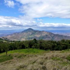
San Cristóbal Volcano, Active volcano in Chinandega Department, Nicaragua
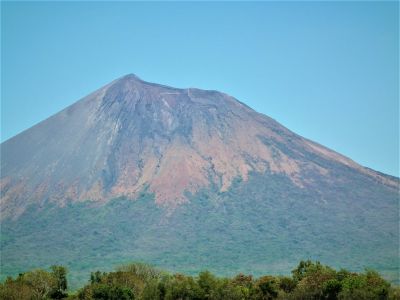
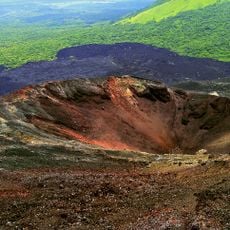
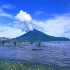
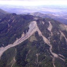
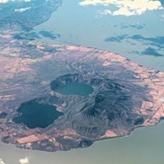
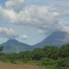
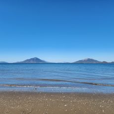
San Cristóbal is an active volcano in Chinandega Department that rises as a symmetrical cone with steep slopes dominating the landscape. The mountain features a crater measuring roughly 500 by 600 meters, creating a distinctive silhouette when viewed from a distance.
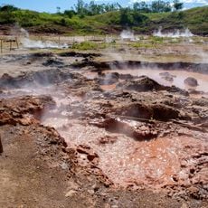
The volcano's first documented eruption happened in 1635, marking the start of volcanic activity that continues today. Eruption frequency has grown over the centuries since that initial event.
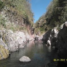
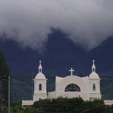
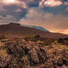
The volcano shapes how local people organize their daily lives, with safety awareness woven into community practices. Residents have adapted their routines to live alongside this natural force that defines their landscape.
Visitors should check current volcanic activity reports and obtain necessary permits from local authorities before attempting to climb. Preparation is important because conditions on the mountain can change quickly.
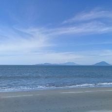
The volcano shows a striking asymmetry between its southwestern and northeastern sides, with the southwestern slope standing noticeably higher. Trade winds have shaped this unusual form over thousands of years.
Location: Chinandega Department
Elevation above the sea: 1,745 m
Made from material: andesite
Address: San Cristóbal Volcano, Nicaragua
GPS coordinates: 12.70318,-87.00642
Latest update: December 7, 2025 20:21
Choluteca Bridge
70.6 km
León Cathedral
32.9 km
Volcán Cerro Negro
39.5 km
Volcán Momotombo
59.5 km
Cosigüina
68.7 km
Volcán Apoyeque
88.5 km
Telica
20.8 km
Somoto Canyon National Monument
89.9 km
Casita Volcano
5.5 km
Chiltepe Peninsula Natural Reserve
87.4 km
Our Lady of the Most Holy Rosary Cathedral, Estelí
82.9 km
Estadio Emilio Williams Agasse
67.7 km
Museum of Traditions and Legends
33.2 km
Estero Padre Ramos Natural Reserve
53 km
Convento de San Pablo
54.9 km
Nature Reserve Tepesomoto-Pataste
74.1 km
Chonco
4 km
Hervideros de San Jacinto
28.1 km
Ortíz Gurdián Foundation Art Center
32.8 km
Telica
20.9 km
Playa de Ratón
85.1 km
Playa Brava (lapyahan sa Honduras, Departamento de Valle, lat 13,25, long -87,62)
90.6 km
Playa Boca de Río Viejo
75.1 km
Playas El Carretal
76.1 km
Las Playas de Cedeño
72.1 km
Playa Secundino
92 km
Playa El Zapote
92.1 km
Estero de Aserradores
35.7 kmVisited this place? Tap the stars to rate it and share your experience / photos with the community! Try now! You can cancel it anytime.
Discover hidden gems everywhere you go!
From secret cafés to breathtaking viewpoints, skip the crowded tourist spots and find places that match your style. Our app makes it easy with voice search, smart filtering, route optimization, and insider tips from travelers worldwide. Download now for the complete mobile experience.
A unique approach to discovering new places❞
— Le Figaro
All the places worth exploring❞
— France Info
A tailor-made excursion in just a few clicks❞
— 20 Minutes