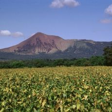
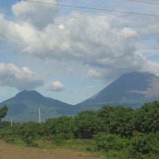
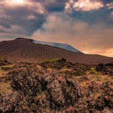
Volcán Cerro Negro, Active volcano in Cordillera de los Maribios, Nicaragua.
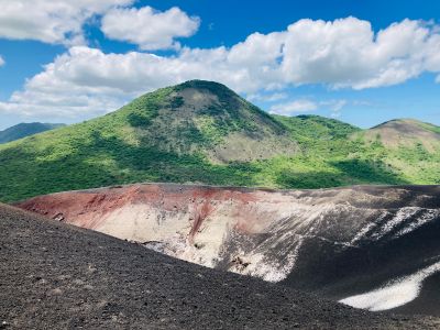
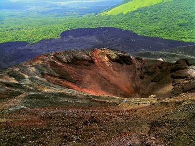
Volcán Cerro Negro is an active volcano in the León Department, part of the Cordillera de los Maribios range. The cone of dark basalt rock rises sharply from the surrounding plain and appears almost black against the lighter hills nearby.
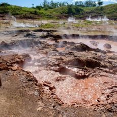
The volcano formed in 1850 following a series of eruptions that lasted several weeks. Further eruptions followed in the 20th and 21st centuries, reshaping the cone with new deposits.
Local guides lead tours to the summit and show visitors the dark grey ash fields that shift underfoot with every step. Many travelers rent protective gear before sliding down on boards, an activity that became popular in the region.
The climb to the summit takes about one hour and crosses loose ash and steep terrain. Solid footwear and enough water are necessary, as there is no shade along the way.
The volcano is considered one of the youngest in Central America and last erupted in the 1990s. From the summit, several other volcanoes in the chain are visible on clear days.
The community of curious travelers
AroundUs brings together thousands of curated places, local tips, and hidden gems, enriched daily by 60,000 contributors worldwide.