Montaña de Comayagua National Park, National park in Comayagua, Honduras
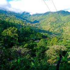
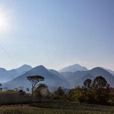
Montaña de Comayagua National Park is a protected forest area north of the city of Comayagua that includes both original and recovering woodland. The terrain is crossed by several streams and marked walking trails.
Montaña de Comayagua National Park was established on 1 January 1987, covering 184.8 square kilometres. It is known locally as Parque Nacional Montaña de Comayagua, or PANACOMA. The protected area lies north of the city of Comayagua, reached via the highway to La Libertad and a dirt road from San Jerónimo.
The village of Río Negro, at 14°32'33"N 87°33'14"W, holds the park's information centre, where hiking guides can be hired before setting out. The turn-off to the village and PANACOMA is marked by a sign on the dirt road from San Jerónimo.
From Comayagua take the highway north to La Libertad, then turn right at San Jerónimo onto a dirt road marked by a sign and follow the signs for Río Negro and PANACOMA. The road is mostly single lane with a few concrete bridges, and a four-wheel-drive vehicle with good clearance is needed. Hiking guides can be hired at the park information centre in the village of Río Negro.
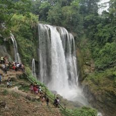
The Cascada de los Ensueños on the Río Gavilán falls 50 metres at 14°32'57.65"N 87°32'36.17"W. Its trailhead lies at 14°33'1.82"N 87°33'1.71"W on the road to Río Negro, and the well-built path takes about an hour to walk.
The community of curious travelers
AroundUs brings together thousands of curated places, local tips, and hidden gems, enriched daily by 93,032 contributors worldwide.