Nextlalpan, Administrative municipality in State of Mexico, Mexico
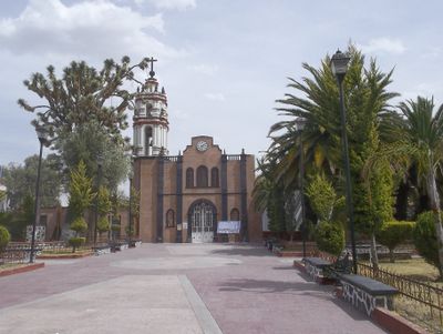
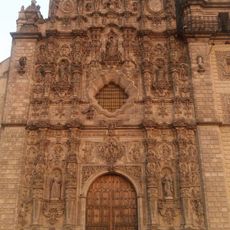
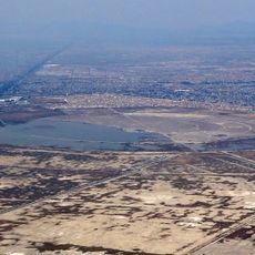
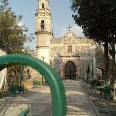
Nextlalpan is an administrative municipality in the State of Mexico comprising three separate communities: Santa Ana Nextlalpan, San Miguel Jaltocan, and Exhacienda Santa Inés. The territory sits in the Zumpango region and blends small urban centers with surrounding rural areas.
The municipality received its official designation on July 31, 1820, marking a pivotal moment in the administrative restructuring of the State of Mexico following independence. This establishment reflected the region's growing need for formal local governance.
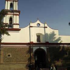
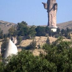
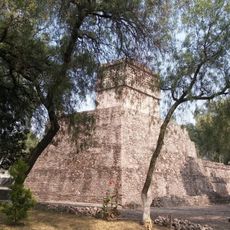
The name Nextlalpan comes from Nahuatl words meaning 'land of ash,' reflecting the area's pre-Hispanic origins. The three communities within the municipality maintain their own local identities through names and daily practices rooted in the region's indigenous heritage.
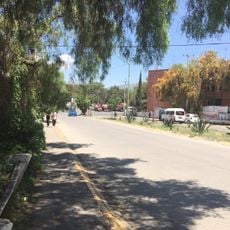
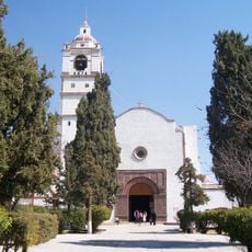
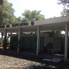
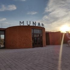
Government facilities are based in Santa Ana Nextlalpan, serving as the main administrative hub for the territory. Plan visits outside the rainy season from April to October when weather conditions are more stable and travel within the area is easier.
The territory sits at elevations ranging from about 2,200 to 2,400 meters (7,200 to 7,900 feet) above sea level, creating a cool highland climate. This elevated position shapes both local temperatures and how weather patterns develop across the landscape.
Location: State of Mexico
Capital city: Santa Ana Nextlalpan
Elevation above the sea: 2,230 m
Website: http://nextlalpan.gob.mx
GPS coordinates: 19.73281,-99.06736
Latest update: December 7, 2025 10:06
Museo Nacional del Virreinato
16.4 km
Santa Lucía Air Force Base Num 1
5.6 km
Puente de Fierro
15 km
Church of San Francisco Javier, Tepotzotlán
16.4 km
Santa Cecilia Acatitlan
22.9 km
Archeological site of Malinalco
22.9 km
El Caracol
19.4 km
Infonavit Norte
16.9 km
Mexican Air Force Museum
8.5 km
National Pyrotechnic Festival
8.3 km
Saint Christopher Church, Ecatepec de Morelos, Estado de México, México
15 km
El Tenayo
23.7 km
St. Bonaventure Cathedral, Cuautitlán
13.7 km
Cathedral of the Sacred Heart of Jesus
15 km
Christ the King
22.6 km
Santiago Apóstol parish in Tequixquiac
21.5 km
Mamut de Tultepec
7.8 km
Museo Xaltocan
2 km
Zona Arqueológica Santa Cecilia Acatitlán
22.9 km
Museum of Man Tepexpan
18.3 km
Letras Pueblo Mágico Tepotzotlan
16.4 km
Museum San Jeronimo Xonacahuacan
12.1 km
Galeria De Arte Del Genoma Mesoamericano
15.2 km
Museo Nacional de la Pirotecnia (MUNAPI)
7.8 km
Museo Arqueológico de Coyotepec Ehecalli
14.5 km
Museo de escultura Mexica Eusebio Dávalos Hurtado
23 km
Museo del Ferrocarrilero
18.2 km
La Magdalena
11.2 kmVisited this place? Tap the stars to rate it and share your experience / photos with the community! Try now! You can cancel it anytime.
Discover hidden gems everywhere you go!
From secret cafés to breathtaking viewpoints, skip the crowded tourist spots and find places that match your style. Our app makes it easy with voice search, smart filtering, route optimization, and insider tips from travelers worldwide. Download now for the complete mobile experience.
A unique approach to discovering new places❞
— Le Figaro
All the places worth exploring❞
— France Info
A tailor-made excursion in just a few clicks❞
— 20 Minutes