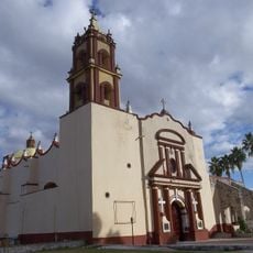
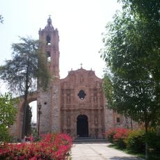
Tepatepec, Municipal seat in Francisco I. Madero, Mexico
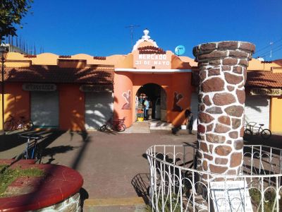
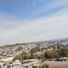
The locality extends across a varied terrain at 1977 meters elevation, featuring both urban infrastructure and agricultural zones in central Mexico.
The area gained municipal status on May 16, 1927, establishing Tepatepec as the administrative center of Francisco I. Madero Municipality.
The population maintains its connection to Otomi heritage, with 1.68 percent of residents speaking the Valle del Mezquital variation of this indigenous language.
The municipality covers 95.1 square kilometers and serves a population of 36,248 residents, offering essential administrative services for the region.
Local farmers produce substantial quantities of alfalfa, reaching 244,085 tons in 2015, making it a principal agricultural output for the region.
Location: Francisco I. Madero
Elevation above the sea: 1,977 m
GPS coordinates: 20.24556,-99.08778
Latest update: March 5, 2025 05:20
Hidalgo state showcases geological formations, ancient ruins, and colonial architecture. The region features basalt columns, thermal springs, caves, and national parks. Historical sites include Toltec warrior statues, silver mining towns, and UNESCO heritage aqueducts. Natural attractions range from wetlands and lakes to marble formations and mountain forests.
Atlantean figures at Tula
33.2 km
Tulasas
33.3 km
Salón de la Fama del Fútbol
36.9 km
San Nicolás Tolentino Temple and Ex-Monastery
15.3 km
Zona Arqueológica de Tula
32.4 km
St. Joseph Cathedral, Tula de Allende
34.1 km
Church of San Miguel Arcángel
29.7 km
Balneario Vito
29.6 km
Grutas Xoxafi
17.1 km
Tula National Park
32.9 km
Via Dorada
36.7 km
Templo y exconvento de San Francisco
19.8 km
Centro Interactivo Mundo Futbol
36.8 km
Museo de miniaturas
36 km
Jorge R. Acosta Museum
32.6 km
San Antonio mine
36.8 km
Biblioteca Central del Estado de Hidalgo Ricardo Garibay
36.8 km
Futbol Interactive Center
36.8 km
San Bartolomé Parish
15.3 km
San Miguel Arcangel Parish
15.3 km
Kiosco Acayuca
35.1 km
Archaeological Museum Apaxco
31.4 km
Santiago Apóstol Parish
15.3 km
Antigua Estación De Ferrocarril De Tula
34.5 km
Parroquia de San Nicolas Tolentino
9 km
Petrograbados
34.2 km
Ex convento de Actopan
15.4 km
Текіскьяк
30.3 kmReviews
Visited this place? Tap the stars to rate it and share your experience / photos with the community! Try now! You can cancel it anytime.
Discover hidden gems everywhere you go!
From secret cafés to breathtaking viewpoints, skip the crowded tourist spots and find places that match your style. Our app makes it easy with voice search, smart filtering, route optimization, and insider tips from travelers worldwide. Download now for the complete mobile experience.
A unique approach to discovering new places❞
— Le Figaro
All the places worth exploring❞
— France Info
A tailor-made excursion in just a few clicks❞
— 20 Minutes